


Organization
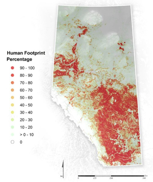
The Human Footprint Inventory (HFI) is a public dataset that maps visible disturbances from human activity across the entire province of Alberta. The dataset is updated annually using a combination of aerial imagery, reference datasets, and consultation with subject matter experts.
In the 2023 update, users will have access to the most accurate classification and dating of seismic lines ever available to the public. The 2023 layer “Seismic lines, trails, and other linear features” will include eight feature types that provide a detailed breakdown by seismic construction method, including township survey features, trails, and other linear features.
The report is available here
Portal(s):