
Search Results
Displaying:
1 - 10 of 10
BERA News Fall 2022
Resource
Understanding how birds respond to landscape disturbance is key to effective restoration. Two studies used non-invasive microphone arrays to determine the exact locations of singing individuals in the...

BERA News Spring 2022
Resource
Mounding is a common restoration technique designed to improve microsite conditions for planted seedlings in wetlands. There are a variety of strategies for constructing mounds, though, and how mounds...
Boreal Caribou Traditional Knowledge-based Habitat Supply Model, Restoration and Monitoring Strategy for Constance Lake Traditional Territory in Ontario
Project
Contact
The purpose of this project is to enable Constance Lake First Nation to address the threat of habitat loss, degradation, and fragmentation for the Woodland Caribou, boreal population (Threatened)...

Reclamation by Transalta Utilities through Planned Research and Experience
Resource
TransAlta Utilities has always believed that finding solutions to reclamation problems must identify the most economical and technically feasible methods. A range of research related programs have...

Reclamation Experience: An Industrial Perspective
Resource
The concepts important to the regulation of reclaimed land have been evolving and will continue to evolve. We have gone from emphasis on "equal to or greater than productivity" to emphasis on...
The Boreal Ecosystem Recovery and Assessment (BERA)
Project
Organization:
The boreal region of Alberta contains extensive disturbances from natural resource extraction. Roads, well pads, seismic lines (petroleum-exploration corridors), forest-harvest areas, and other...
The Edge 2022 (BERA Systhesis)
Resource
The central goal of the Boreal Ecosystem Recovery and Assessment (BERA) program is to understand the effects of industrial disturbance on natural ecosystem dynamics, and to develop strategies for...

The Edge: The BERA Program 2024 Synthesis Report
Resource
The 2024 issue of The Edge summarizes the following key findings: Plan A better understanding of passive recovery trajectories will help guide restoration planning LiDAR is a powerful planning tool...

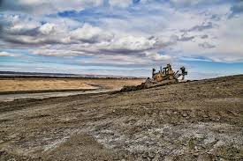
Whitewood Mine Closure
Resource
1665 ha has been reclaimed, including one end pit lake, numerous wetland features, woodland/wildlife areas revegetated through assisted natural recovery and perennially cropped agricultural lands
