
Search Results
Displaying:
1 - 3 of 3
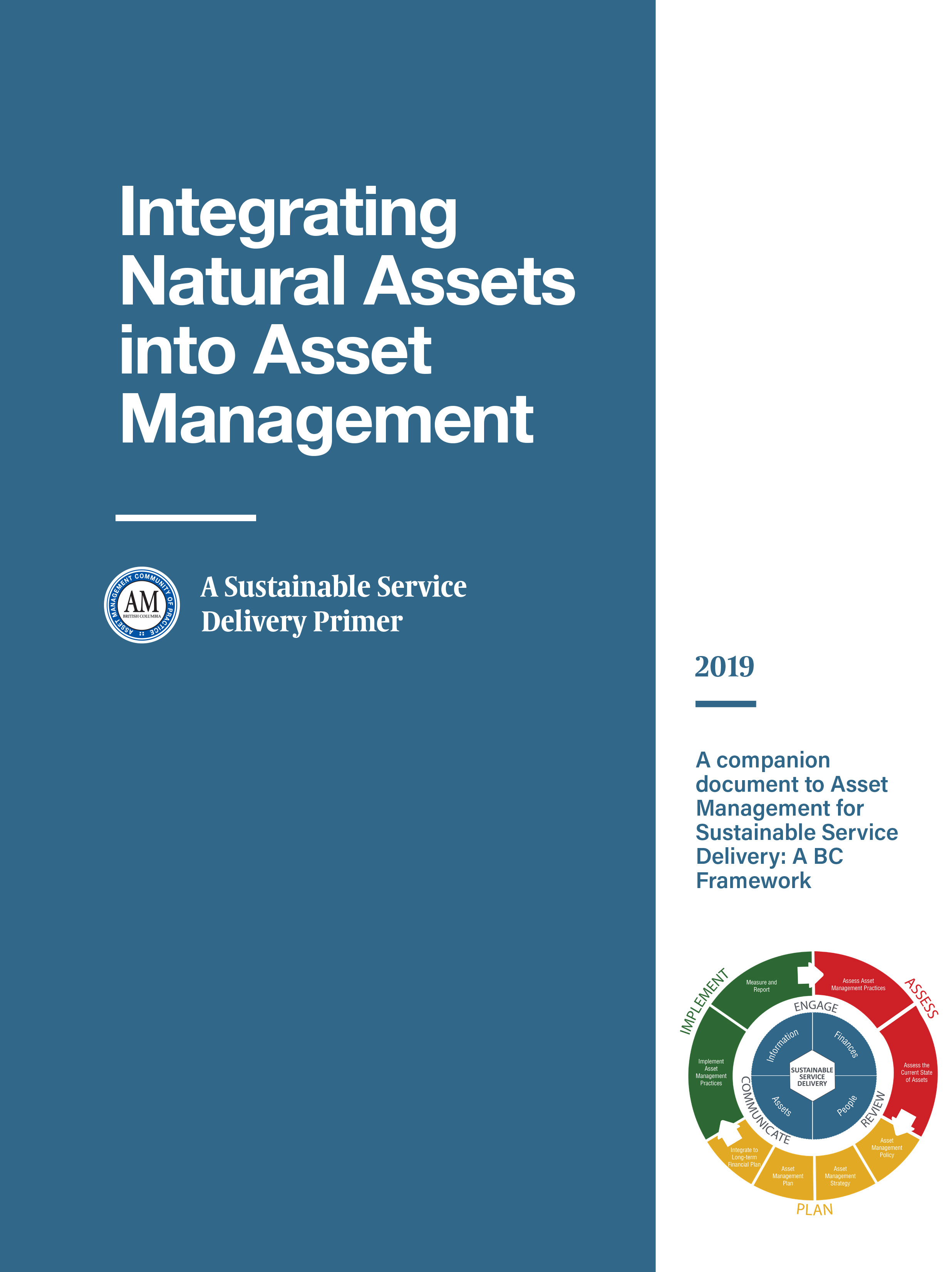
Integrating Natural Assets into Asset Management: A Sustainable Service Delivery Primer
Resource
This primer is for staff of local governments in BC and is intended to help them capitalize on the real and immediate benefits of managing their natural assets.
Video - Riparian Vegetation: Identifying Boundaries and Quantifying Structure using LiDAR
Resource
Jay Mills, Vegetation Data Specialist with Jeodesy GIS, talks about LiDAR data and interpreting it for riparian vegetation.
