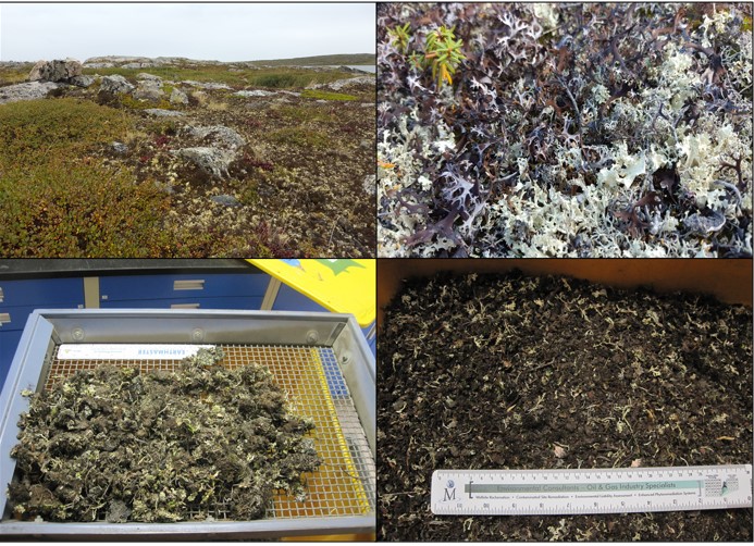
Boreal Caribou Search Results
Resource
The epilithic microbial and micro-invertebrate communities under conditions of light and shade were studied from April to November 1978
Resource
Authors
Aaron Sekerak
Gordon Walder
16-24 species of fish were found in each watershed. Forage fish (lake chub, pearl dace, longnose dace, trout-perch, brook stickleback, slimy sculpin) and white and longnose suckers were most abundant
Resource
Authors
Aaron Sekerak
Gordon Walder
Maps showing fish collection locations, photos and details of the physical characteristics of nine streams within five watersheds (Firebag, Muskeg, Steepbank, MacKay, and Ells) in AOSERP study area
Resource
Authors
Hal Hamilton
Ron Wallace
D. Westlake
Julia Foght
Barry Taylor
Steve Hrudey
Relationship between hydrocarbons present naturally, or introduced due to surface oil sands mining and upgrading activities, and their potential bioaccumulation and tainting of the commercial fishery
Resource
During 1978, a number of aquatic projects were funded by AOSERP using a habitat inventory and mapping approach.
Resource
Authors
T.W. Chamberlin
E.A. Harding
Philosophy and structure of aquatic system inventory as conducted by the BC Resource Analysis Branch. Additional topics included data management and examples of detailed interpretive projects
Resource
Authors
GRID-Arendal
Levi Westerveld
Tiina Kurvits
T. Schoolmeester
Oda Mulelid
Torjus Eckhoff
Pier Overduin
Michael Fritz
Hugues Lantuit
Björn Alfthan
A. Sinisalo
Frederieke Miesner
L.-K. Viitanen
NUNATARYUK Consortium
Resource Date:
October
2023
This atlas is an attempt to translate and consolidate the available knowledge on permafrost. It is a timely book suffused with the compelling enthusiasm of its authors and contributors. Close to a...
Resource
Goals of this investigation were to describe the present hydrologic and sediment regimes and to predict the consequences of surface disturbances which precede oil sands mining using runoff plots.
Resource
Authors
Hydrocon Engineering (Continental) Ltd.
Monenco Consultants Ltd.
Document provides an evaluation of currently available rainfall runoff sediment production methodologies, identifies key parameters, and outlines field programs to gather data for model calibration
Resource
Authors
Mark Baah-Acheamfour
Mark Dewey
Erin Fraser
Stefan Schreiber
Amanada Schoonmaker
Empirical evaluations of reclamation success are critical for understanding the speed of ecosystem recovery and improving best practices. In this study, we provide a quantitative evaluation of the...
Resource
We conducted a full peatland assessment using the new criteria on a restored well pad near Peace River, Alberta. In 2012, mineral overburden was removed along with geo-textile and the buried peat was...
Resource
Authors
Mark Baah-Acheamfour
Jean-Marie Sobze
The longevity of seeds in storage is modulated by the initial quality as well as the storage conditions.
Resource
There is an existing gap in knowledge on the economic impacts of caribou recovery measures on forestry activities and non-renewable resource extraction. To address this knowledge gap, this project...
Resource
The cold climate and short growing season characteristic of the major oil and gas producing regions of western Canada make it particularly important to conduct phytoremediation research on plants...
Resource
Authors
Olaf Niemann
Fabio Visintini
Changes observed in the foliage of trees killed by bark beetles are usually described in terms of stages that have been related to a specific timeframe. The “green attack” stage is the period of time...
Resource
Authors
Sarah Ficko
Diane Haughland
Anne Naeth
This resource is available on an external database and may require a paid subscription to access it. It is included on the CCLM to support our goal of capturing and sharing the breadth of all...
Resource
Authors
Rod Olson
Bruce Thompson
Henry Bertram
Roy Peters
Determine changes in the input rate of atmospheric trace substances into sensitive ecosystems and provide a database for the documentation of variations in chemical characteristics of precipitation
Resource
This report identifies historical, annual and open water, low flow sequences for 13 stations in the Athabasca River Basin which can be used to determine management guidelines for the River basin
Resource
Monthly flows are provided for the period 1912 to 1980 at 21 locations on the Athabasca River and its major tributaries. The flow data sets are suitable for water management planning
Resource
Nearly 76% of all water used in the basin in 1981 was obtained from the river, 22% from major tributaries and other surface sources, and the remaining 2% from groundwater