Land Management Search Results
Resource
Authors
Kevin Smith
Christopher Smith
Silvie Forest
Alain Richard
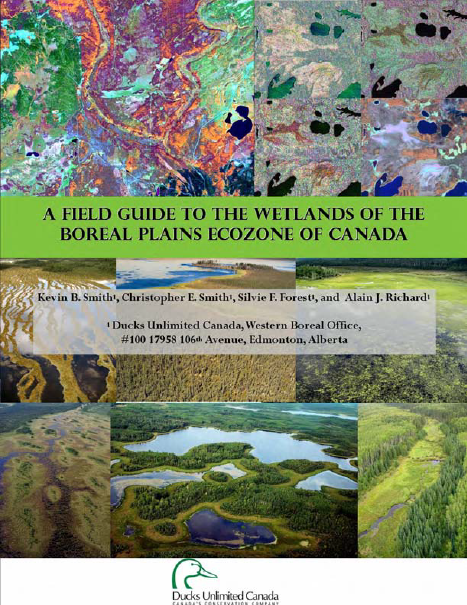
This guide provides an in-depth look at Ducks Unlimited Canada's (DUC) remote-sensing satellite mapping efforts and the development of the DUC enhanced wetland classification system.
Resource
Ducks Unlimited Canada has been leading the effort to provide detailed and accurate wetland maps for large areas of the western boreal forest. These mapping products have become the cornerstone of DUC...
Resource
Authors
Anne McIntosh
Bonnie Drozdowski
Dani Degenhardt
Chris Powter
Christina Small
John Begg
Dan Farr
Arnold Janz
Randi Lupardus
Delinda Ryerson
Jim Schiek
We developed a scientifically robust and financially sustainable monitoring protocol to enable a consistent assessment of ecological recovery at reclaimed industrial wellsites in forested lands
Resource
Authors
Mariano Feldman
Marc Mazerolle
Louis Imbeau
Nicole Fenton
As resource extraction moves north across the globe, wetland ecosystems in Canada are increasingly degraded because of disturbances associated with anthropic activities, including timber harvesting...
Resource
Authors
Laura Chasmer
Edberto Moura Lima
Craig Mahoney
Chris Hopkinson
Joshua Montgomery
Danielle Cobbaert
Resource Date:
August
2021
Bi-temporal LiDAR data used to identify correspondence between density of anthropogenic disturbances, wetland shape complexity and changes in vegetation height within >1800 wetlands near Fort McKay
Resource
Authors
Guillermo Castilla
Ronald Hall
Rob Skakun
Michelle Filiatrault
André Beaudoin
Michael Gartrell
Lisa Smith
Kathleen Groenewegen
Chris Hopkinson
Jurjen van der Sluijs
Resource Date:
February
2022
Wall-to-wall 30 m raster maps of broad forest type, stand height, crown closure, stand volume, total volume, aboveground biomass, and stand age were created for a ~400,000 km2 area, validated with independent data, and generalized into a polygon GIS layer resembling a traditional FI map. The MVI project showed that a reasonably accurate FI map for large, remote, predominantly non-inventoried boreal regions can be obtained at a low cost by combining limited field data with remote sensing data from multiple sources.
Resource
Authors
Dale Vitt
Melissa House
Lilyan Glaeser
Minerogenous peatlands that accumulate deep deposits of organic matter (fens) were an important part of the pre-disturbance landscape across Alberta’s oil sands mining area. Bryophytes occupy 80–100%...
Resource
Authors
Scott Davidson
Emily Dazé
Eunji Byun
Dean Hiler
Markus Kangur
Julie Talbot
Sarah Finkelstein
Maria Strack
Resource Date:
March
2022
Swamps are a highly significant wetland type in North America both in terms of areal extent and their role in terrestrial carbon cycling. These wetlands, characterized by woody vegetation cover...
Resource
Authors
Chantel Markle
Henry Gage
Alex Tekatch
Sophie Wilkinson
James Waddington
Boreal peatland ecosystems are generally resilient to low severity wildfire. However, climate change may increase wildfire intensity and frequency, potentially shifting wetlands to less wildfire...
Resource
Authors
Phoebe Maund
Katherine Irvine
Jonathan Reeves
Emily Strong
Ruth Cromie
Martin Dallimer
Zoe Davies
Resource Date:
November
2019
Abstract Nature-based health interventions (NBIs) for the treatment of poor mental health are becoming increasingly common, yet evidence to support their effectiveness is lacking. We conduct a pilot...