Land Management Search Results
Resource
Authors
K.A. Baldwin
L. Allen
S. Basquill
K. Chapman
D. Downing
N. Flynn
W. Mackenzie
M. Major
W.J. Meades
D. Meidinger
C. Morneau
J.-P. Saucier
J. Thorpe
Vegetation Zones of Canada: a Biogeoclimatic Perspective maps Canadian geography in relation to regional climate, as indicated by vegetation patterns. Compared to previous similar national-scale...
Resource
This presentation provides insight and understanding to how LiDAR data is used to produce digital elevation models and vegetation maps.
Resource
The presentation describes how multi-temporal remote sensing offers a better understanding of landscape changes over time in comparison to the more traditional two-date, before and after comparison.
Resource
The presentation describes ABMI's role in collecting monitoring data and how the data can be used in environmental management.
Resource
One of the neat things about working in environmental monitoring is the sheer range of tools available to use, and the rate at which they’re evolving. One example that’s rapidly changing monitoring...
Resource
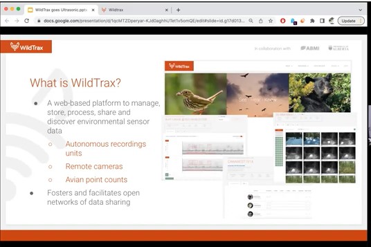
Join Alex MacPhail for an overview of ultrasonic data management and processing on WildTrax! Our newest features let you manage and tag data from bat or small mammal monitoring projects.
Resource
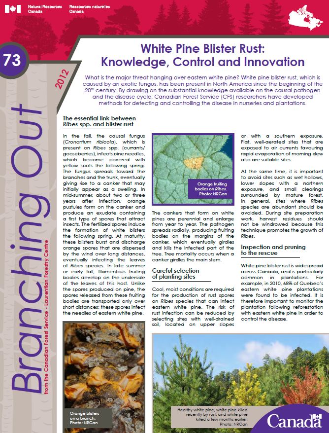
What is the major threat hanging over eastern white pine? White pine blister rust, which is caused by an exotic fungus, has been present in North America since the beginning of the 20th century. By...
Resource
Authors
Alberta Biodiversity Monitoring Institute
This document was created by the Alberta Remote Camera Steering Committee (RCSC). The Alberta RCSC is chaired by Alberta Environment and Parks and comprises a group of wildlife camera experts from...