Land Management Search Results
Resource
Authors
Erin Bayne
Diana Stralberg
Amy Nixon
Use of ABMI samples to understand genetic variation and changes in genetic structure is identified as an area where ABMI data can be used to understand how biodiversity is adapting to climate change
Resource
Authors
Janet Dooley
Susan Koziel
Brian Eaton
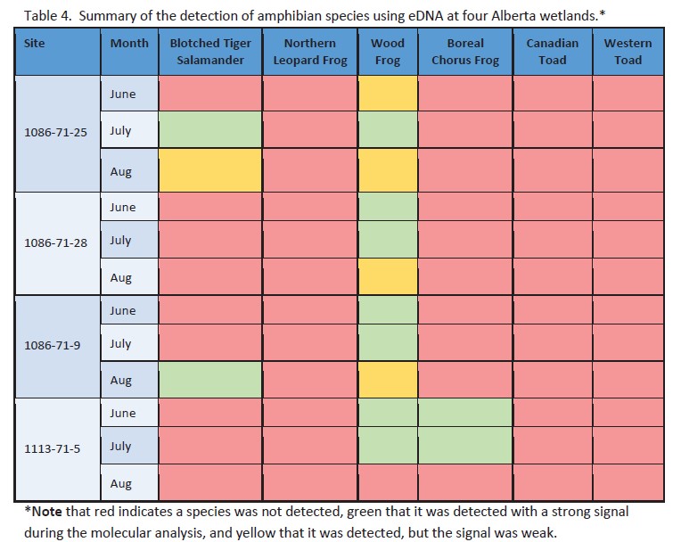
The eDNA approach detected three amphibian species across the four sites sampled in this project. Three amphibian species were identified by ARU methods at the four sites.
Resource
Authors
Marcus Becker
Dave Huggard
Melanie Dickie
Camille Warbington
Jim Schieck
Emily Herdman
Robert Serrouya
Stan Boutin
Estimating animal abundance and density are fundamental goals of many wildlife monitoring programs. Camera trapping has become an increasingly popular tool to achieve these monitoring goals due to...
Resource
Resource Date:
August
2021
With the support of Alberta Environment and Parks, the Alberta Biodiversity Monitoring Institute has become the trusted source for data about habitat, species, and the human footprint.
Resource
Authors
Bev Gingras
Cynthia Paszkowski
Garry Scrimgeour
Sharon Kendall
Objective was to compare the effectiveness of four commonly used sampling techniques (pitfall traps, funnel traps, visual searches and call surveys) to detect stream amphibian communities.
Resource
Authors
Alberta Biodiversity Monitoring Institute
This report is part of a larger endeavor to develop a monitoring program capable of detecting changes in the biological diversity of Alberta’s forested region.
Resource
Authors
Garry Scrimgeour
Sharon Kendall
This chapter describes aquatic elements and sampling protocols that could be used to monitor forested stream ecosystems in Alberta and Saskatchewan
Resource
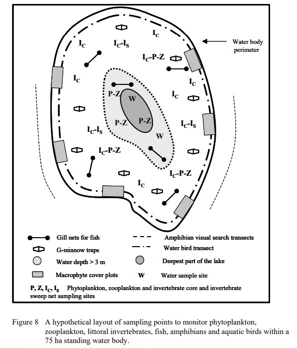
Protocols for sampling biotic and abiotic parameters in large lakes, large rivers, wetlands, and streams in Alberta is provided. Estimates of time costs are given.
Resource
Authors
Alberta Biodiversity Monitoring Institute
As of 2010, human footprint in the Active In-situ Region was 7.7%, whereas it was 20.8% in the Mineable Region. Total human footprint in all Woodland Caribou ranges increased between 2007 and 2010
Resource
Authors
Alberta Biodiversity Monitoring Institute
As of 2012, the total human footprint across the OSR was 13.8%. Energy footprint covered 2.2% of the OSR. The total human footprint in the OSR increased from 11.3% to 13.8% between 1999 and 2012.
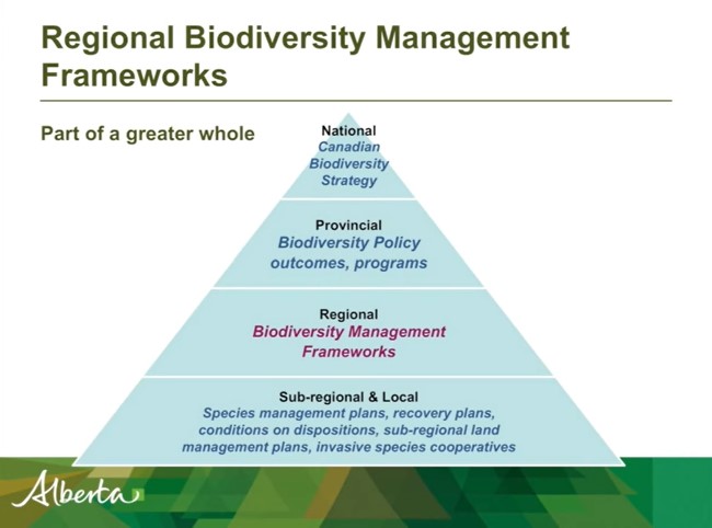
Resource
Authors
Shannon White
Jim Herbers
Jasmine Janes
Sarah Depoe
Shannon R. White is the Biodiversity Specialist for the Land-use Framework Regional Planning Branch for ESRD. She discusses Biodiversity Management Frameworks (BMFs), including indicators, triggers...
Resource
Presentation tracks the evolution in technology used to monitor birds by recording their songs, with examples from different regions of the province.
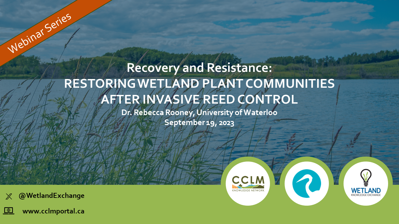
Resource
Resource Date:
September
2023
Recovery and Resistance: Restoring the wetland plant community after invasive reed control Presenter: Dr. Rebecca Rooney, University of Waterloo For established invasions, like European common reed...
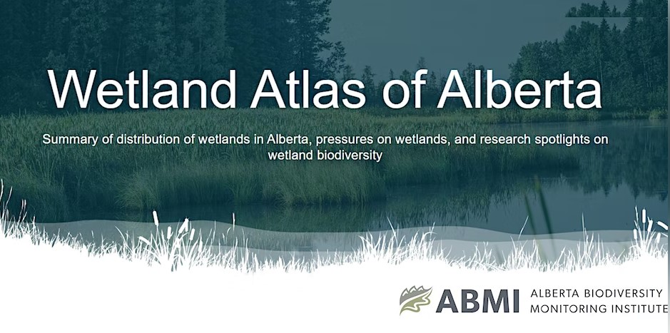
Resource
Authors
Alberta Biodiversity Monitoring Institute
The Wetland Atlas describes the distribution of wetlands in Alberta and summarizes human footprint around open water wetlands. Also included are research spotlights on wetland biodiversity including...
Resource
Resource Date:
December
2023
The Wetland Knowledge Exchange releases monthly newsletters that highlight new research, publications, news, events and more. In this edition you will learn about: The wetlands of Ontario The advances...
Resource
Resource Date:
September
2023
The Wetland Knowledge Exchange releases monthly newsletters that highlight new research, publications, news, events and more. In this edition you will learn about: The outsized role of small ephemeral...