Land Management Search Results
Resource
The various applications of Ducks Unlimited Canada’s wetland inventories play a critical role in wetland conservation. They serve as key planning tools, helping people who live and work in the boreal...
Resource
In order to protect boreal wetlands, we must first know where they are. This 6-minute video will show you how Ducks Unlimited Canada uses satellite data and remote sensing techniques to map wetlands...
Resource
The presentation describes how multi-temporal remote sensing offers a better understanding of landscape changes over time in comparison to the more traditional two-date, before and after comparison.
Resource
The presentation describes ABMI's role in collecting monitoring data and how the data can be used in environmental management.
Resource
Authors
Evan DeLancey
Fiona Gregory
Agatha Czekajlo
ABMI's new Alberta-wide Wetland Inventory: how it was generated, R&D to improve wetland mapping/monitoring data, and how this tool can be used in land-use decision making
Resource
Authors
Michael Merchant
Lyle Boychuk
The Government of Alberta’s current wetland inventory is a publicly available, generalized dataset collated from the best available spatial wetland data across the province. The Alberta Merged Wetland...
Resource
Resource Date:
October
2020
iWETLAND: Managing Species at Risk Habitat through Wetland Water Level Citizen Science Presented by Taylor North and the McMaster Ecohydrology Lab iWetland is a citizen science wetland water level...
Resource
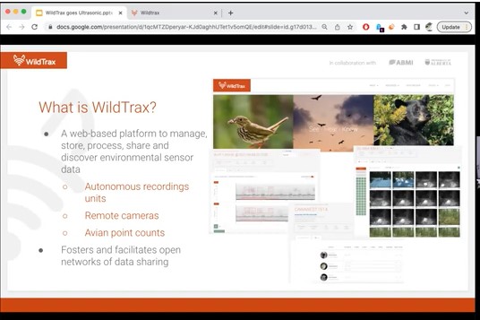
One of the neat things about working in environmental monitoring is the sheer range of tools available to use, and the rate at which they’re evolving. One example that’s rapidly changing monitoring...
Resource
Join Alex MacPhail for an overview of ultrasonic data management and processing on WildTrax! Our newest features let you manage and tag data from bat or small mammal monitoring projects.