Land Management Search Results
Resource
Authors
James Saracco
Peter Pyle
Danielle Kaschube
Monica Kohler
Christine Godwin
Kenneth Foster
Habitat loss and disturbance from industrial resource development may be contributing to declines in boreal bird populations. We applied hierarchical multi-species models to data from 31 bird species...
Resource
Authors
Erin Bayne
Jacqueline Dennett
Jenet Dooley
Monica Kohler
Jeff Ball
Mark Bidwell
Andrew Braid
John Chetelat
Eric Dillegeard
Dan Farr
Jason Fisher
Maureen Freemark
Ken Foster
Christine Godwin
Craig Hebert
Dave Huggard
Dianne McIssac
Tara Narwani
Scott Nielsen
Bruce Pauli
Sanjay Prasad
David Roberts
Simon Slater
Samantha Song
Stella Swanson
Phil Thomas
Judith Toms
Colin Twitchell
Shannon White
Faye Wyatt
Lukas Mundy
One of the theme areas monitored within the OSM program is terrestrial biodiversity, known programmatically as Terrestrial Biological Monitoring (TBM). Biodiversity refers to the diversity of wild...
Resource
Authors
William Wadsworth
Ave Dersch
Robin Woywitka
Kisha Supernant
The Athabasca Oil Sands (AOS) region of Alberta has one of the densest accumulations of known archaeological sites, and possibly the most archaeological sites at risk, in the country. Expanding...
Resource
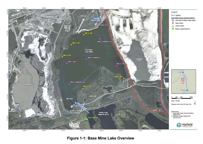
Syncrude's Base Mine Lake (BML) is the first, and currently the only full-scale commercial demonstration of the end pit lake technology in the oil sands industry. An oil sands end pit lake (EPL) is an...
Resource
Authors
Chris Powter
Brent Scorfield
Brent Lakeman
Shane Patterson
The development of integrated geomatics and remote sensing technologies for environmental management holds promise to meet economic diversification and effective environmental management.
Resource
Authors
Roger DeAbreu
Shane Patterson
Todd Shipman
Chris Powter
NRCan pilot science projects have proven that Earth Observation can provide relevant and valuable information to inform and enhance monitoring and support regulatory frameworks
Resource
Authors
Chris Johnson
Libby Ehlers
Dale Seip
This resource is available on an external database and may require a paid subscription to access it. It is included on the CCLM to support our goal of capturing and sharing the breadth of all...
Resource
Authors
Leila Taheriazad
Carlos Portillo-Quintero
Arturo Sanchez-Azofeifa
This report presents a comprehensive review of industrial applications of an emerging environmental monitoring technology called Wireless Sensor Networks (WSN) and a WSN installed at Coal Valley Mine
Resource
Authors
Jean Birks
Yi Yi
Sunny Cho
Emily Taylor
John Gibson
This study was conducted to characterize the composition of polar dissolved organic compounds present in snow and surface waters in the Athabasca Oil Sands Region (AOSR) with the goal of identifying...
Resource
Authors
Nadia Rochdi
J. Zhang
Karl Staenz
X. Yang
D. Rolfson
J. Banting
C. King
R. Doherty
Scope of the project is to develop a geomatics-based monitoring system to support the Government of Alberta’s efforts for monitoring reclamation success. Software will support decision making process
Resource
Authors
Jean Birks
Yi Yi
Sunny Cho
John Gibson
Rod Hazewinkel
Goal was identifying whether atmospherically-derived organics present in snow are a significant contributor to the organics detected in rivers and lakes in the oil sands region
Resource
Authors
Mar Martinez
Gary Borstad
Leslie Brown
Kaan Ersahin
Michael Henley
Monitoring of reclaimed sites is a complex, interdisciplinary undertaking, especially in large, disturbed areas with difficult access. In that context, remote sensing is a unique and valuable tool...
Resource
Authors
Ken Foster
Christine Godwin
Peter Pyle
The MAPS protocol (Monitoring Avian Productivity and Survivorship) was applied in a 2011 pilot program in the boreal forest in the oil sands region
Resource
Authors
Virgil Hawkes
Gillian Donald
A long-term plot network would allow the monitoring data to describe the ecological condition of the reclaimed lands and define appropriate management strategies for achieving revegetation goals
Resource
Video tutorial that lays out the field sampling process for reclaimed wetland assessment from start to finish in easy-to-follow steps and visually clarifies how protocols should be enacted
Resource
Pilot study to assess the use of early successional stands (i.e. those ranging in age from 4 to 17 years) by wildlife (songbirds, small mammals, and ungulates), using a wildlife monitoring protocol
Resource
In most years, evaporation exceeds summer rainfall. Using natural aspen stands as a comparison, it is expected that water use from the soil cover will continue to increase as the ecosystem ages.
Resource
Authors
Terry Macyk
Martin Fung
Ron Pauls
Syncrude Canada Ltd. produces 200,000 barrels of synthetic crude oil per day from its oil sands surface mining operations located 50 km north of Fort McMurray, Alberta. The three major types of...
Resource
Authors
Daphne Cheel
Stephen Moran
Mark Trudell
Don Thacker
Terry Macyk
Report synthesizes and summarizes 36 RRTAC reports to provide the user with a unified source of information on land and groundwater reclamation research in the plains of Alberta
Resource
Authors
Richard Johnson
P. Bork
E.A.D. Allen
W.H. James
L. Koverny
The experiments detailed in this report show that it was possible to increase the solids content of sludge to 50% solids by adding three parts sand (tailings sand) to one part sludge.