Wetlands Knowledge Search Results
Resource
Authors
NAIT Centre for Boreal Research
The Decision Support Systems (DSS) uses a scenario approach to guiding reclamation and restoration activities. This resource follows the Vegetation Treatment Process for Forest Land (Upland). DSS are...
Resource
The deeper soil salvage depth (40 cm) was better than the shallow salvage depth (15 cm) at establishing a forest understory plant community characteristic of the boreal forest.
Resource
Across northern Canada evidence of oil and gas seismic exploration remains from the 1950's to current day. While many of these linear features are still visible, others can no longer be seen. Research...
Resource
Resource Date:
August
2020
This document is part of the 360 tours project Toolkit developed by Canada's Oil Sands Innovation Alliance (COSIA) led by Cenovus Energy Inc., in collaboration with Natural Resources Canada. The...
Resource
Authors
Corey Feduck
Gregory McDermid
Guillermo Castilla
Rapid assessment of forest regeneration using unmanned aerial vehicles (UAVs) is likely to decrease the cost of establishment surveys in a variety of resource industries. This research tests the...
Resource
Long-term monitoring of some sites would ultimately be needed to show that recovering wellsites are on a trajectory that consistently leads to full recovery.
Resource
Bromacil and tebuthiuron are herbicides used from the 1960s to 1990s on industrial sites to control vegetation. Approximately 61,750 sites are considered contaminated when comparing total herbicide...
Resource
Three mid- to high-elevation lines of slender wheatgrass were selected and released as varieties for use in reclamation
Resource
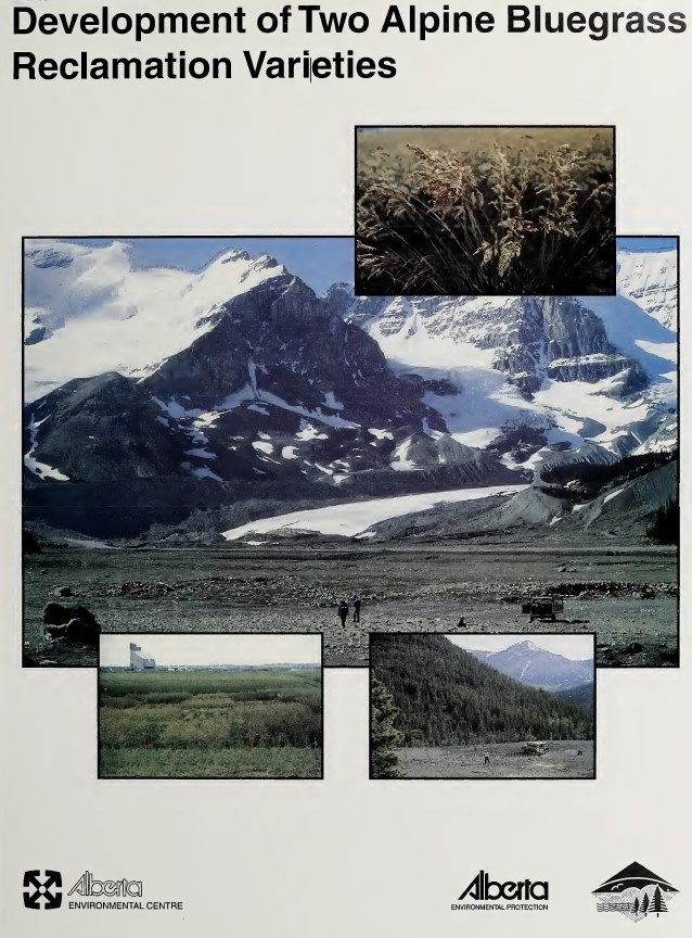
Two lines of alpine bluegrass were selected and released as varieties for use in reclamation
Resource
Soils sampled at sites 2.3 and 5.3 km south of the Great Canadian Oil Sands (GCOS) plant, Fort McMurray, respectively were found to differ statistically with reference to several macronutrients
Resource
Stem cuttings of balsam poplar and three poplar hybrids were directly planted onto reclamation material ontailings dyke slope. The overall rooting success was poor - direct planting is not recommended
Resource
Authors
Sandra Landsburg
Elizabeth Dwyer
Dissipation of bromacil in Humic Luvic Gleysols amended with cow manure was evaluated at two sites in northwestern Alberta from 1984 to 1987
Resource
The trial was established on blended materials consisting of native sand, clayey overburden and peat. Nine native grasses and eight cultivated grass varieties were seeded in June of 1981.
Resource
Authors
Roger DeAbreu
Shane Patterson
Todd Shipman
Chris Powter
NRCan pilot science projects have proven that Earth Observation can provide relevant and valuable information to inform and enhance monitoring and support regulatory frameworks
Resource
Authors
K.A. Baldwin
P.W.C. Uhlig
M.C. Wester
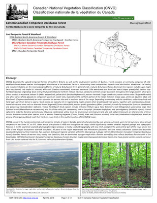
The Canadian National Vegetation Classification (CNVC) is an ecological classification of natural and semi-natural Canadian vegetation. The classification is a hierarchical taxonomy, describing...
Resource
Authors
K.A. Baldwin
J.-P. Saucier
P.W.C. Uhlig
The Canadian National Vegetation Classification (CNVC) is an ecological classification of natural and semi-natural Canadian vegetation. The classification is a hierarchical taxonomy, describing...
Resource
There was only very limited evidence of biological responses to increased pollutant content in spite of significantly higher pollutant levels in tissues close to existing industrial developments.
Resource
Authors
M.D. Thompson
M.C. Wride
M.E. Kirby
Classification system devised for mapping vegetation and surficial geology from 1:60,000 scale false colour infrared photographs; 1:50 000 base maps plus a vegetation and a surficial geology overlay
Resource
Ground surveys of vegetation and surficial geology generally confirmed that the classification systems used in the mapping accurately described and defined the ecological habitat features
Resource
Authors
ERMP Project Advisory Group
Monitoring protocols for forested land wellsites to determine if a reclaimed site has returned to similar structure and function as found in a representative undisturbed reference area.