Wetlands Knowledge Search Results
Resource
purpose of this project is to determine the population size of moose in the survey area with regard given to sex and age ratios and distribution according to habitat and seasonal climatic features
Resource
Authors
Jeffrey Green
Gail Harrison
The costs and methods of wildlife habitat reclamation are discussed for three examples. The first example, the Cascade Landfill site in Banff National Park, illustrates the approach and costs of...
Resource
Authors
Marcus Becker
Dave Huggard
Melanie Dickie
Camille Warbington
Jim Schieck
Emily Herdman
Robert Serrouya
Stan Boutin
Estimating animal abundance and density are fundamental goals of many wildlife monitoring programs. Camera trapping has become an increasingly popular tool to achieve these monitoring goals due to...
Resource
Authors
Melanie Dickie
Branislav Hricko
Christopher Hopkinson
Victor Tran
Monica Kohler
Sydney Toni
Robert Serrouya
Jahan Kariyeva
Anthropogenic habitat alteration is leading to the reduction of global biodiversity. Consequently, there is an imminent need to understand the state and trend of habitat alteration across broad areas...
Resource
Several insect species and groups of insects are examined for their potential as biological indicators in the AOSERP area.
Resource
The epilithic microbial and micro-invertebrate communities under conditions of light and shade were studied from April to November 1978
Resource
Authors
Aaron Sekerak
Gordon Walder
16-24 species of fish were found in each watershed. Forage fish (lake chub, pearl dace, longnose dace, trout-perch, brook stickleback, slimy sculpin) and white and longnose suckers were most abundant
Resource
Authors
Aaron Sekerak
Gordon Walder
Maps showing fish collection locations, photos and details of the physical characteristics of nine streams within five watersheds (Firebag, Muskeg, Steepbank, MacKay, and Ells) in AOSERP study area
Resource
Authors
Hal Hamilton
Ron Wallace
D. Westlake
Julia Foght
Barry Taylor
Steve Hrudey
Relationship between hydrocarbons present naturally, or introduced due to surface oil sands mining and upgrading activities, and their potential bioaccumulation and tainting of the commercial fishery
Resource
During 1978, a number of aquatic projects were funded by AOSERP using a habitat inventory and mapping approach.
Resource
Authors
T.W. Chamberlin
E.A. Harding
Philosophy and structure of aquatic system inventory as conducted by the BC Resource Analysis Branch. Additional topics included data management and examples of detailed interpretive projects
Resource
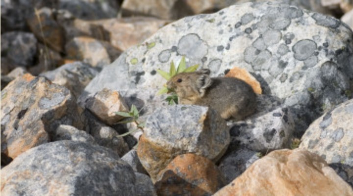
American Pika populations in Alberta will likely be capable of persisting throughout this century, although their survival will depend increasingly on successful vertical migration.
Resource
Goals of this investigation were to describe the present hydrologic and sediment regimes and to predict the consequences of surface disturbances which precede oil sands mining using runoff plots.
Resource
Authors
Hydrocon Engineering (Continental) Ltd.
Monenco Consultants Ltd.
Document provides an evaluation of currently available rainfall runoff sediment production methodologies, identifies key parameters, and outlines field programs to gather data for model calibration
Resource
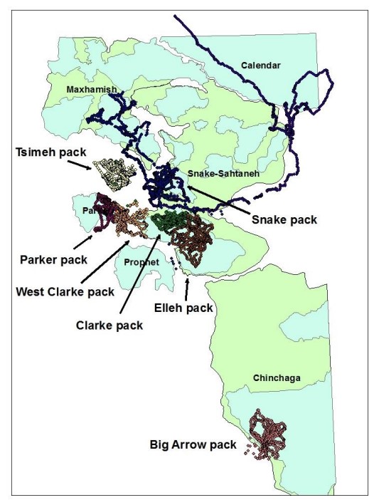
In 2013, we completed the last year of data collection for the project. Across the project’s three years, we collected GPS data from 57 female caribou, 19 wolves (Canis lupus) and 19 black bears...
Resource
Authors
Alberta Biodiversity Monitoring Institute
Alberta Innovates - Technology Futures
With few exceptions, permeability across in situ developments was the main factor affecting caribou movement. Relationship was non-linear, suggesting a minimum threshold of permeability is needed
Resource
Authors
Alberta Biodiversity Monitoring Institute
Alberta Innovates - Technology Futures
Salmo Consulting
At current levels of industrial development, pipelines and linear features have a very small negative effect on caribou populations compared to the high levels of predation.
Resource
Authors
Rod Olson
Bruce Thompson
Henry Bertram
Roy Peters
Determine changes in the input rate of atmospheric trace substances into sensitive ecosystems and provide a database for the documentation of variations in chemical characteristics of precipitation
Resource
This report identifies historical, annual and open water, low flow sequences for 13 stations in the Athabasca River Basin which can be used to determine management guidelines for the River basin
Resource
Monthly flows are provided for the period 1912 to 1980 at 21 locations on the Athabasca River and its major tributaries. The flow data sets are suitable for water management planning