
Search Results
Displaying:
1 - 4 of 4
Extending the National Burned Area Composite Time Series of Wildfires in Canada
Resource
This study created a 35-year time series of wildfire burned areas in Canada from 1986 to 2020, using data from satellite imagery and aerial surveys. Wildfires are a major natural disturbance in Canada...

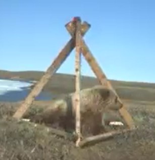
Network of Wildlife Cameras and Audio Recorders Expanded to Better Monitor Biodiversity
News
Organization
Biodiversity monitoring partners across the NWT are getting a closer look at wildlife as the Government of the Northwest Territories’ Biodiversity Monitoring Program expands. Remote cameras and audio...
The Multisource Vegetation Inventory (MVI): A Satellite-Based Forest Inventory for the Northwest Territories Taiga Plains
Resource
Wall-to-wall 30 m raster maps of broad forest type, stand height, crown closure, stand volume, total volume, aboveground biomass, and stand age were created for a ~400,000 km2 area, validated with independent data, and generalized into a polygon GIS layer resembling a traditional FI map. The MVI project showed that a reasonably accurate FI map for large, remote, predominantly non-inventoried boreal regions can be obtained at a low cost by combining limited field data with remote sensing data from multiple sources.