
Search Results
Displaying:
1 - 4 of 4
High-resolution Satellite Imagery Applied to Monitoring Revegetation of Oil-sands-exploration Well Pads
Resource
Project demonstrated that high-spatial-resolution satellite imagery could be used to develop accurate land-cover classifications on reclaimed in-situ operations

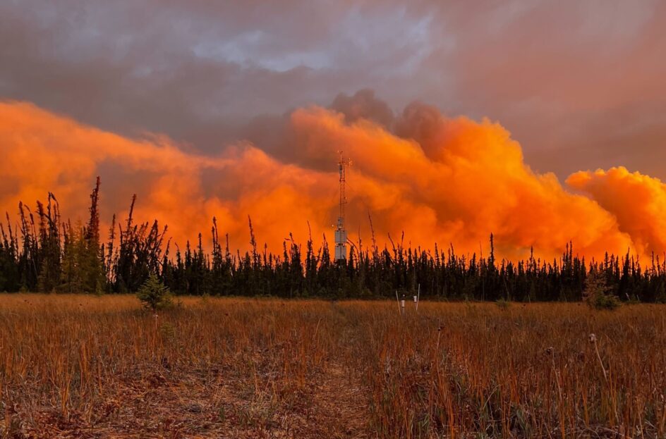
Indigenous-led Climate Research Station Rebuilds After October Wildfire
News
Organization
In October 2022, Scotty Creek Research Station—a prominent climate research facility in the Northwest Territories (NWT) of Canada located within a wetland complex—was almost entirely consumed by an...
Spatial Factors Related to Mortality and Population Decline of Endangered Mountain Caribou
Resource
This resource is available on an external database and may require a paid subscription to access it. It is included on the CCLM to support our goal of capturing and sharing the breadth of all...
