
Search Results
Displaying:
1 - 6 of 6
Cultivating Professional Communities Virtual Conference
Event
Event Date and Time
December 1st, 2021 at 8:30am MST to December 2nd, 2021 at 4:00pm MST
Organization
Alberta Society of Professional Biologists, the Association of the Chemical Profession of Alberta, and the Association of Alberta Forest Management Professionals are excited to be hosting the second...

Extending the National Burned Area Composite Time Series of Wildfires in Canada
Resource
This study created a 35-year time series of wildfire burned areas in Canada from 1986 to 2020, using data from satellite imagery and aerial surveys. Wildfires are a major natural disturbance in Canada...

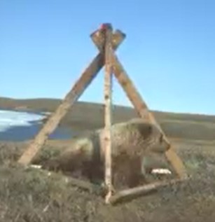
Network of Wildlife Cameras and Audio Recorders Expanded to Better Monitor Biodiversity
News
Organization
Biodiversity monitoring partners across the NWT are getting a closer look at wildlife as the Government of the Northwest Territories’ Biodiversity Monitoring Program expands. Remote cameras and audio...
The Multisource Vegetation Inventory (MVI): A Satellite-Based Forest Inventory for the Northwest Territories Taiga Plains
Resource
Wall-to-wall 30 m raster maps of broad forest type, stand height, crown closure, stand volume, total volume, aboveground biomass, and stand age were created for a ~400,000 km2 area, validated with independent data, and generalized into a polygon GIS layer resembling a traditional FI map. The MVI project showed that a reasonably accurate FI map for large, remote, predominantly non-inventoried boreal regions can be obtained at a low cost by combining limited field data with remote sensing data from multiple sources.