Boreal Caribou Search Results
Resource
Resource Date:
October
2018
This study utilized mesocosms to investigate the effects of oil sands process water (OSPW) and densified fluid fine tails (dFFT) on aquatic ecosystems to support development of end pit lake technology
Resource
Resource Date:
August
2020
This document is part of the 360 tours project Toolkit developed by Canada's Oil Sands Innovation Alliance (COSIA) led by Cenovus Energy Inc., in collaboration with Natural Resources Canada. The...
Resource
Authors
Alberta Biodiversity Monitoring Institute
This report is part of a larger endeavor to develop a monitoring program capable of detecting changes in the biological diversity of Alberta’s forested region.
Resource
Long-term monitoring of some sites would ultimately be needed to show that recovering wellsites are on a trajectory that consistently leads to full recovery.
Resource
Three mid- to high-elevation lines of slender wheatgrass were selected and released as varieties for use in reclamation
Resource
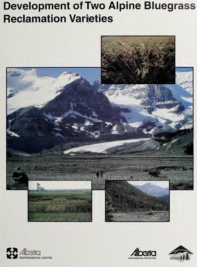
Two lines of alpine bluegrass were selected and released as varieties for use in reclamation
Resource
Soils sampled at sites 2.3 and 5.3 km south of the Great Canadian Oil Sands (GCOS) plant, Fort McMurray, respectively were found to differ statistically with reference to several macronutrients
Resource
Stem cuttings of balsam poplar and three poplar hybrids were directly planted onto reclamation material ontailings dyke slope. The overall rooting success was poor - direct planting is not recommended
Resource
Authors
Sandra Landsburg
Elizabeth Dwyer
Dissipation of bromacil in Humic Luvic Gleysols amended with cow manure was evaluated at two sites in northwestern Alberta from 1984 to 1987
Resource
Highway rights-of-way in Alberta, and elsewhere, are dull because they consist of limited, non-native species mixes that are frequently mowed. These rights-of-way are therefore not much more exciting...
Resource
The trial was established on blended materials consisting of native sand, clayey overburden and peat. Nine native grasses and eight cultivated grass varieties were seeded in June of 1981.
Resource
Authors
Roger DeAbreu
Shane Patterson
Todd Shipman
Chris Powter
NRCan pilot science projects have proven that Earth Observation can provide relevant and valuable information to inform and enhance monitoring and support regulatory frameworks
Resource
There was only very limited evidence of biological responses to increased pollutant content in spite of significantly higher pollutant levels in tissues close to existing industrial developments.
Resource
Authors
M.D. Thompson
M.C. Wride
M.E. Kirby
Classification system devised for mapping vegetation and surficial geology from 1:60,000 scale false colour infrared photographs; 1:50 000 base maps plus a vegetation and a surficial geology overlay
Resource
Ground surveys of vegetation and surficial geology generally confirmed that the classification systems used in the mapping accurately described and defined the ecological habitat features
Resource
Authors
ERMP Project Advisory Group
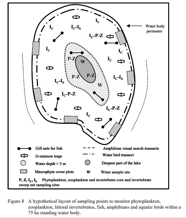
Monitoring protocols for forested land wellsites to determine if a reclaimed site has returned to similar structure and function as found in a representative undisturbed reference area.
Resource
Authors
Alberta Biodiversity Monitoring Institute
Select appropriate vegetation, soil, and habitat indicators for a long-term reclamation monitoring program and provide sampling protocols for the selected indicators.
Resource
Our statistical design and the hands on learning experience we gained in the field can be applied when implementing the long-term monitoring program for certified wellsites.
Resource
Authors
Alberta Biodiversity Monitoring Institute
Three workshops were held to examine a suite of vegetation, soil, and habitat indicators that could potentially be used to monitor recovery in a long-term reclamation monitoring program
Resource
Data show that for many vegetation and soil indicators, wellsite development impacts are long lasting and may remain for 30 years or more after reclamation.