Boreal Caribou Search Results
Resource
Objective to evaluate the streamflow, suspended sediment, lake level, and water quality networks in the AOSERP study area so as to provide the basis for continuation and/or redirection.
Resource
Authors
Ann Smreciu
Kimberly Gould
This study evaluated the effect of sowing season (spring versus fall) and propagule type (clean seeds versus whole fruit) on emergence of 41 species on oil sands mine reclamation sites.
Resource
Summary of the meteorological data collected by the meteorological tower network in the Gregoire Lake region of northeast Alberta during the spring and summer of 1979 to monitor impact of Amoco plant
Resource
Authors
Jean Birks
John Manchuk
Yi Yi
Cynthia McClain
Michael Moncur
John Gibson
Clayton Deutsch
Emily Taylor
Guy Bayegnak
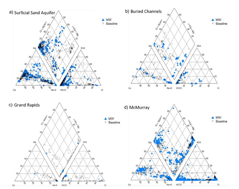
Groundwater quality data for the AOSR are compiled and interpreted to provide information on regional water quality to inform groundwater monitoring and land use planning. A database of 546 water...
Resource
Authors
Jean Birks
John Manchuk
Yi Yi
Cynthia McClain
Michael Moncur
John Gibson
Clayton Deutsch
Emily Taylor
Guy Bayegnak
Groundwater quality data for the AOSR are compiled and interpreted to provide information on regional water quality to inform groundwater monitoring and land use planning. A database of 546 water...
Resource
A set of 11 sites were established in the Alberta Oil Sands Environmental Research Program study area to provide baseline information on vegetation and soils with respect to air pollution impact
Resource
Authors
Sini-Selina Salko
Jussi Juola
Iuliia Burdun
Harri Vasander
Miina Rautiainen
Boreal peatlands store ~25 % of global soil organic carbon and host many endangered species; however, they face degradation due to climate change and anthropogenic drainage. In boreal peatlands...
Resource
Authors
Angelo Filicetti
Jesse Tigner
Scott Nielsen
Katherine Wolfenden
Murdoch Taylor
Paula Benthamd
Resource Date:
November
2023
Seismic lines, linear features originating from the oil and gas industry for energy exploration, pose a substantial management challenge due to their collective impact on biogeochemical cycles, plant...
Resource
Authors
Ken Foster
Christine Godwin
Peter Pyle
The MAPS protocol (Monitoring Avian Productivity and Survivorship) was applied in a 2011 pilot program in the boreal forest in the oil sands region
Resource
Authors
Nadia Rochdi
J. Zhang
Karl Staenz
X. Yang
D. Rolfson
J. Banting
C. King
R. Doherty
Scope of the project is to develop a geomatics-based monitoring system to support the Government of Alberta’s efforts for monitoring reclamation success. Software will support decision making process
Resource
In most years, evaporation exceeds summer rainfall. Using natural aspen stands as a comparison, it is expected that water use from the soil cover will continue to increase as the ecosystem ages.
Resource
Authors
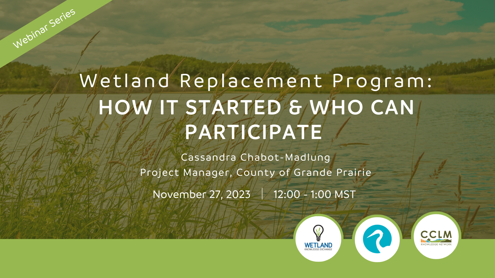
Wetland Knowledge Exchange
Resource Date:
November
2023
Cassandra Chabot-Madlung, County of Grande Prairie presents - Wetland Replacement Program: How it Started & Who Can Participate This is a Municipal viewpoint of Alberta Environment and Protected Areas...
Resource
Authors
Richard Johnson
P. Bork
E.A.D. Allen
W.H. James
L. Koverny
The experiments detailed in this report show that it was possible to increase the solids content of sludge to 50% solids by adding three parts sand (tailings sand) to one part sludge.
Resource
Authors
Craig Mahoney
Joshua Montgomery
Stephanie Connor
Danielle Cobbaert
Abstract Boreal wetlands within the oil sands region of Alberta, Canada, are subject to natural and anthropogenic pressures, resulting in the need for monitoring these sensitive ecosystems to ensure...
Resource
Authors
Virgil Hawkes
Gillian Donald
A long-term plot network would allow the monitoring data to describe the ecological condition of the reclaimed lands and define appropriate management strategies for achieving revegetation goals
Resource
Authors
Terry Macyk
Martin Fung
Ron Pauls
Syncrude Canada Ltd. produces 200,000 barrels of synthetic crude oil per day from its oil sands surface mining operations located 50 km north of Fort McMurray, Alberta. The three major types of...
Resource
Authors
Marie-Claude Roy
J. Kariyeva
Jim Herbers
Jim Schieck
Final recommendations to the development of a wetland monitoring program for the Oil Sands region of Alberta.
Resource
Authors
Meike Lemmer
Bin Xu
Maria Strack
Linne Rochefort
Resource Date:
April
2022
This resource is available on an external database and may require a paid subscription to access it. It is included on the CCLM to support our goal of capturing and sharing the breadth of all...
Resource
Authors
Howard Baldwin
Bryant Bidgood
Design techniques are presented for a very high frequency telemetry system capable of transmitting short radio frequency pulse signals from the body of a fish to an aircraft flying over a river.
Resource
Authors
Robert Danielson
Suzanne Visser
Associated with the roots of silver-berry and buffalo-berry are two symbionts the N2-fixing actinomycete, Frankia, and the vesicular-arbuscular mycorrhizal (VAM) fungi.