Land Management Resources
Resource
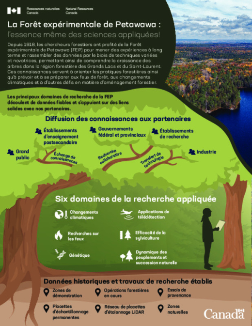
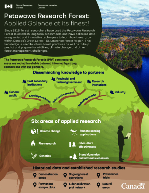
Since 1918, forest researchers have used the Petawawa Research Forest to establish long term experiments and have collected data using varied and innovative techniques to learn how trees grow within...
Resource
Since 1918, forest researchers have used the Petawawa Research Forest to establish long term experiments and have collected data using varied and innovative techniques to learn how trees grow within...
Resource
Author(s)
Tim Keddy
Derek Sidders
Connie Nichol
The goal of this operations guide is to assist those who seek to establish and manage fast growing, high-yield afforestation plantations for the vegetation of phosphogypsum (PG) stacks. The approach...
Resource
Author(s)
Tim Keddy
Derek Sidders
Connie Nichol
The video for this guide can be found here: www.cclmportal.ca/resource/reclamation-phosphogypsum-stacks-using-afforestation-video The goal of this operations guide is to assist those who seek to...
Resource
Author(s)
Ressources naturelles Canada
Forests are part of a living system where carbon is continually captured from and emitted to the atmosphere. Calculating the impact of human actions on forest carbon is a complex, but critically...
Resource
Author(s)
Natural Resources Canada (NRCan)
Forests are part of a living system where carbon is continually captured from and emitted to the atmosphere. Calculating the impact of human actions on forest carbon is a complex, but critically...
Resource
Resource Date:
March
2013
This presentation describes how the Alberta oil and gas industry decided to go with a oil/gas spill cooperative rather than having individual company spill response units.
Resource
Resource Date:
March
2013
Lorne Fitch takes us on a tour through the natural regions of Alberta.
Resource
Resource Date:
March
2013
This presentation discusses land-use as a tool to understand the drivers of water processes.
Resource
Resource Date:
March
2013
This presentation summarizes strategies Canada can learn from the U.K. about flood risk management.