Land Management Search Results
Resource
Authors
Ken Foster
Christine Godwin
Peter Pyle
The MAPS protocol (Monitoring Avian Productivity and Survivorship) was applied in a 2011 pilot program in the boreal forest in the oil sands region
Resource
Authors
Alberta Biodiversity Monitoring Institute
Boreal caribou populations are declining across Alberta and much of their Canadian range. Key factors causing this decline include a warming climate along with habitat change from industrial...
Resource
Authors
Alberta Biodiversity Monitoring Institute
Seismic lines and other linear features created by humans are thought to negatively impact woodland caribou. It is estimated that there are c. 100,000 km of conventional seismic lines in caribou...
Resource
Authors
Amy Nixon
Ryan Fisher
Diana Stralberg
Erin Bayne
Climate suitability projections, and current distribution of grassland and cropland habitats in Alberta suggest that some climate-mediated range expansion of grassland songbirds is possible
Resource
Authors
Howard Baldwin
Bryant Bidgood
Design techniques are presented for a very high frequency telemetry system capable of transmitting short radio frequency pulse signals from the body of a fish to an aircraft flying over a river.
Resource
Authors
Cameron Nordell
Erin Bayne
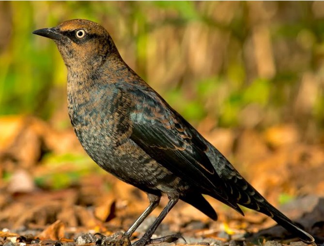
The Rusty Blackbird ( Euphagus carolinus ) was listed as Special Concern on Schedule 1 of the federal Species at Risk Act in March 2009 because of large and longterm declines in population size. The...
Resource
Authors
Alberta Biodiversity Monitoring Institute
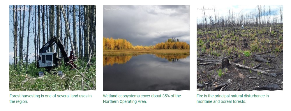
This online report describes the status of human footprint, species, and habitat in Norbord Inc.'s two main operating areas located in northwestern Alberta. This information establishes baseline...
Resource
Authors
Alberta Biodiversity Monitoring Institute
As of 2010, human footprint in the Active In-situ Region was 7.7%, whereas it was 20.8% in the Mineable Region. Total human footprint in all Woodland Caribou ranges increased between 2007 and 2010
Resource
Authors
Alberta Biodiversity Monitoring Institute
As of 2012, the total human footprint across the OSR was 13.8%. Energy footprint covered 2.2% of the OSR. The total human footprint in the OSR increased from 11.3% to 13.8% between 1999 and 2012.
Resource
Authors
Alberta Biodiversity Monitoring Institute
This report presents data on several indicators of environmental health for the Kakwa River Project area where ARC Resources operates in northwestern Alberta. The Kakwa River Project area covers...
Resource
Authors
Chris Stockdale
Quinn Barber
Marc-André Parisien
Resource Date:
April
2018
The boreal forests of Alberta have dense networks of seismic exploration lines which have been shown to contribute significantly to the decline in woodland caribou (Rangifer tarandus caribou)...
Resource
Authors
Alberta Biodiversity Monitoring Institute
This document was created by the Alberta Remote Camera Steering Committee (RCSC). The Alberta RCSC is chaired by Alberta Environment and Parks and comprises a group of wildlife camera experts from...
Resource
Authors
M. Nietfeld
J. Wilk
K. Woolnough
B. Hoskin
Summarize information to assist in defining species habitat relationships relevant to Alberta environments for a number of Alberta wildlife species to aid in developing habitat interpretation models