Land Management Search Results
Resource
Authors
Kim Chapman
Rob Fleming
Nelson Thiffault
Daniel Gouge
Gordan Kayahara
Dave Morris
Wayne Bell
We present an ecological framework for classifying sites to support vegetation management decisions in the boreal and northern temperate forests of northeastern Ontario and northwestern Quebec. This...
Resource
This report is adapted from a brief that was delivered in May, 2021 to the Standing Committee on Climate Change and Environmental Stewardship, an all-party committee of the New Brunswick Legislature...
Resource
During the 1980's, environmental issues grew rapidly in importance, and more sophisticated modelling scenarios were developed as an aid in predicting the transport and persistence behaviour of...
Resource
Authors
Jay Woosaree
Brij Verma
Byron James
Phytoremediation, the use of plants to remove, degrade or stabilize sites contaminated with organic or toxic chemicals is gaining in popularity as an alternative and economical technique in...
Resource
Authors
Nelson Thiffault
Caludie-Maude Canuel
Michael Hoepting
James Farrell
This fact sheet provides an overview of a study on the management implications of pre-commercial thinning in balsam fir. While the effects of pre-commercial thinning on stand growth and quality are...
Resource
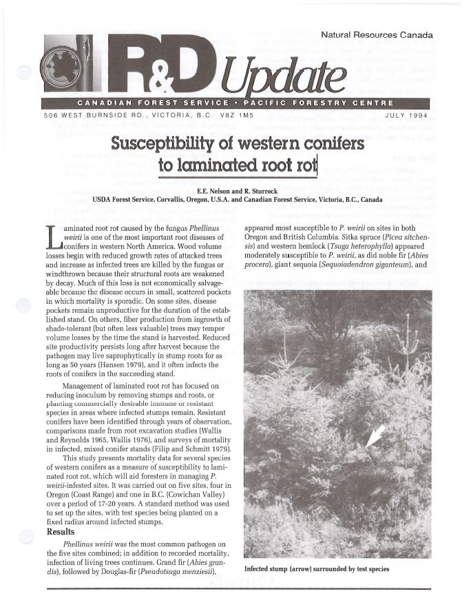
Laminated root rot caused by the fungus Phellinus weirii is one of the most important root diseases of conifers in western North America. This short note discusses the susceptibility of western...
Resource
Authors
Guillermo Castilla
Ronald Hall
Rob Skakun
Michelle Filiatrault
André Beaudoin
Michael Gartrell
Lisa Smith
Kathleen Groenewegen
Chris Hopkinson
Jurjen van der Sluijs
Resource Date:
February
2022
Wall-to-wall 30 m raster maps of broad forest type, stand height, crown closure, stand volume, total volume, aboveground biomass, and stand age were created for a ~400,000 km2 area, validated with independent data, and generalized into a polygon GIS layer resembling a traditional FI map. The MVI project showed that a reasonably accurate FI map for large, remote, predominantly non-inventoried boreal regions can be obtained at a low cost by combining limited field data with remote sensing data from multiple sources.
Resource
Authors
Kim Chapman
Rob Fleming
Nelson Thiffault
Daniel Gouge
Gordon Kayahara
Dave Morris
Wayne Bell
We present an ecological framework for classifying sites to support vegetation management decisions in the boreal and northern temperate forests of northeastern Ontario and northwestern Quebec. This...