Land Management Search Results
Resource
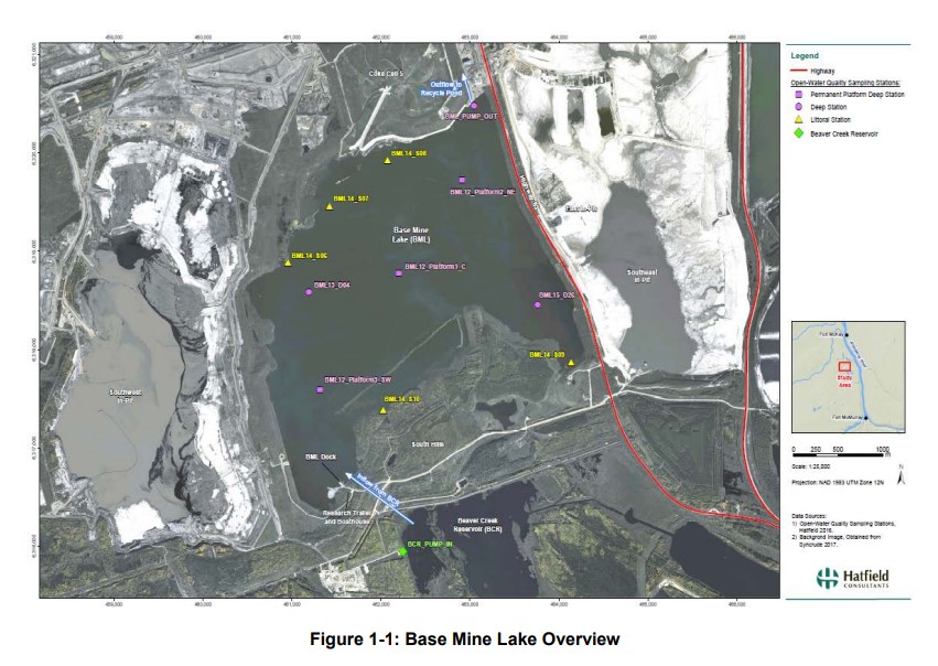
Syncrude's Base Mine Lake (BML) is the first, and currently the only full-scale commercial demonstration of the end pit lake technology in the oil sands industry. An oil sands end pit lake (EPL) is an...
Resource
Vegetation workshop was held November 1979 to evaluate user needs for more detailed vegetation descriptions and maps and to review the results of the vegetation survey as a step towards meeting needs
Resource
Authors
Daphne Cheel
Stephen Moran
Mark Trudell
Don Thacker
Terry Macyk
Report synthesizes and summarizes 36 RRTAC reports to provide the user with a unified source of information on land and groundwater reclamation research in the plains of Alberta
Resource
Authors
Erin Bayne
Diana Stralberg
Amy Nixon
Use of ABMI samples to understand genetic variation and changes in genetic structure is identified as an area where ABMI data can be used to understand how biodiversity is adapting to climate change
Resource
Authors
Natalie Shelby-James
Sarah Thacker
Chris Powter
Paul Fuellbrandt
Tomislav Hengl
Leandro Parente
Objective is to work collaboratively with soil data users to develop the Alberta Background Soil Quality System (ABSQS) as a tool to assist industry and government in environmental management
Resource
The Natural Regions and Subregions classification represents the state-of-the-art in ecological land classification in Alberta. This classification provides a valuable baseline for resource management...
Resource
Authors
R.B. Caton
C.S. Davis
Martin Davies
D.L.M. Stevens
Ron Wallace
Tony Yarranton
Reid Crowther
The result of this review was a plan for a five-year biophysical monitoring program to provide the necessary scientific and technical information upon which to base an effective regulatory approach.
Resource
Authors
Leila Taheriazad
Carlos Portillo-Quintero
Arturo Sanchez-Azofeifa
This report presents a comprehensive review of industrial applications of an emerging environmental monitoring technology called Wireless Sensor Networks (WSN) and a WSN installed at Coal Valley Mine
Resource
Several insect species and groups of insects are examined for their potential as biological indicators in the AOSERP area.
Resource
Authors
Aaron Sekerak
Gordon Walder
Maps showing fish collection locations, photos and details of the physical characteristics of nine streams within five watersheds (Firebag, Muskeg, Steepbank, MacKay, and Ells) in AOSERP study area
Resource
During 1978, a number of aquatic projects were funded by AOSERP using a habitat inventory and mapping approach.
Resource
Authors
M.S. Thompson
J. Crosby-Diewold
Relationship between aquatic macrophyte growth and habitat factors found in the AOSERP study area is outlined, as are some implications of aquatic macrophyte inventory for management and revegetation
Resource
Understanding how birds respond to landscape disturbance is key to effective restoration. Two studies used non-invasive microphone arrays to determine the exact locations of singing individuals in the...
Resource
Authors
Alberta Biodiversity Monitoring Institute
In summer 2013 field crews spent five weeks sampling soil and vegetation indicators at 18 wellsites and adjacent reference sites in the Dry Mixedgrass subregion of Alberta
Resource
Authors
Jocelyn Gregoire
Richard Hedley
Erin Bayne
Seismic lines have an extensive footprint in Canada's western boreal forest that alter habitat conditions for many species. Seismic lines exist within a range of seral states due to changing practices...
Resource
As caribou habitat restoration initiatives have become more widespread across Alberta in the last decade, key uncertainties have been recognized regarding what treatment types are appropriate for...
Resource
Authors
D.W. Mayhood
Linda Corkum
Baseline data available on the Muskeg River hydrology, benthic invertebrates, plankton and fish are generally useful, but additional information is desireable
Resource
The present volume evaluates the 1980 monitoring program, and makes suggestions for the conduct of future monitoring studies on the Muskeg River and elsewhere in the AOSERP area
Resource
Authors
Chris Powter
Brent Scorfield
Brent Lakeman
Shane Patterson
The development of integrated geomatics and remote sensing technologies for environmental management holds promise to meet economic diversification and effective environmental management.
Resource
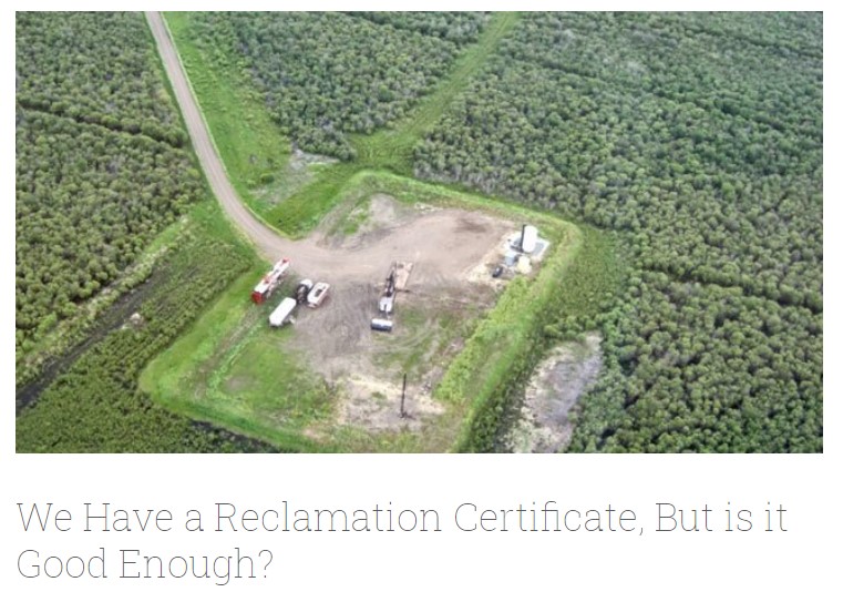
Long-term monitoring of some sites would ultimately be needed to show that recovering wellsites are on a trajectory that consistently leads to full recovery.