Land Management Search Results
Resource
Authors
Angelo Filicetti
Scott Nielsen
Energy exploration has led to fragmentation of habitats worldwide. In boreal forests of Alberta, Canada narrow clear-cut linear disturbances (3–14 m wide) called seismic lines are often the largest...
Resource
Authors
Ingrid Visseren-Hamakers
Marcel Kok
Over fifty years of global conservation has failed to bend the curve of biodiversity loss, so we need to transform the ways we govern biodiversity. The UN Convention on Biological Diversity aims to...
Resource
Resource Date:
August
2021
With the support of Alberta Environment and Parks, the Alberta Biodiversity Monitoring Institute has become the trusted source for data about habitat, species, and the human footprint.
Resource
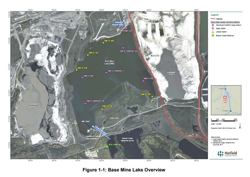
Syncrude's Base Mine Lake (BML) is the first, and currently the only full-scale commercial demonstration of the end pit lake technology in the oil sands industry. An oil sands end pit lake (EPL) is an...
Resource
Authors
Alberta Biodiversity Monitoring Institute
As of 2015, 29.2% of Alberta is under human footprint, up from 25.7% in 1999—that’s an average increase of about 0.22%, or around 1450 km2 (560 sections) per year.
Resource
Authors
Mighty Peace Watershed Alliance
The Mighty Peace Watershed Alliance (MPWA) supports the three goals of Alberta’s Water for Life Strategy: safe secure drinking water, healthy aquatic ecosystems, and reliable, quality water supplies...
Resource
Authors
Axel Anderson
Richard Mccleary
Sheena Spencer
Michael Wagner
Resource Date:
January
2018
This poster outlines the development of a watershed assessment procedure for the eastern slopes of Alberta. The process was developed with the Oldman Watershed Council, using the Oldman River Basin as a study site.
Resource
Resource Date:
September
2017
Rapid landscape alteration associated with human activity is currently challenging the evolved dynamical stability of many predator–prey systems by forcing species to behaviourally respond to novel...
Resource
Authors
Chris Powter
Brent Scorfield
Brent Lakeman
Shane Patterson
The development of integrated geomatics and remote sensing technologies for environmental management holds promise to meet economic diversification and effective environmental management.
Resource
Authors
Melanie Dickie
Robert Serrouya
Scott McNay
Stan Boutin
Predation by grey wolves Canis lupus has been identified as an important cause of boreal woodland caribou Rangifer tarandus caribou mortality, and it has been hypothesized that wolf use of human...
Resource
Authors
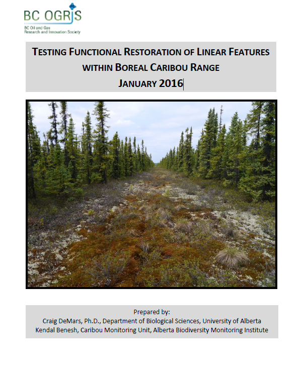
Craig DeMars
Kendal Benesh
The boreal ecotype of woodland caribou ( Rangifer tarandus caribou) is provincially Red-listed in British Columbia and federally listed as Threatened. Population declines of boreal caribou have been...
Resource
Authors
Roger DeAbreu
Shane Patterson
Todd Shipman
Chris Powter
NRCan pilot science projects have proven that Earth Observation can provide relevant and valuable information to inform and enhance monitoring and support regulatory frameworks
Resource
Authors
Chris Johnson
Libby Ehlers
Dale Seip
This resource is available on an external database and may require a paid subscription to access it. It is included on the CCLM to support our goal of capturing and sharing the breadth of all...
Resource
Authors
Jean Birks
Yi Yi
Sunny Cho
Emily Taylor
John Gibson
This study was conducted to characterize the composition of polar dissolved organic compounds present in snow and surface waters in the Athabasca Oil Sands Region (AOSR) with the goal of identifying...
Resource
Authors
Jean Birks
Yi Yi
Sunny Cho
John Gibson
Rod Hazewinkel
Goal was identifying whether atmospherically-derived organics present in snow are a significant contributor to the organics detected in rivers and lakes in the oil sands region
Resource
Authors
Daniel Fortin
Pietro-Luciano Buono
André Fortin
Nicolas Courbin
Christian Gingras
Paul Moorcroft
Réhaume Courtois
Claude Dussault
Associate Editor: Wolf Mooij
Editor: Judith Bronstein
This resource is available on an external database and may require a paid subscription to access it. It is included on the CCLM to support our goal of capturing and sharing the breadth of all...
Resource
Authors
Alberta Biodiversity Monitoring Institute
As of 2010, human footprint in the Active In-situ Region was 7.7%, whereas it was 20.8% in the Mineable Region. Total human footprint in all Woodland Caribou ranges increased between 2007 and 2010
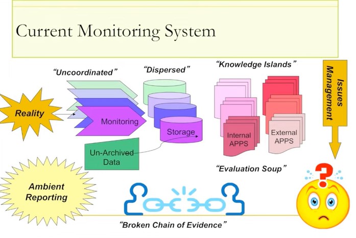
Resource
Ernie Hui gave a keynote address at the CWRA-WPAC joint conference on March 13, 2013. Ernie Hui is the CEO, Environmental Monitoring, for Alberta Environment and Sustainable Resource Development. The...
Resource
Authors
Daphne Cheel
Stephen Moran
Mark Trudell
Don Thacker
Terry Macyk
Report synthesizes and summarizes 36 RRTAC reports to provide the user with a unified source of information on land and groundwater reclamation research in the plains of Alberta
Resource
Authors
Stephen Moran
Terry Macyk
Mark Trudell
Margot Pigot
In 1985, a one hectare pond developed in the upland reclaimed landscape at Vesta Mine in an area where extensive ponding had not previously been observed. Because of the thickness of the spoil, about...