Wetlands Knowledge Search Results
Resource
Authors
Kevin Smith
Christopher Smith
Silvie Forest
Alain Richard
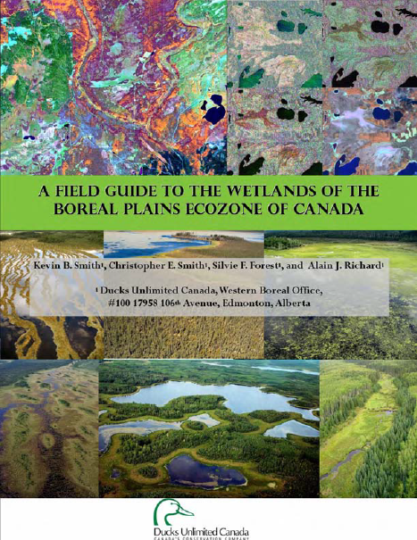
This guide provides an in-depth look at Ducks Unlimited Canada's (DUC) remote-sensing satellite mapping efforts and the development of the DUC enhanced wetland classification system.
Resource
Authors
Landmark Resource Management Ltd.
Boreal caribou ( Rangifer tarandus caribou) are traditionally a highly significant species to ADKFN and the species is currently listed as ‘threatened’ under Canada’s Species at Risk Act (SARA). As a...
Resource
Authors
GRID-Arendal
Levi Westerveld
Tiina Kurvits
T. Schoolmeester
Oda Mulelid
Torjus Eckhoff
Pier Overduin
Michael Fritz
Hugues Lantuit
Björn Alfthan
A. Sinisalo
Frederieke Miesner
L.-K. Viitanen
NUNATARYUK Consortium
Resource Date:
October
2023
This atlas is an attempt to translate and consolidate the available knowledge on permafrost. It is a timely book suffused with the compelling enthusiasm of its authors and contributors. Close to a...
Resource
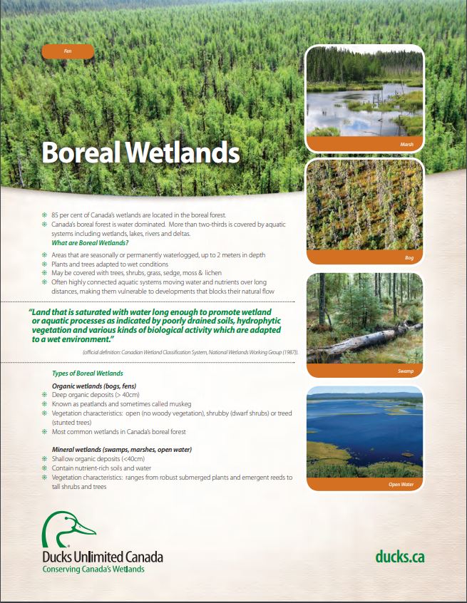
These fact sheets highlight plant, soil, and water indicators and key ecological benefits of each of the five major wetlands types.
Resource
Authors
Valda Walsh
Charles Hobart
Research concepts, methodologies and data collection instruments and procedures which are appropriate in white communities might not be so in Indian and Metis communities.
Resource
Authors
Amy Christianson
Colin Sutherland
Faisal Moola
Noémie Bautista
David Young
Heather MacDonald
Indigenous perspectives have often been overlooked in fire management in North America. With a focus on the boreal region of North America, this paper provides a review of the existing literature...
Resource
Ducks Unlimited Canada has been leading the effort to provide detailed and accurate wetland maps for large areas of the western boreal forest. These mapping products have become the cornerstone of DUC...
Resource
Authors
Michael Willoughby
Dave Downing
Margaret Meijer
The Upper Boreal Highlands subregion is found elevationally above the Lower Boreal Highlands subregion in the Birch Mountain, Buffalo Head Hills and Cameron Hills of Northcentral and Northwestern...
Resource
Resource Date:
March
2011
... conducted 20 interviews with holders of Gwich’in traditional knowledge and searched the digital archives of GSCI for relevant primary and secondary data to obtain TK about [woodland caribou].
Resource
Authors
Jean Polfus
Micheline Manseau
Deborah Simmons
Michael Neyelle
Walter Bayha
Frederick Andrew
Leon Andrew
Cornelya Klütsch
Keren Rice
Paul Wilson
Using multiple knowledge sources to interpret patterns of biodiversity can generate the comprehensive species characterizations that are required for effective conservation strategies. Caribou...
Resource
Welcome to MarshWatch! MarshWatch is a new pilot program focused on wetland birds and amphibians for beginners. Virtual webinars along with self-guided activities slowly build your identification...
Resource
Welcome to MarshWatch! MarshWatch is a new pilot program focused on wetland birds and amphibians for beginners. Virtual webinars along with self-guided activities slowly build your identification...
Resource
Welcome to MarshWatch! MarshWatch is a new pilot program focused on wetland birds and amphibians for beginners. Virtual webinars along with self-guided activities slowly build your identification...
Resource
Welcome to MarshWatch! MarshWatch is a new pilot program focused on wetland birds and amphibians for beginners. Virtual webinars along with self-guided activities slowly build your identification...
Resource
Authors
Anne McIntosh
Bonnie Drozdowski
Dani Degenhardt
Chris Powter
Christina Small
John Begg
Dan Farr
Arnold Janz
Randi Lupardus
Delinda Ryerson
Jim Schiek
We developed a scientifically robust and financially sustainable monitoring protocol to enable a consistent assessment of ecological recovery at reclaimed industrial wellsites in forested lands
Resource
Resource Date:
September
2023
Although peatlands cover only 3% of the world's land, they store about twice as much carbon as in the biomass of all the world's forests combined. Thus, they are incredibly important especially for...
Resource
Authors
Laura Chasmer
Edberto Moura Lima
Craig Mahoney
Chris Hopkinson
Joshua Montgomery
Danielle Cobbaert
Resource Date:
August
2021
Bi-temporal LiDAR data used to identify correspondence between density of anthropogenic disturbances, wetland shape complexity and changes in vegetation height within >1800 wetlands near Fort McKay
Resource
Authors
Rachel Hovel
Jeremy Brammer
Emma Hodgson
Amy Amos
Trevor Lantz
Chanda Turner
Tracey Proverbs
Sarah Lord
Rapid environmental change in the Arctic elicits numerous concerns for ecosystems, natural resources, and ways of life. Robust monitoring is essential to adaptation and management in light of these...
Resource
Authors
Guillermo Castilla
Ronald Hall
Rob Skakun
Michelle Filiatrault
André Beaudoin
Michael Gartrell
Lisa Smith
Kathleen Groenewegen
Chris Hopkinson
Jurjen van der Sluijs
Resource Date:
February
2022
Wall-to-wall 30 m raster maps of broad forest type, stand height, crown closure, stand volume, total volume, aboveground biomass, and stand age were created for a ~400,000 km2 area, validated with independent data, and generalized into a polygon GIS layer resembling a traditional FI map. The MVI project showed that a reasonably accurate FI map for large, remote, predominantly non-inventoried boreal regions can be obtained at a low cost by combining limited field data with remote sensing data from multiple sources.
Resource
Authors
Dale Vitt
Melissa House
Lilyan Glaeser
Minerogenous peatlands that accumulate deep deposits of organic matter (fens) were an important part of the pre-disturbance landscape across Alberta’s oil sands mining area. Bryophytes occupy 80–100%...