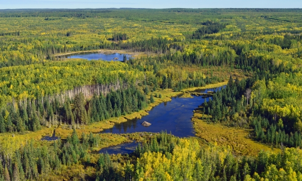
Wetlands Knowledge Search Results
Displaying:
1041 - 1060 of 2392
To narrow down your search results use the filters at left to find Contacts, active Projects, specific resource Formats, News & Events or, for example view only resources from a specific Organization, or about specific Disturbance Types.
Make Wetlands your Valentine: Bow River Regional Wetlands Datasets information session
Event
Organization
What better way to spend a Valentine’s Day lunch than learning about a new, open-access resource to view and understand wetlands in the Bow River region? We are pleased to invite you to a webinar with...
Managing and Enhancing Terrestrial Road Ecology
Resource
This document provides decision-making criteria to assist in various aspects of roadway design and operation for management of sustainable road systems
Manitoba taxpayers hit with cost of Sask.'s spring runoff
News
Organization
Surge of water that partially collapsed a culvert 12 feet in diameter was the latest in an ongoing onslaught. Connor McDowell / Local Journalism Initiative Reporter / Brandon Sun Jun 26, 2025 8:00 PM...
Map Gallery: Climate Change Impact Projections for Boreal Songbirds
Resource
Bioclimatic niche models of current avian distribution and density for 80 boreal-breeding songbird species are mapped based on present counts and climate change models
Map of Beaver Coexistence Tools
Resource
Beavers, Canada's national animal, provide many valuable ecosystem services including storage of water during droughts and flooding, creation of habitat for a variety of species, and improvement of...
Map Our Marshes
Event
Event Date and Time
August 20th, 2022 at 5:00pm to August 21st, 2022 at 4:00pm
Organization
The B.C. Wildlife Federation's Wetlands Education Program presents Map our Marshes, a free 1.5-day public workshop, hosted in partnership with the Arrowsmith Naturalists and Mid-Vancouver Island...
Mapping and Monitoring Peatland Conditions from Global to Field Scale
Resource
Peatlands cover only 3–4% of the Earth’s surface, but they store nearly 30% of global soil carbon stock. This significant carbon store is under threat as peatlands continue to be degraded at alarming...
Mapping And Monitoring Peatland Conditions from Global to Field Scale
Resource
Peatlands cover only 3–4% of the Earth’s surface, but they store nearly 30% of global soil carbon stock. This significant carbon store is under threat as peatlands continue to be degraded at alarming...
Mapping Canadian Wetlands
Resource
This briefing note synthesizes knowledge from two resources on wetland mapping available on the Canadian and Conservation Land Management (CCLM) Knowledge Portal.
Mapping Degrading Dendritic Peat Plateaus, NWT, Canada
Resource
In the discontinuous permafrost zone, thermokarst lakes and thermal erosion are widespread and common permafrost thaw-related phenomena. Thermokarst features are indicative of thaw sensitive...
Mapping Groundwater Dependent Ecosystems in Alberta’s Oil Sands Region
Resource
The relationship between groundwater and its receiving environment is of particular interest in the Alberta oil sands region (OSR) where industrial operations have the potential to affect both the...
Mapping Smouldering Fire Potential in Boreal Peatlands and Assessing Interactions with the Wildland-Human Interface in Alberta, Canada
Resource
This resource is available on an external database and may require a paid subscription to access it. It is included on the CCLM to support our goal of capturing and sharing the breadth of all...
Marcel Darveau
Contact
Organization
Position Title
National Boreal Sustainable Land Use Research Scientist
March 2021 Wetland Knowledge Exchange Webinar
Event
ONLINE,
Contact
Floods, carbon, ducks, and trails: Quantifying and communicating wetland ecosystem services in Atlantic Canada Presented by Emma Bocking, Ducks Unlimited Canada Rapid functional assessment tools like...