Wetlands Knowledge Search Results
Resource
Authors
Brian Eaton
Cindy Paszkowski
Kris Kendell
Arthur Whiting
Erin Bayne
Dave Huggard
Scott Nielsen
This report provides recommendations for an amphibian monitoring pilot study in the Lower Athabasca Planning Region.
Resource
Field data on the abundance (or percent cover) of vascular plants, bryophytes, and soil mesofauna were obtained in the summer of 2008 and 2009 from nine produced water release sites in Alberta and...
Resource
Authors
Kevin Smith
Christopher Smith
Silvie Forest
Alain Richard
This guide provides an in-depth look at Ducks Unlimited Canada's (DUC) remote-sensing satellite mapping efforts and the development of the DUC enhanced wetland classification system.
Resource
The overall objective of this research is to obtain sufficient scientific data relevant to salinity in peatlands in northern climates to allow for the derivation of risk-based assessment and...
Resource
Authors
Sylvain Ménard
Marcel Darveau
Louis Imbeau
Forest inventory maps can be used to quantify the area of wetland habitats and to define homogeneous regions in this regard, and therefore provide a functional tool for coarse-scale wetland management
Resource
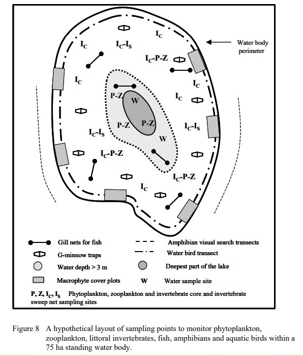
Protocols for sampling biotic and abiotic parameters in large lakes, large rivers, wetlands, and streams in Alberta is provided. Estimates of time costs are given.
Resource
Authors
Alberta Biodiversity Monitoring Institute
This report is part of a larger endeavor to develop a monitoring program capable of detecting changes in the biological diversity of Alberta’s forested region.
Resource
Authors
Bev Gingras
Cynthia Paszkowski
Garry Scrimgeour
Sharon Kendall
Objective was to compare the effectiveness of four commonly used sampling techniques (pitfall traps, funnel traps, visual searches and call surveys) to detect stream amphibian communities.
Resource
Authors
Garry Scrimgeour
Sharon Kendall
This chapter describes aquatic elements and sampling protocols that could be used to monitor forested stream ecosystems in Alberta and Saskatchewan
Resource
Authors
G.R. Hillman
J.D. Johnson
S.K. Takyi
Three experimental forest drainage sites were established in Alberta’s boreal forest to determine the effects of lowered water tables on soils, local hydrology, ground vegetation composition and tree...
Resource
Resource Date:
January
1994
Report of proceedings from a workshop to produce a strategic plan for developing a Watershed Assessment Model and identifying key project events.
Resource
Authors
Larry Turchenek
J.D. Lindsay
Recurring patterns of soils, landforms, and vegetation were delineated. The information was transferred first to 1:50,000 preliminary maps and then to eight 1:126,720 maps which accompany this report
Resource
Authors
J.P. Verschuren
L. Wojtiw
Point measurements of maximum depth showed that over 50% of the rainstorms occur in June and July, with only a small percentage in April (5.6) and September (10. 1).
Resource
Authors
W. Roberts
V. Lewin
L. Brusnyk
Wood frog (Rana sylvatica) was the most abundant and widespread species in 20 sites examined. Boreal chorus frogs (Pseudacris triseriata maculata) and Canadian toads (Bufohemiophrys) found at
Resource
Authors
Larry Turchenek
J.D. Lindsay
The emphasis in this inventory is on soils and the landforms on which they occur; both are indicated on maps. Air photo interpretation and field checking have been completed
Resource
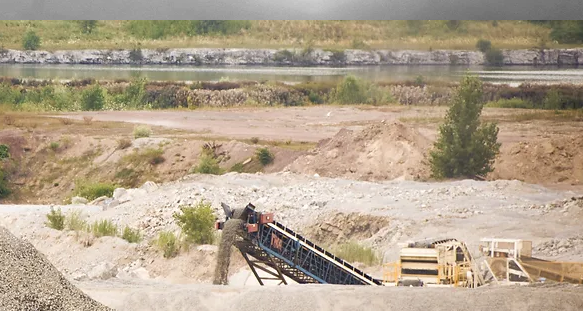
Many after-uses of aggregate extraction land do exist: forestry, agriculture, recreation, nature reserves, housing and waste disposal sites. Attempts at reclaiming this land for alternate uses has...
Resource
Authors
Michael Rowell
Jean Crepin
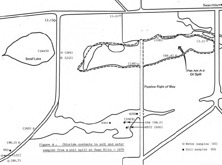
Salt spills are liable to become more prevalent in the oil producing regions of Alberta as the volume of brine relative to crude oil increases with the depletion of the older oil-fields. High...
Resource
In the Stat~ of Illinois lands that have been abandoned after deep mining or strip mining of coal present unique land reclamation problems. One such area is the Staunton l Reclamation Site. Through...
Resource
Ground water conditions are frequently overlooked when placing surface materials in a mine reclamation scheme. The purpose of this paper is to outline the interaction between the surface materials and...
Resource
Authors
Prince Albert Grand Council
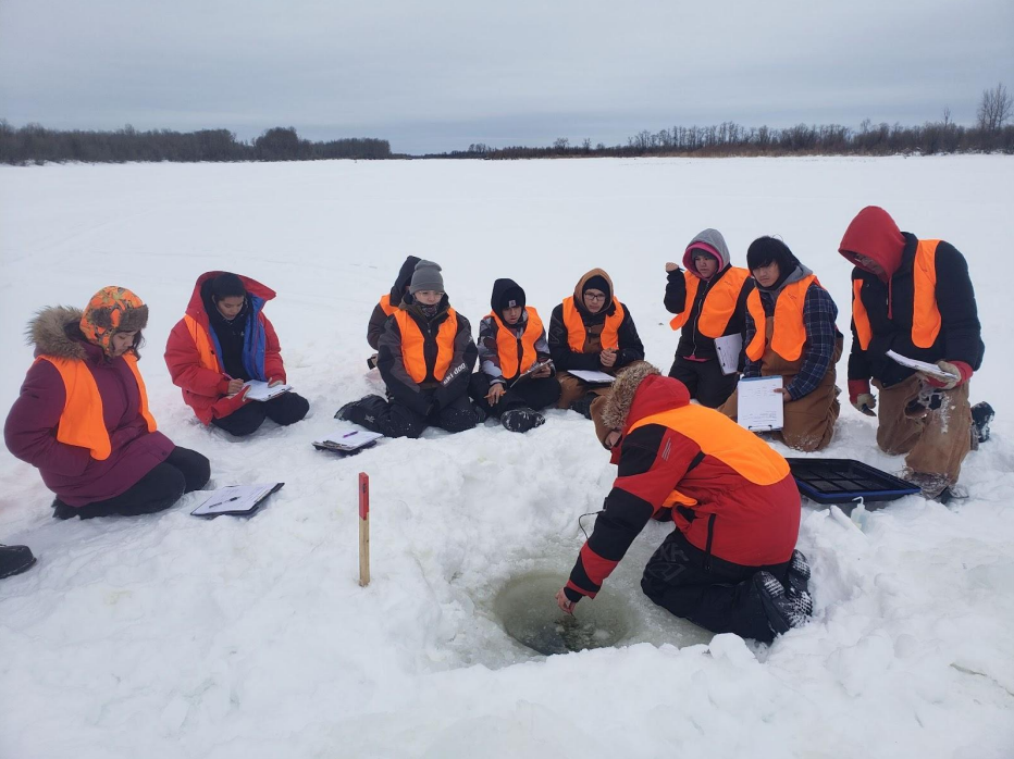
This article describes the community-based climate monitoring and fish habitat protection programs that Prince Albert Grand Council (PAGC) is undertaking. PAGC trains their youth in science and...