
Search Results
Displaying:
1 - 6 of 6
Deciduous Tree Species Classification Using Object-Based Analysis and Machine Learning with Unmanned Aerial Vehicle Multispectral Data
Resource
This resource is available on an external database and may require a paid subscription to access it. It is included on the CCLM to support our goal of capturing and sharing the breadth of all...
Hierarchical Land Cover and Vegetation Classification using Multispectral Data Acquired from an Unmanned Aerial Vehicle
Resource
This resource is available on an external database and may require a paid subscription to access it. It is included on the CCLM to support our goal of capturing and sharing the breadth of all...
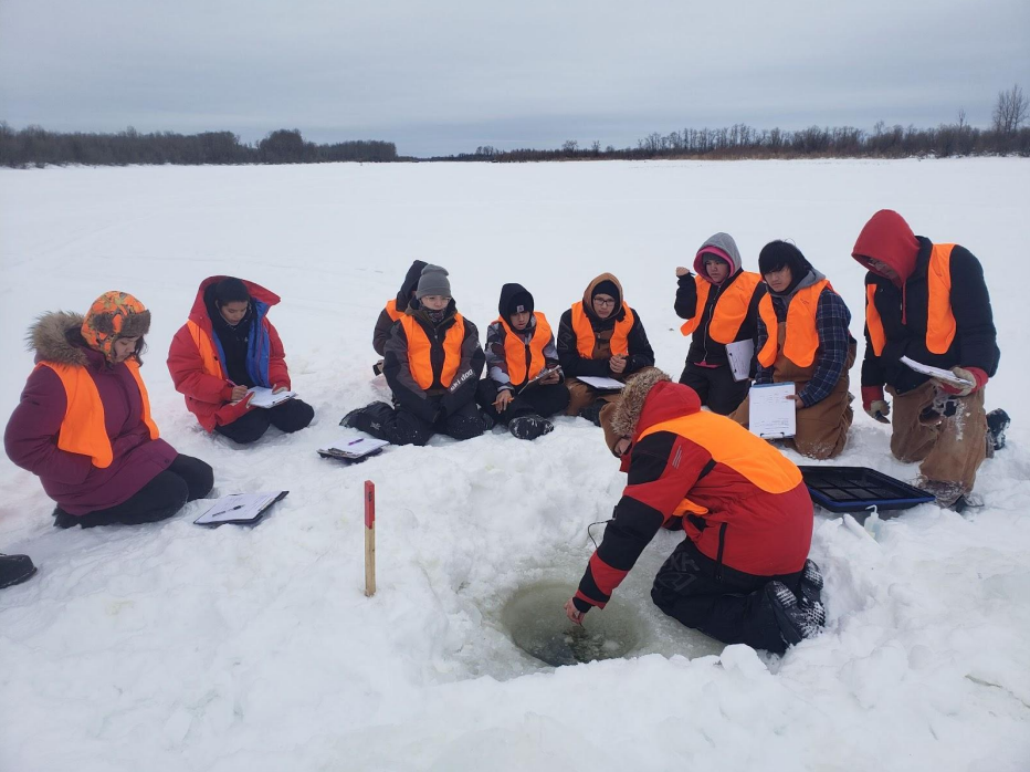
Indigenous Communities in Northern SK are Taking Action to Mitigate Climate Change Effects
Resource
This article describes the community-based climate monitoring and fish habitat protection programs that Prince Albert Grand Council (PAGC) is undertaking. PAGC trains their youth in science and...
The Third Generation of Pan-Canadian Wetland Map at 10 m Resolution Using Multisource Earth Observation Data on Cloud Computing Platform
Resource
Development of the Canadian Wetland Inventory Map (CWIM) has thus far proceeded over two generations, reporting the extent and location of bog, fen, swamp, marsh, and water wetlands across the country...
