
Search Results
Displaying:
21 - 40 of 62
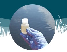
Forest Ecosystem Monitoring in Saskatchewan and Alberta: Identification of Aquatic Elements and Sampling Protocols
Resource
This chapter describes aquatic elements and sampling protocols that could be used to monitor forested stream ecosystems in Alberta and Saskatchewan

Global Peatlands Assessment: The State of the World’s Peatlands
Resource
Peatlands are unique and rare ecosystems that, despite only covering around 3-4% of the planet’s land surface, they contain up to one-third of the world’s soil carbon, which is twice the amount of...

HydroGeoSim: A Water Purification Geosimulation Modelling Platform
Resource
The model documentation summarizes the data, variables and assumptions required to capture how water purification services are provided across landscapes in Alberta

Isotope-based Water Balance Assessment of Open Water Wetlands Across Alberta: Regional Trends with Emphasis on the Oil Sands Region
Resource
Water sampling for stable isotopes ( 18O and 2H) was carried out during 2009–2019 across Alberta, Canada, as part of a survey targeting 1022 open water wetlands. The study presents the first site...

It's Our Nature To Know Webinar Series - Episode 8 - The Human Footprint Inventory
Event
Event Date and Time
January 26th, 2022 at 12:00pm MST to January 26th, 2022 at 1:00pm MST
Organization
In the eighth episode of our webinar series, ABMI GIS Coordinator Branko Hricko discusses the ABMI's Human Footprint Inventory (HFI). The HFI provides an unique view into current and historical...

Large-scale Probabilistic Identification of Boreal Peatlands Using Google Earth Engine, Open-access Satellite Data, and Machine Learning
Resource
The resulting peatland occurrence model shows an accuracy of 87% compared to our validation data set. Differentiating peatlands from mineral wetlands achieved an accuracy of 69%.

Leveraging Genomics Tools to Explore Relationships Between Agriculture, Biodiversity and Waterfowl Productivity in Prairie Wetlands
Resource
Environmental genomics is a research method that sequences DNA from samples collected from the environment (e.g. wetlands, water, soil, organisms, etc.). This method can accelerate species...

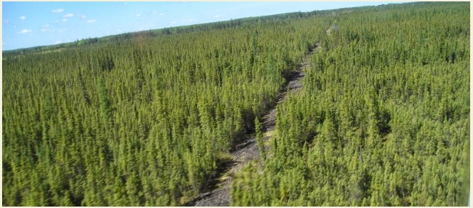
Low-impact Line Construction Retains and Speeds Recovery of Trees on Seismic Lines in Forested Peatlands
Resource
Seismic lines, linear features originating from the oil and gas industry for energy exploration, pose a substantial management challenge due to their collective impact on biogeochemical cycles, plant...

Map Gallery: Climate Change Impact Projections for Boreal Songbirds
Resource
Bioclimatic niche models of current avian distribution and density for 80 boreal-breeding songbird species are mapped based on present counts and climate change models

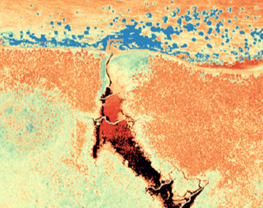
Modelling the Pre-Anthropogenic Distribution of Wetlands in the Boreal Natural Region
Resource
This research poster describes a model used to assess pre-anthropogenic distribution of wetlands in the Lower Athabasca Region. Presented at the NAIT 7th Seminar on Linear Disturbance Impacts on...

New Imaging Centre for Aerial Data Collection
News
Organization
We are excited to announce the establishment of the Imaging Centre! The Imaging Centre will lead our growing aerial data collection program. It will also lead innovative projects using machine...
Online Workshop on Landscape Connectivity Assessment
Event
Event Date and Time
May 16th, 2023 at 10:00am MST to May 16th, 2023 at 12:00pm MST
We invite you to join an end-user workshop to learn about a collaborative NSERC Alliance project (2023-2025) between the University of Toronto and ABMI. The project aims to facilitate structural...
Press Release: Agreement Between Pulse Seismic and the ABMI Benefits Research on Seismic Line Recovery in Alberta
News
Organization
Pulse Seismic Inc. (Pulse) and the Alberta Biodiversity Monitoring Institute (ABMI) have signed a data sharing agreement to enhance public information on seismic lines in Alberta.
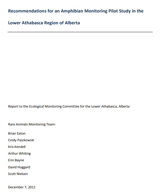
Recommendations for an Amphibian Monitoring Pilot Study in the Lower Athabasca Region of Alberta
Resource
This report provides recommendations for an amphibian monitoring pilot study in the Lower Athabasca Planning Region.
Recommendations Knowledge Requirements - An Integrated Wetland Monitoring Program for Alberta's Oil Sands Region
Resource
Final recommendations to the development of a wetland monitoring program for the Oil Sands region of Alberta.

Regional Patterns in the Water Balance of Alberta’s Wetlands
News
Organization
The Wetland Atlas of Alberta now features a new section, “Regional Patterns in the Water Balance of Alberta’s Wetlands.” This new section highlights research on regional patterns in the water balance...
Rob Hinchliffe
Contact
Organization
Position Title
Aquatic Invertebrate Coord, Faculty of Science - Alberta Biodiversity Monitoring Institute
Status of Human Footprint in Alberta
Project
Organization:
The ABMI defines human footprint as the visible alteration or conversion of native ecosystems to temporary or permanent residential, recreational, agricultural, or industrial landscapes. The...
