
Search Results
Displaying:
1 - 5 of 5
High-resolution Satellite Imagery Applied to Monitoring Revegetation of Oil-sands-exploration Well Pads
Resource
Project demonstrated that high-spatial-resolution satellite imagery could be used to develop accurate land-cover classifications on reclaimed in-situ operations

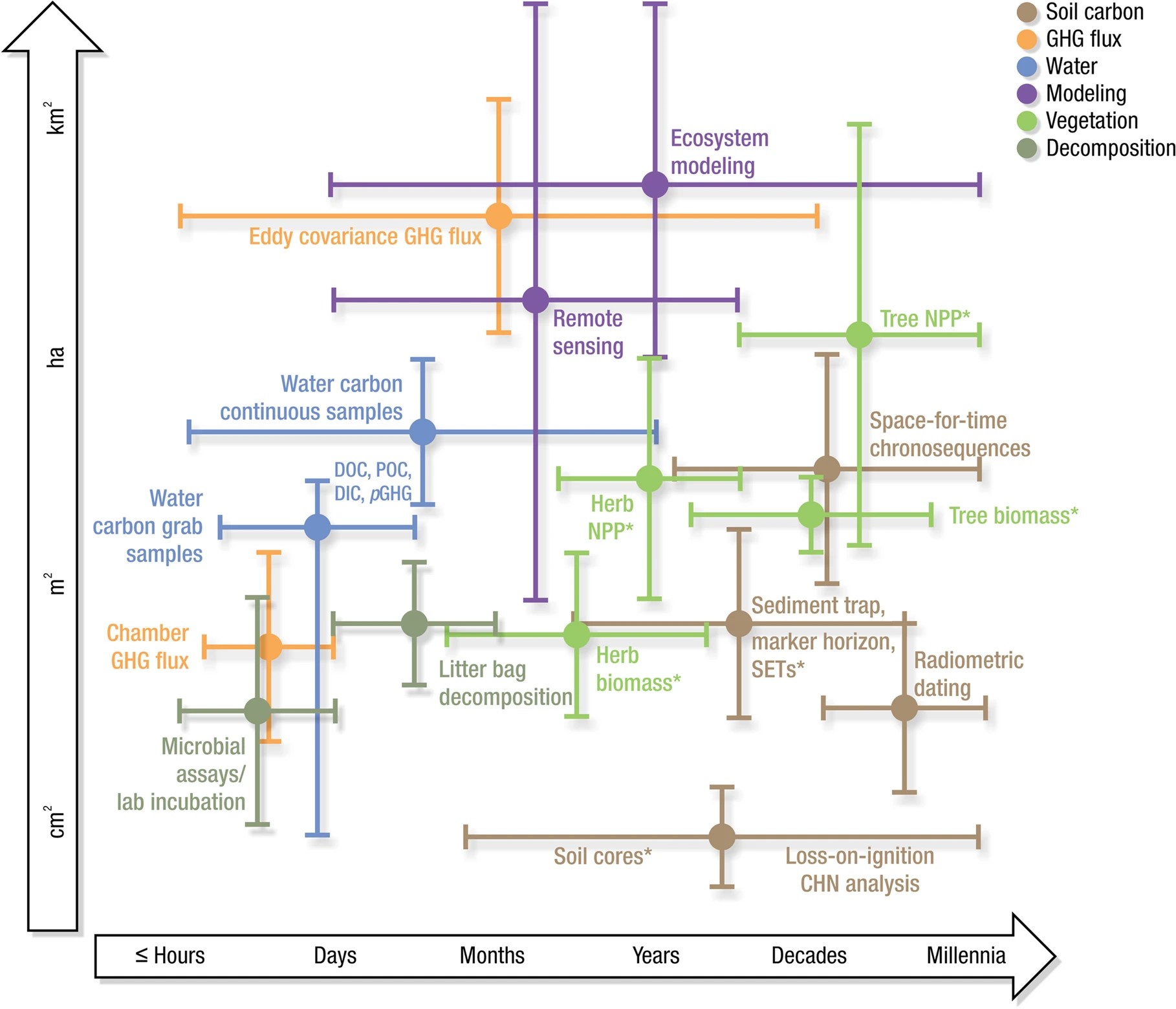
Practical Guide to Measuring Wetland Carbon Pools and Fluxes
Resource
Wetlands cover a small portion of the world, but have disproportionate influence on global carbon (C) sequestration, carbon dioxide and methane emissions, and aquatic C fluxes. However, the underlying...
Woody Vegetation Indicators Vary With Time Since Wetland Restoration
Resource
Successful wetland restoration depends on the development of the vegetation community post-restoration. Woody vegetation provides functional and structural support to the wetland ecosystem and...
