
Search Results
Displaying:
141 - 160 of 466
Drivers, Pressures, and State Responses to Inform Long-term Oil Sands Wetland Monitoring Program Objectives
Resource
Boreal peatlands provide numerous ecosystem services ranging from carbon sequestration to the provisioning of habitat for species integral to Indigenous communities. In the Oil Sands Region of Alberta...

Early Performance of Some Native and Cultivated Grasses on Oil Sands Mine Disturbance Materials
Resource
The trial was established on blended materials consisting of native sand, clayey overburden and peat. Nine native grasses and eight cultivated grass varieties were seeded in June of 1981.

Ecological Bench-marking and Biomonitoring for Detection of Airborne Pollutant Effects on Vegetation and Soils
Resource
There was only very limited evidence of biological responses to increased pollutant content in spite of significantly higher pollutant levels in tissues close to existing industrial developments.

Ecological Habitat Mapping of the AOSERP Study Area: Phase 1
Resource
Classification system devised for mapping vegetation and surficial geology from 1:60,000 scale false colour infrared photographs; 1:50 000 base maps plus a vegetation and a surficial geology overlay

Ecological Habitat Mapping of the AOSERP Study Area (Supplement): Phase 1
Resource
Ground surveys of vegetation and surficial geology generally confirmed that the classification systems used in the mapping accurately described and defined the ecological habitat features

Ecological Studies of the Aquatic Invertebrates of the Alberta Oil Sands Environmental Research Program Study Area of Northeastern Alberta
Resource
Describe basic ecology of aquatic benthic macrofauna of the Athabasca River and its major tributaries, the Muskeg and Steepbank rivers

Effects of Air Pollutants on the Forest Ecosystem: A Review
Resource
Alberta is in a fortunate situation because most of its soils are underlain by calcareous bedrock and can, therefore, neutralize in-coming acids more efficiently than Canadian Shield areas

Environmenta1 Planning for Rights-of-way
Resource
A recent study (using a 10% stratified random sample) estimated the amount of area physically disturbed by energy related activity, to be 66,576 acres (26,963 ha) for a selective study area...
Environmental Handbook for Pipeline Construction
Resource
This handbook recognizes the potential adverse impact of pipeline construction on the environment and the public and identifies environmental protection measures to minimize those impacts.

Establishment and Survival of Ground Cover Plantings on Disturbed Areas in Alberta. Final Report of Phase I
Resource
Research project set up to study the establishment and survival of ground cover vegetation on roadsides, utility rights-of-way, and non-cultivated disturbed areas in Alberta

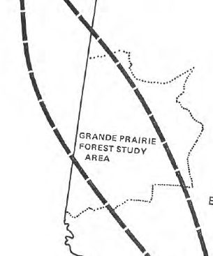
Establishment and Survival of Ground Cover Plantings on Disturbed Areas in Alberta. Progress Report #2. Revegetation of Disturbed Sites. such as Power Line Rights-of-way and Strip Mines
Resource
Powerline rights-of-way were surveyed throughout Alberta to find out what vegetation was growing on them and if reseeding was required. The Whitewood coal mine at Wabamun was surveyed
Establishment and Survival of Ground Cover Plantings on Disturbed Areas in Alberta. Progress Report #3. Revegetation of Roadsides
Resource
General survey of roadside vegetation done to see what species it consisted of. The results were then compared to the Department of Highways and Transport's records of seeding conducted from 1963-1972

Establishment and Survival of Ground Cover Plantings on Disturbed Areas in Alberta. Progress Report #4. Soils
Resource
In this report an attempt has been made to relate the vegetation to a group of soil factors as well as climate and to examine soil texture in more detail and effects on plant communities and species

Establishment and Survival of Ground Cover Plantings on Disturbed Areas in Alberta. Report No. 1 Revegetation of Disturbed Sites such as Pipelines, Cutlines and Stripmining Areas
Resource
Determine which native plant species might be useful in the revegetation of disturbed sites such as pipelines, cutlines and strip mining areas and collect seed for further studies

Establishment and Vegetation Survey of 16 Pinus banksiana-dominated Permanent Plots for the Athabasca Oil Sands Ecological Monitoring Project in 1981
Resource
16 undisturbed, 5-ha, permanent plots dominated by Pinus banksiana (jack pine) were established along an impingement gradient of atmospheric emissions from oil sands processing plants

Establishment Report on the Mildred Lake Native and Cultivated Grass Reclamation Trial
Resource
The trial was established on blended materials consisting of native sand, clayey overburden and peat. Nine native grasses and eight cultivated grass varieties were seeded in June of 1981

Estimate of the Maximum Probable Precipitation for Alberta River Basins
Resource
Point measurements of maximum depth showed that over 50% of the rainstorms occur in June and July, with only a small percentage in April (5.6) and September (10. 1).

Estimating Lichen Biomass in Forests and Peatlands of Northwestern Canada in a Changing Climate
Resource
Climate warming in the North could lead to lichen decline within critical woodland caribou habitat. We used repeat measurements of sixty-nine plots over ten years (2007–2008 and 2017–2018) to assess...
Estimating Ungulate Recruitment and Growth Rates Using Age Ratios
Resource
This resource is available on an external database and may require a paid subscription to access it. It is included on the CCLM to support our goal of capturing and sharing the breadth of all...
