Land Management Resources
Resource
Author(s)
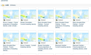
Boreal Avian Modelling Project
Bioclimatic niche models of current avian distribution and density for 80 boreal-breeding songbird species are mapped based on present counts and climate change models
Resource
Author(s)
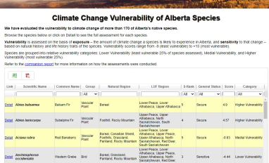
Alberta Biodiversity Monitoring Institute (ABMI)
Vulnerability to climate change of more than 170 of Alberta’s native species is assessed on the basis of exposure and sensitivity to change
Resource
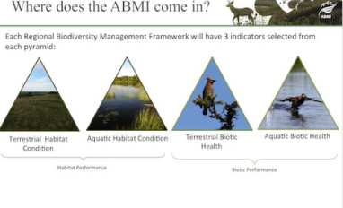
The presentation discusses the role of the ABMI in supporting regional Biodiversity Management Frameworks
Resource
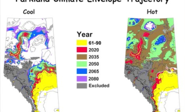
As a consequence of climate change, current landscape patterns are unlikely to persist in the future. The types of ecological changes expected to occur as the climate warms are described
Resource
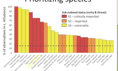
Monitoring and conservation of rare species, particularly in the boreal forests of northern Alberta, is a challenge due to knowledge gaps on distribution and abundance of species
Resource
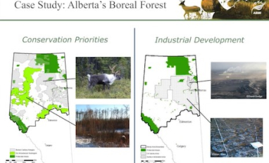
Oil sands industry case study evaluated the economic and ecological performance of alternative offset networks targeting either ecologically equivalent areas or regional conservation priorities
Resource
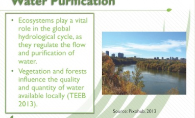
The presentation describes the purpose and development of a water purification model that can be used to help decision-makers evaluate tradeoffs for land use development proposals
Resource
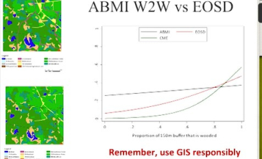
The presentation covers the use of remote sensing in assessing biodiversity and how using covariate data can improve on the interpretation of results
Resource
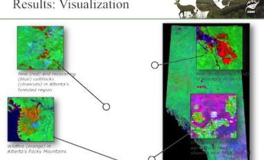
The presentation describes how multi-temporal remote sensing offers a better understanding of landscape changes over time in comparison to the more traditional two-date, before and after comparison.
Resource
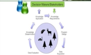
The presentation describes ABMI's role in collecting monitoring data and how the data can be used in environmental management.