Land Management Search Results
Resource
Authors
Mar Martinez
Gary Borstad
Leslie Brown
Kaan Ersahin
Michael Henley
Monitoring of reclaimed sites is a complex, interdisciplinary undertaking, especially in large, disturbed areas with difficult access. In that context, remote sensing is a unique and valuable tool...
Resource
Authors
S. Couturier
Aaron Dale
Bryn Wood
Jamie Snook
Formal report of the results of the 2017 aerial survey of the Torngat Mountains caribou herd.
Resource
Provides recommendations based on the field survey and ground checking, for developing methodologies to enhance the detail on 1:50 000 vegetation maps (preliminary vegetation community classification)
Resource
Authors
Anthony Stewart
Meghan Halabisky
Chad Babcock
David Butman
David D’Amore
Monika Moskal
Inland wetlands are critical carbon reservoirs storing 30% of global soil organic carbon (SOC) within 6% of the land surface. However, forested regions contain SOC-rich wetlands that are not included...
Resource
Authors
Iuliia Burdun
Michel Bechtold
Valentina Sagris
Annalea Lohila
Elyn Humphreys
Ankur Desai
Mats Nilsson
Gabrielle De Lannoy
Ülo Mander
Resource Date:
September
2020
The OPtical TRApezoid Model (OPTRAM) is a physically-based approach for remote soil moisture estimation. OPTRAM is based on the response of short-wave infrared (SWIR) reflectance to vegetation water...
Resource
Authors
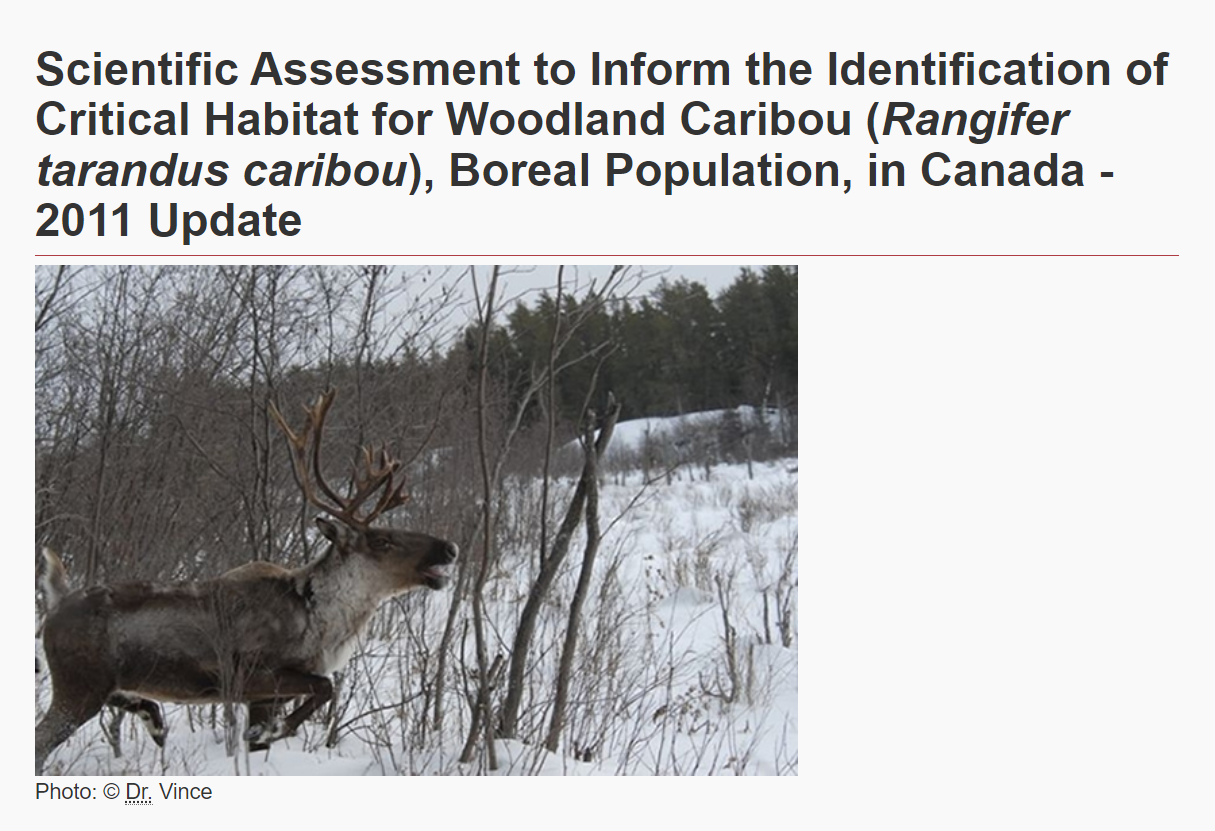
Environment and Climate Change Canada
The Woodland Caribou ( Rangifer tarandus caribou), Boreal Population was last assessed by the Committee on the Status of Endangered Wildlife in Canada as Threatened (COSEWIC 2002), and listed under...
Resource
It is generally recognized that plants are genetically adapted to the prevailing climate. Planting stock is often moved across environmental gradients with little knowledge of the ecological risks...
Resource
Authors
Thaís Abib
Laura Chasmer
Chris Hopkinson
Craig Mahoney
Luiz Carlos Estraviz Rodriguez
Resource Date:
March
2019
This resource is available on an external database and may require a paid subscription to access it. It is included on the CCLM to support our goal of capturing and sharing the breadth of all...
Resource
This thesis investigates the effectiveness of machine learning algorithms for automatic detection of coniferous seedling data along Boreal seismic lines. In order to obtain a survival assessment and...
Resource
Authors
Ellen Whitman
Marc-André Parisien
Dan Thompson
Mike Flannigan
Resource Date:
December
2019
The size and frequency of large wildfires in western North America have increased in recent years, a trend climate change is likely to exacerbate. Due to fuel limitations, recently burned forests...
Resource
Authors
Anne Naeth
Donna White
David Chanasyk
Terry Macyk
Chris Powter
Don Thacker
To provide coordinated direction for reclamation research in Alberta, the need to review the current understanding and the role of soil physical properties in soil disturbance related activities was...
Resource
Authors
Pedocan Land Evaluation Ltd.
Part 1 of this manual is a background and explanatory section that describes the terminology used in soil surveys and presents the assumptions and conventions upon which the interpretations are based
Resource
Authors
Pedocan Land Evaluation Ltd.
Part 2 presents typical data and interpretations for each soil series in Alberta. The interpretations were made by applying the guidelines in Part 1, and checking the results against experience
Resource
Authors
Tal Avgar
James Baker
Glen Brown
Jevon Hagens
Andrew Kittle
Erin Mallon
Madeleine McGreer
Anna Mosser
Steven Newmaster
Brent Patterson
Douglas Reid
Art Rodgers
Jennifer Shuter
Garrett Street
Ian Thompson
Merritt Turetsky
Philip Wiebe
Resource Date:
February
2015
Movement patterns offer a rich source of information on animal behaviour and the ecological significance of landscape attributes. This is especially useful for species occupying remote landscapes...
Resource
Authors
Steven Wilson
Glenn Sutherland
Nicholas Larter
Allicia Kelly
Ashley McLaren
James Hodson
Troy Hegel
Robin Steenweg
Dave Hervieux
Thomas Nudds
Understanding spatial distributions of organisms and the consequences for conservation policy and management decisions remain important challenges. We describe a method for grouping caribou into plausible candidate Local Population Units that may better approximate geographic closure than the existing LPUs.
Resource
Authors
David Olefeldt
Mikael Hovemyr
McKenzie Kuhn
David Bastviken
Theodore Bohn
John Connolly
Patrick Crill
Eugénie Euskirchen
Sarah Finkelstein
Hélène Genet
Guido Grosse
Lorna Harris
Liam Heffernan
Manuel Helbig
Gustaf Hugelius
Ryan Hutchins
Sari Juutinen
Mark Lara
Avni Malhotra
Kristen Manies
David McGuire
Susan Natali
Jonathan O'Donnell
Frans-Jan Parmentier
Aleksi Räsänen
Christina Schädel
Oliver Sonnentag
Maria Strack
Suzanne Tank
Claire Treat
Ruth Varner
Tarmo Virtanen
Rebecca Warren
Jennifer Watts
Here we present the Boreal–Arctic Wetland and Lake Dataset (BAWLD), a land cover dataset based on an expert assessment, extrapolated using random forest modelling from available spatial datasets of...
Resource
Authors
José Gérin-Lajoie
Alain Cuerrier
Laura Siegwart Collier
In full colour with photos of the 145 contributing Inuit elders, “The Caribou Taste Different Now” grounds the discussions, debates, and discourses about climate change to material and everyday life in the contemporary Canadian Arctic.
Resource
Authors
Rachel Hovel
Jeremy Brammer
Emma Hodgson
Amy Amos
Trevor Lantz
Chanda Turner
Tracey Proverbs
Sarah Lord
Rapid environmental change in the Arctic elicits numerous concerns for ecosystems, natural resources, and ways of life. Robust monitoring is essential to adaptation and management in light of these...
Resource
Authors
Guillermo Castilla
Ronald Hall
Rob Skakun
Michelle Filiatrault
André Beaudoin
Michael Gartrell
Lisa Smith
Kathleen Groenewegen
Chris Hopkinson
Jurjen van der Sluijs
Resource Date:
February
2022
Wall-to-wall 30 m raster maps of broad forest type, stand height, crown closure, stand volume, total volume, aboveground biomass, and stand age were created for a ~400,000 km2 area, validated with independent data, and generalized into a polygon GIS layer resembling a traditional FI map. The MVI project showed that a reasonably accurate FI map for large, remote, predominantly non-inventoried boreal regions can be obtained at a low cost by combining limited field data with remote sensing data from multiple sources.
Resource
Authors
Allice Legat
Mary McCreadie
This report considers Tłı̨chǫ knowledge of the relationships that tǫdzı (boreal caribou) have with their habitat, including human and other-than human beings.


")