Land Management Search Results
Resource
The deeper soil salvage depth (40 cm) was better than the shallow salvage depth (15 cm) at establishing a forest understory plant community characteristic of the boreal forest.
Resource
Authors
Karl Lamothe
Haibin Dong
Oscar Senar
Sonja Teichert
Irena Creed
David Kreutzweiser
Fiona Schmiegelow
Lisa Venier
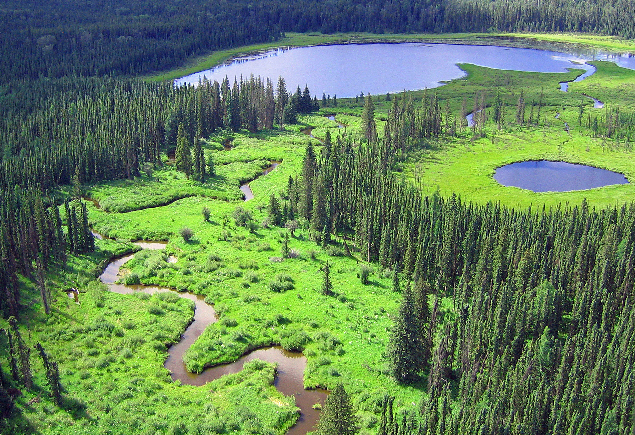
The Canadian boreal zone provides ecosystem services from local to global scales. Either directly or indirectly, demands for these services have and will continue to serve as drivers of change in the...
Resource
Resource Date:
August
2020
This document is part of the 360 tours project Toolkit developed by Canada's Oil Sands Innovation Alliance (COSIA) led by Cenovus Energy Inc., in collaboration with Natural Resources Canada. The...
Resource
Authors
Corey Feduck
Gregory McDermid
Guillermo Castilla
Rapid assessment of forest regeneration using unmanned aerial vehicles (UAVs) is likely to decrease the cost of establishment surveys in a variety of resource industries. This research tests the...
Resource
Authors
Annie He
Gregory McDermid
Mir Mustafizur Rahman
Maria Strack
Saraswati Saraswati
Bin Xu
Resource Date:
September
2018
This study develops allometric equations for three dominant genera found in boreal fens: Alnus spp. (alder), Salix spp. (willow) and Betula pumila (bog birch).
Resource
Authors
Alberta Biodiversity Monitoring Institute
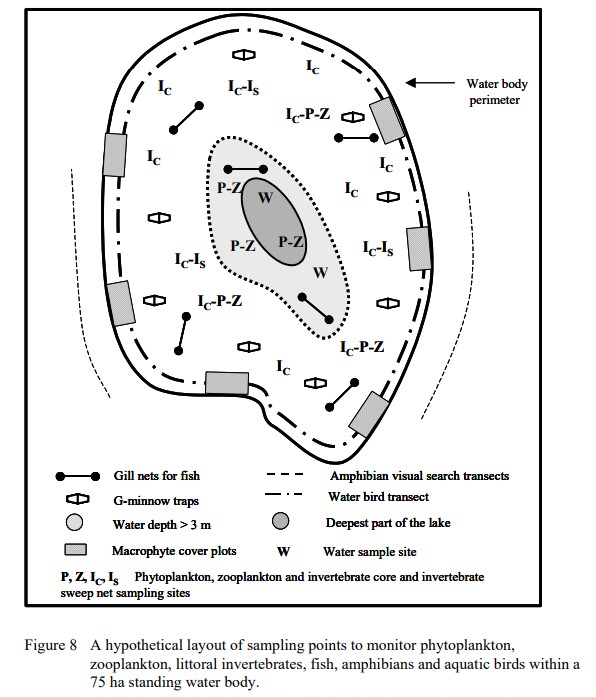
This report is part of a larger endeavor to develop a monitoring program capable of detecting changes in the biological diversity of Alberta’s forested region.
Resource
Long-term monitoring of some sites would ultimately be needed to show that recovering wellsites are on a trajectory that consistently leads to full recovery.
Resource
Bromacil and tebuthiuron are herbicides used from the 1960s to 1990s on industrial sites to control vegetation. Approximately 61,750 sites are considered contaminated when comparing total herbicide...
Resource
Soils sampled at sites 2.3 and 5.3 km south of the Great Canadian Oil Sands (GCOS) plant, Fort McMurray, respectively were found to differ statistically with reference to several macronutrients
Resource
Stem cuttings of balsam poplar and three poplar hybrids were directly planted onto reclamation material ontailings dyke slope. The overall rooting success was poor - direct planting is not recommended
Resource
Authors
Sandra Landsburg
Elizabeth Dwyer
Dissipation of bromacil in Humic Luvic Gleysols amended with cow manure was evaluated at two sites in northwestern Alberta from 1984 to 1987
Resource
Authors
Laura Finnegan
Doug MacNearney
Karine Pigeon
Resource Date:
February
2018
Using field data from 351 seismic lines across [Alberta], and focusing on forage taxa preferred by moose and bears, we [investigated the effects of seismic line clearing on forage and resilience]
Resource
Highway rights-of-way in Alberta, and elsewhere, are dull because they consist of limited, non-native species mixes that are frequently mowed. These rights-of-way are therefore not much more exciting...
Resource
Resource Date:
January
2016
This presentation provides an overview of the Ducks Unlimited Canada Enhanced Wetland Classification System, including current and potential uses for wetland conservation and management.
Resource
The trial was established on blended materials consisting of native sand, clayey overburden and peat. Nine native grasses and eight cultivated grass varieties were seeded in June of 1981.
Resource
Authors
Roger DeAbreu
Shane Patterson
Todd Shipman
Chris Powter
NRCan pilot science projects have proven that Earth Observation can provide relevant and valuable information to inform and enhance monitoring and support regulatory frameworks
Resource
Authors
Matthew Elmes
Scott Davison
Jonathan Price
Resource Date:
November
2021
This resource is available on an external database and may require a paid subscription to access it. It is included on the CCLM to support our goal of capturing and sharing the breadth of all...
Resource
There was only very limited evidence of biological responses to increased pollutant content in spite of significantly higher pollutant levels in tissues close to existing industrial developments.
Resource
Authors
M.D. Thompson
M.C. Wride
M.E. Kirby
Classification system devised for mapping vegetation and surficial geology from 1:60,000 scale false colour infrared photographs; 1:50 000 base maps plus a vegetation and a surficial geology overlay
Resource
Ground surveys of vegetation and surficial geology generally confirmed that the classification systems used in the mapping accurately described and defined the ecological habitat features