Land Management Search Results
Resource
Authors
Anthony Stewart
Meghan Halabisky
Chad Babcock
David Butman
David D’Amore
Monika Moskal
Inland wetlands are critical carbon reservoirs storing 30% of global soil organic carbon (SOC) within 6% of the land surface. However, forested regions contain SOC-rich wetlands that are not included...
Resource
Authors
Iuliia Burdun
Michel Bechtold
Valentina Sagris
Annalea Lohila
Elyn Humphreys
Ankur Desai
Mats Nilsson
Gabrielle De Lannoy
Ülo Mander
Resource Date:
September
2020
The OPtical TRApezoid Model (OPTRAM) is a physically-based approach for remote soil moisture estimation. OPTRAM is based on the response of short-wave infrared (SWIR) reflectance to vegetation water...
Resource
Authors
Environment and Climate Change Canada
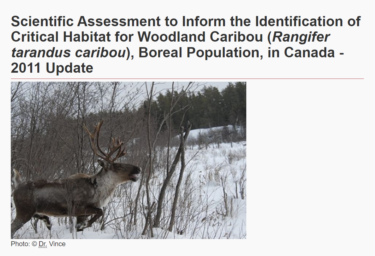
The Woodland Caribou ( Rangifer tarandus caribou), Boreal Population was last assessed by the Committee on the Status of Endangered Wildlife in Canada as Threatened (COSEWIC 2002), and listed under...
Resource
It is generally recognized that plants are genetically adapted to the prevailing climate. Planting stock is often moved across environmental gradients with little knowledge of the ecological risks...
Resource
This thesis investigates the effectiveness of machine learning algorithms for automatic detection of coniferous seedling data along Boreal seismic lines. In order to obtain a survival assessment and...
Resource
Authors
Steven Wilson
Glenn Sutherland
Nicholas Larter
Allicia Kelly
Ashley McLaren
James Hodson
Troy Hegel
Robin Steenweg
Dave Hervieux
Thomas Nudds
Understanding spatial distributions of organisms and the consequences for conservation policy and management decisions remain important challenges. We describe a method for grouping caribou into plausible candidate Local Population Units that may better approximate geographic closure than the existing LPUs.
Resource
Authors
David Olefeldt
Mikael Hovemyr
McKenzie Kuhn
David Bastviken
Theodore Bohn
John Connolly
Patrick Crill
Eugénie Euskirchen
Sarah Finkelstein
Hélène Genet
Guido Grosse
Lorna Harris
Liam Heffernan
Manuel Helbig
Gustaf Hugelius
Ryan Hutchins
Sari Juutinen
Mark Lara
Avni Malhotra
Kristen Manies
David McGuire
Susan Natali
Jonathan O'Donnell
Frans-Jan Parmentier
Aleksi Räsänen
Christina Schädel
Oliver Sonnentag
Maria Strack
Suzanne Tank
Claire Treat
Ruth Varner
Tarmo Virtanen
Rebecca Warren
Jennifer Watts
Here we present the Boreal–Arctic Wetland and Lake Dataset (BAWLD), a land cover dataset based on an expert assessment, extrapolated using random forest modelling from available spatial datasets of...
Resource
Authors
Julie Lovitt
Mir Mustafizur Rahman
Saraswati Saraswati
Gregory McDermid
Maria Strack
Bin Xu
Resource Date:
February
2018
Peatlands are globally significant stores of soil carbon, where local methane (CH 4 ) emissions are strongly linked to water table position and microtopography. Historically, these factors have been...
Resource
Understanding how populations are structured and how they use natural and anthropogenic spaces is essential for effective wildlife management. A total of 510 barren-ground ( Rangifer tarandus...
Resource
Authors
K.A. Baldwin
Lorna Allen
S. Basquill
K. Chapman
D. Downing
N. Flynn
W. Mackenzie
M. Major
W.J. Meades
D. Meidinger
C. Morneau
J.-P. Saucier
J. Thorpe
Vegetation Zones of Canada: a Biogeoclimatic Perspective maps Canadian geography in relation to regional climate, as indicated by vegetation patterns. Compared to previous similar national-scale...
Resource
The various applications of Ducks Unlimited Canada’s wetland inventories play a critical role in wetland conservation. They serve as key planning tools, helping people who live and work in the boreal...
Resource
In order to protect boreal wetlands, we must first know where they are. This 6-minute video will show you how Ducks Unlimited Canada uses satellite data and remote sensing techniques to map wetlands...
Resource
This presentation provides insight and understanding to how LiDAR data is used to produce digital elevation models and vegetation maps.
Resource
The presentation describes how multi-temporal remote sensing offers a better understanding of landscape changes over time in comparison to the more traditional two-date, before and after comparison.
Resource
Authors
Michael Merchant
Lyle Boychuk
The Government of Alberta’s current wetland inventory is a publicly available, generalized dataset collated from the best available spatial wetland data across the province. The Alberta Merged Wetland...
Resource
One of the neat things about working in environmental monitoring is the sheer range of tools available to use, and the rate at which they’re evolving. One example that’s rapidly changing monitoring...
Resource
Authors
Jahan Kariyeva
Mike Watmough
Lyle Boychuk
Matthew Wilson
Nadia Rochdi
Bob Sleep
Robert Albricht
Johanna Weston
The key outcome of the workshop was the creation of a vision statement to guide leadership and action for an optimal provincial scale wetland inventory.
Resource
Authors
Wetland Knowledge Exchange
Resource Date:
January
2023
The Wetland Knowledge Exchange releases monthly newsletters that highlight new research, publications, news, interesting facts, events and more. In this edition you will learn about: How wetlands...
Resource
Authors
Wetland Knowledge Exchange
The Wetland Knowledge Exchange releases monthly newsletters that highlight new research, publications, news, interesting facts, events and more. In this edition you will learn about: International bog...
Resource
Resource Date:
September
2023
The Wetland Knowledge Exchange releases monthly newsletters that highlight new research, publications, news, events and more. In this edition you will learn about: The outsized role of small ephemeral...