Land Management Search Results
Resource
Authors
Qihua Huang
Hao Wang
Mark Lewis
Previous work has considered the effect of a toxin on the population dynamics of a single trophic level, such as fish, we focus on the impacts of toxins on the population dynamics of aquatic food webs
Resource
Authors
Xiaomei Li
Yongsheng Feng
A one dimensional approach was used to model the evaporation process from fine tails. Understanding the complex interactions among the solids, water and external atmospheric demand is required
Resource
Authors
Amy Darling
Carol Stefan
Corey De La Mare
Canada’s boreal forest is important habitat for many North American birds, which play a vital role in the health of forests, and provide ecosystem services. Expanding human development in northern...
Resource
Authors
Roger DeAbreu
Shane Patterson
Todd Shipman
Chris Powter
NRCan pilot science projects have proven that Earth Observation can provide relevant and valuable information to inform and enhance monitoring and support regulatory frameworks
Resource
Authors
M.D. Thompson
M.C. Wride
M.E. Kirby
Classification system devised for mapping vegetation and surficial geology from 1:60,000 scale false colour infrared photographs; 1:50 000 base maps plus a vegetation and a surficial geology overlay
Resource
Ground surveys of vegetation and surficial geology generally confirmed that the classification systems used in the mapping accurately described and defined the ecological habitat features
Resource
Authors
Erin Bayne
Hedwig Lankau
Jesse Tigner
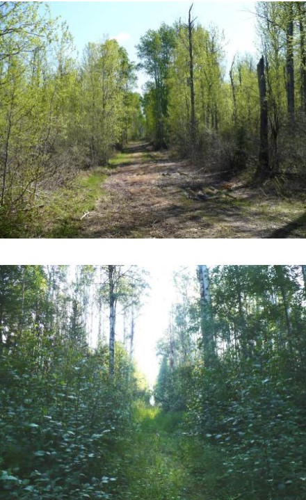
We conducted a series of surveys to evaluate wildlife responses to different types of seismic lines in bogs, conifer‐dominated, mixedwood and deciduous forests in the western boreal forest. Research...
Resource
Authors
Cole Burton
Christopher Beirne
Catherine Sun
Erin Tattersall
Joanna Burgar
Jason Fisher
This project has clearly demonstrated the utility of camera trap surveys for monitoring restoration effectiveness in boreal environments. The cameras facilitated the collection of longitudinal data on...
Resource
The Emend for Schools: 360° Video EMEND Tour Teachers Resource is a full lesson plan and 360 immersive and interactive video teaching tool, including a teacher lesson plan and student workbook aligned...
Resource
Authors
Brad Seely
John Nelson
Pierre Vernier
Ralph Wells
Arnold Moy
The primary response to the present mountain pine beetle (MPB) epidemic has focused on salvaging beetle-killed wood while it remains economically viable, and developing methods for reducing the spread...
Resource
Authors
Tyler Flockhart
Greg Mitchell
Richard Krikun
Erin Bayne
Successful conservation of migratory birds demands we understand how habitat factors on the breeding grounds influences breeding success. Multiple factors are known to directly influence breeding...
Resource
Authors
Jian Zhang
Scott Nielsen
Jessica Stolar
Youhua Chen
Wilfried Thuiller
We found that 368 species (24%) may lose on average > 80% of their current suitable climates (habitats), while 539 species (35%) were projected to more than double their current suitable range
Resource
Breeding bird studies using the mapping method were combined with intensive habitat quantification to determine the relative values to breeding avifauna of 21 habitat types
Resource
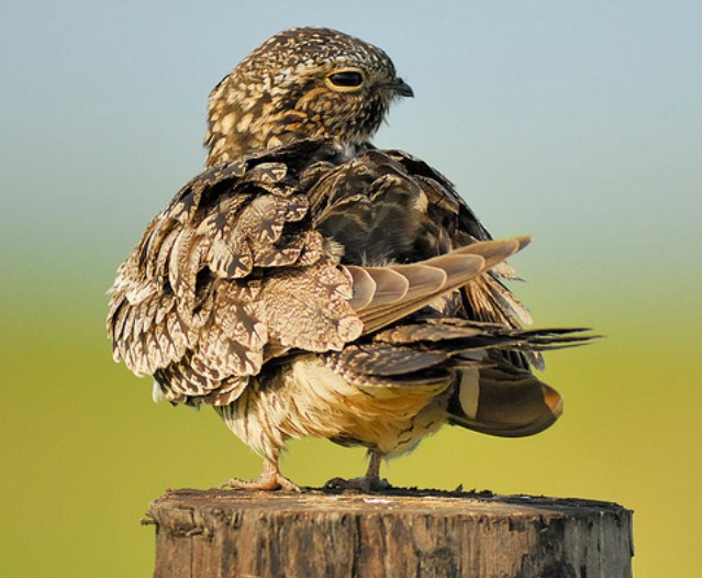
Conservation management is impeded by the lack of baseline data for many non-passerine, cryptic, or nocturnal species that are inadequately sampled by traditional monitoring programs. The recent rise...
Resource
Authors
Jeff Wilson
Scott Heckbert
Craig Aumann
Marius Cutlac
William Donahue
Mike Kennedy
Yongbo Liu
Daiyuan Pan
Wanhong Yang
The model documentation summarizes the data, variables and assumptions required to capture how water purification services are provided across landscapes in Alberta
Resource
Authors
Kimberly Dawe
Erin Bayne
Stan Boutin
This resource is available on an external database and may require a paid subscription to access it. It is included on the CCLM to support our goal of capturing and sharing the breadth of all...
Resource
Authors
Larry Turchenek
J.D. Lindsay
The emphasis in this inventory is on soils and the landforms on which they occur; both are indicated on maps. Air photo interpretation and field checking have been completed
Resource
Authors
Zhan Li
Joanne White
Michael Wulder
Txomin Hermosilla
Andrew Davidson
Alexis Comber
Large-area land cover maps are produced to satisfy different information needs. Land cover maps having partial or complete spatial and/or temporal overlap, different legends, and varying accuracies...
Resource
Authors
Camile Sothe
Alemu Gonsamo
Joyce Arabian
James Snider
Resource Date:
August
2021
Canada has extensive forests and peatlands that play key roles in global carbon cycle. Canadian soils and peatlands are assumed to store approximately 20% of the world’s soil carbon stock. However...
Resource
Authors
Boreal Avian Modelling Project
Bioclimatic niche models of current avian distribution and density for 80 boreal-breeding songbird species are mapped based on present counts and climate change models