Land Management Search Results
Resource
Authors
Alberta Biodiversity Monitoring Institute
Resource Date:
January
2020
Linear features, including seismic lines, pipelines, transmission lines, roads, railways, and trails are pervasive in Alberta’s boreal forest and have been implicated as a primary factor leading to...
Resource
Authors
Mike Ostafichuk
George LaRoi
Of the 16 permanent plots established in 1981, four of these, Nos. 1,6,11, and 13 were destroyed by fire shortly after they were surveyed. In 1982, four new plots were established to replace the...
Resource
Authors
Virgil Hawkes
Gillian Donald
A long-term plot network would allow the monitoring data to describe the ecological condition of the reclaimed lands and define appropriate management strategies for achieving revegetation goals
Resource
Authors
Terry Macyk
Martin Fung
Ron Pauls
Syncrude Canada Ltd. produces 200,000 barrels of synthetic crude oil per day from its oil sands surface mining operations located 50 km north of Fort McMurray, Alberta. The three major types of...
Resource
Authors
Natalie Sánchez
Luis Sandoval
Richard Hedley
Colleen St. Clair
Erin Bayne
Anthropogenic noise can create an acoustic environment detrimental for animals that communicate using acoustic signals. Currently, most studies of noise and wildlife come from traffic noise in cities...
Resource
Authors
Howard Baldwin
Bryant Bidgood
Design techniques are presented for a very high frequency telemetry system capable of transmitting short radio frequency pulse signals from the body of a fish to an aircraft flying over a river.
Resource
Provides recommendations based on the field survey and ground checking, for developing methodologies to enhance the detail on 1:50 000 vegetation maps (preliminary vegetation community classification)
Resource
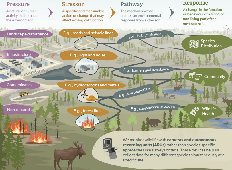
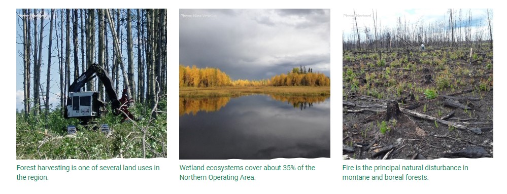
The Oil Sands Monitoring Program is assessing the environmental impacts of oil sands development at different spatial scales. Monitoring in the Oil Sands Region operates under a consistent framework...
Resource
Authors
Cameron Nordell
Erin Bayne
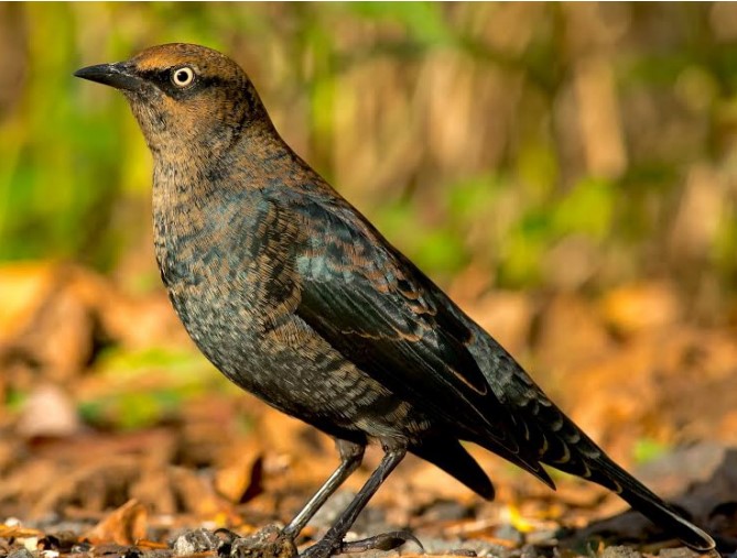
The Rusty Blackbird ( Euphagus carolinus ) was listed as Special Concern on Schedule 1 of the federal Species at Risk Act in March 2009 because of large and longterm declines in population size. The...
Resource
Authors
Anna Dabros
Kellina Higgins
Jaime Pinzon
This resource is available on an external database and may require a paid subscription to access it. It is included on the CCLM to support our goal of capturing and sharing the breadth of all...
Resource
Authors
Doug Maynard
K. E. Hogg
E.F. Wass
M.P. Curran
Soil disturbance from forest harvesting has been shown to compromise site productivity. We established satellite trials in five of the Long-Term Soil Productivity (LTSP) sites in southeast British...
Resource
Authors
Anne Naeth
Donna White
David Chanasyk
Terry Macyk
Chris Powter
Don Thacker
To provide coordinated direction for reclamation research in Alberta, the need to review the current understanding and the role of soil physical properties in soil disturbance related activities was...
Resource
Authors
Pedocan Land Evaluation Ltd.
Part 1 of this manual is a background and explanatory section that describes the terminology used in soil surveys and presents the assumptions and conventions upon which the interpretations are based
Resource
Authors
Pedocan Land Evaluation Ltd.
Part 2 presents typical data and interpretations for each soil series in Alberta. The interpretations were made by applying the guidelines in Part 1, and checking the results against experience
Resource
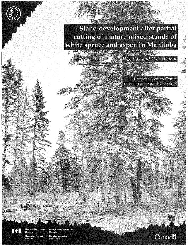
One-hundred-year-old mixed white spruce–aspen stands were partially cut in 1953, 1954, and 1955 and scarified leaving treatments that retained 14–100% of total stand basal area. Composition of the...
Resource
Authors
Alberta Biodiversity Monitoring Institute
This online report describes the status of human footprint, species, and habitat in Norbord Inc.'s two main operating areas located in northwestern Alberta. This information establishes baseline...
Resource
UAV-based remote sensing as a method for monitoring well pad recovery is determined to be feasible from a technical and field perspective.
Resource
Authors
Stan Aronoff
G.A. Ross
W.A. Ross
Figures and Tables associated with Volume 1
Resource
Authors
B.L. Barge
R.G. Humphries
S.L. Olson
The feasibility of a weather radar to map precipitation in the Alberta Oil Sands Environmental Research Program (AOSERP) study area near Fort McMurray, Alberta was investigated
Resource
Authors
Alberta Biodiversity Monitoring Institute
As of 2010, human footprint in the Active In-situ Region was 7.7%, whereas it was 20.8% in the Mineable Region. Total human footprint in all Woodland Caribou ranges increased between 2007 and 2010