Land Management Search Results
Resource
As caribou habitat restoration initiatives have become more widespread across Alberta in the last decade, key uncertainties have been recognized regarding what treatment types are appropriate for...
Resource
Reconstructed soils representing different materials handling and replacement techniques were characterized and variability in chemical and physical properties was assessed
Resource
Authors
Erin Bayne
Hedwig Lankau
Jesse Tigner
We conducted a series of surveys to evaluate wildlife responses to different types of seismic lines in bogs, conifer‐dominated, mixedwood and deciduous forests in the western boreal forest. Research...
Resource
Authors
Cole Burton
Christopher Beirne
Catherine Sun
Erin Tattersall
Joanna Burgar
Jason Fisher
This project has clearly demonstrated the utility of camera trap surveys for monitoring restoration effectiveness in boreal environments. The cameras facilitated the collection of longitudinal data on...
Resource
Authors
Anne McIntosh
Bonnie Drozdowski
Dani Degenhardt
Chris Powter
Christina Small
John Begg
Dan Farr
Arnold Janz
Randi Lupardus
Delinda Ryerson
Jim Schiek
We developed a scientifically robust and financially sustainable monitoring protocol to enable a consistent assessment of ecological recovery at reclaimed industrial wellsites in forested lands
Resource
Authors
Jay Woosaree
Brij Verma
Byron James
Phytoremediation, the use of plants to remove, degrade or stabilize sites contaminated with organic or toxic chemicals is gaining in popularity as an alternative and economical technique in...
Resource
Authors
Cassidy van Rensen
Scott Nielsena
Barry White
Tim Vinge
Victor Lieffers
Mapping of oil reserves involves the use of seismic lines (linear disturbances) to determine both their location and extent. Conventional clearing techniques for seismic assessment have left a legacy...
Resource
Authors
Richard Johnson
P. Bork
E.A.D. Allen
W.H. James
L. Koverny
The experiments detailed in this report show that it was possible to increase the solids content of sludge to 50% solids by adding three parts sand (tailings sand) to one part sludge.
Resource
Authors
Hedwig Lankau
Erin Bayne
Craig Machtans
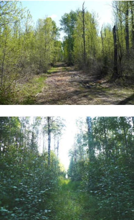
The boreal forest of western Canada is being dissected by seismic lines used for oil and gas exploration. The vast amount of edge being created is leading to concerns that core habitat will be reduced...
Resource
Mapping of oil reserves involves the use of seismic lines (linear disturbances) to determine size of reserves. These linear disturbances fragment forests and in many cases fail to regenerate trees...
Resource
Authors
Bonnie Drozdowski
Craig Aumann
Chris Powter
Report of a seminar to develop a collective understanding of the benefits and opportunities of Predictive Soil Mapping as they relate to Alberta
Resource
Authors
Alberta Biodiversity Monitoring Institute
Resource Date:
January
2020
Linear features, including seismic lines, pipelines, transmission lines, roads, railways, and trails are pervasive in Alberta’s boreal forest and have been implicated as a primary factor leading to...
Resource
Authors
Krysta Paudyn
Allison Rutter
Kerry Rowe
John Poland
Resource Date:
August
2007
This resource is available on an external database and may require a paid subscription to access it. It is included on the CCLM to support our goal of capturing and sharing the breadth of all...
Resource
Diesel invert wastes are one of the more difficult types of drilling mud wastes to dispose of due to the presence of hydrocarbons and salts. In 1989 a joint research program funded by the Alberta...
Resource
Authors
Millennium EMS Solutions Ltd.
The current document reports specifically on issues relating to the ecological direct contact exposure pathway (growth and reproduction of plants and soil invertebrates) in native grasslands areas of...
Resource
Authors
Millennium EMS Solutions Ltd.
The current document is focussed specifically on issues relating to the ecological direct contact exposure pathway (growth and reproduction of plants and soil invertebrates) in native grasslands areas...
Resource
This thesis investigates the effectiveness of machine learning algorithms for automatic detection of coniferous seedling data along Boreal seismic lines. In order to obtain a survival assessment and...
Resource
Authors
Anne Naeth
Donna White
David Chanasyk
Terry Macyk
Chris Powter
Don Thacker
To provide coordinated direction for reclamation research in Alberta, the need to review the current understanding and the role of soil physical properties in soil disturbance related activities was...
Resource
Authors
Pedocan Land Evaluation Ltd.
Part 1 of this manual is a background and explanatory section that describes the terminology used in soil surveys and presents the assumptions and conventions upon which the interpretations are based
Resource
Authors
Pedocan Land Evaluation Ltd.
Part 2 presents typical data and interpretations for each soil series in Alberta. The interpretations were made by applying the guidelines in Part 1, and checking the results against experience