Land Management Search Results
Resource
Authors
Daphne Cheel
Stephen Moran
Mark Trudell
Don Thacker
Terry Macyk
Report synthesizes and summarizes 36 RRTAC reports to provide the user with a unified source of information on land and groundwater reclamation research in the plains of Alberta
Resource
Authors
Natalie Shelby-James
Sarah Thacker
Chris Powter
Paul Fuellbrandt
Tomislav Hengl
Leandro Parente
Objective is to work collaboratively with soil data users to develop the Alberta Background Soil Quality System (ABSQS) as a tool to assist industry and government in environmental management
Resource
Authors
R.B. Caton
C.S. Davis
Martin Davies
D.L.M. Stevens
Ron Wallace
Tony Yarranton
Reid Crowther
The result of this review was a plan for a five-year biophysical monitoring program to provide the necessary scientific and technical information upon which to base an effective regulatory approach.
Resource
Authors
Leila Taheriazad
Carlos Portillo-Quintero
Arturo Sanchez-Azofeifa
This report presents a comprehensive review of industrial applications of an emerging environmental monitoring technology called Wireless Sensor Networks (WSN) and a WSN installed at Coal Valley Mine
Resource
Significant factors relating to effects on physical and chemical characteristics of the northern Alberta environment as a result of potential oil sands development in the Athabasca tar sands were docu
Resource
No measureable air pollutant effect was observed on either vascular or lichen communities at any site even though significantly high tissue pollutant concentrations were documented within 10km of GCOS
Resource
Understanding how birds respond to landscape disturbance is key to effective restoration. Two studies used non-invasive microphone arrays to determine the exact locations of singing individuals in the...
Resource
Authors
Jordan Seider
Trevor Lantz
Txomin Hermosilla
Michael Wulder
Jonathan Wang
Temperature increases across the circumpolar north have driven rapid increases in vegetation productivity, often described as ‘greening’. These changes have been widespread, but spatial variation in...
Resource
Resource Date:
August
2021
With the support of Alberta Environment and Parks, the Alberta Biodiversity Monitoring Institute has become the trusted source for data about habitat, species, and the human footprint.
Resource
Authors
Alberta Biodiversity Monitoring Institute
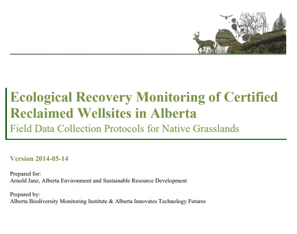
In summer 2013 field crews spent five weeks sampling soil and vegetation indicators at 18 wellsites and adjacent reference sites in the Dry Mixedgrass subregion of Alberta
Resource
Reconstructed soils representing different materials handling and replacement techniques were characterized and variability in chemical and physical properties was assessed
Resource
Salix interior Rowlee (INT) is a wide-ranging North American willow from the small taxonomic group Salix section Longifoliae, notable for its ability to form multi-stemmed vegetative stem colonies...
Resource
Authors
Chris Powter
Brent Scorfield
Brent Lakeman
Shane Patterson
The development of integrated geomatics and remote sensing technologies for environmental management holds promise to meet economic diversification and effective environmental management.
Resource
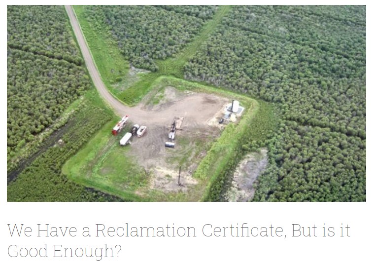
Long-term monitoring of some sites would ultimately be needed to show that recovering wellsites are on a trajectory that consistently leads to full recovery.
Resource
There was only very limited evidence of biological responses to increased pollutant content in spite of significantly higher pollutant levels in tissues close to existing industrial developments.
Resource
Authors
ERMP Project Advisory Group
Monitoring protocols for forested land wellsites to determine if a reclaimed site has returned to similar structure and function as found in a representative undisturbed reference area.
Resource
Authors
Alberta Biodiversity Monitoring Institute
Select appropriate vegetation, soil, and habitat indicators for a long-term reclamation monitoring program and provide sampling protocols for the selected indicators.
Resource
Our statistical design and the hands on learning experience we gained in the field can be applied when implementing the long-term monitoring program for certified wellsites.
Resource
Authors
Alberta Biodiversity Monitoring Institute
Three workshops were held to examine a suite of vegetation, soil, and habitat indicators that could potentially be used to monitor recovery in a long-term reclamation monitoring program
Resource
Data show that for many vegetation and soil indicators, wellsite development impacts are long lasting and may remain for 30 years or more after reclamation.