Land Management Search Results
Resource
Authors
Alberta Biodiversity Monitoring Institute
As of 2015, 29.2% of Alberta is under human footprint, up from 25.7% in 1999—that’s an average increase of about 0.22%, or around 1450 km2 (560 sections) per year.
Resource
Authors
Wei-Yew Chang
Chris Gaston
Julie Cool
Barb Thomas
Genomics-assisted tree breeding (GATB) is an emerging biotechnology method that has the potential to produce improved planting stock in selected traits, such as greater volume or higher wood quality...
Resource
Vegetation workshop was held November 1979 to evaluate user needs for more detailed vegetation descriptions and maps and to review the results of the vegetation survey as a step towards meeting needs
Resource
Authors
Claire Depardieu
Martin Girardin
Simon Nadeau
Patrick Lenz
Jean Bousquet
Nathalie Isabel
Drought intensity and frequency are increasing under global warming, with soil water availability now being a major factor limiting tree growth in circumboreal forests. Still, the adaptive capacity of...
Resource
Authors
Intercontinental Engineering of Alberta Ltd.
A collection of technical working papers that helped inform the final report and recommendations
Resource
Authors
Martin Girardin
Nathalie Isabel
Xiao Jing Guo
Manuel Lamothe
Isabelle Duchesne
Patrick Lenz
Assisted gene flow between populations has been proposed as an adaptive forest management strategy that could contribute to the sequestration of carbon. Here we provide an assessment of the mitigation...
Resource
Authors
M.S. Thompson
J. Crosby-Diewold
Relationship between aquatic macrophyte growth and habitat factors found in the AOSERP study area is outlined, as are some implications of aquatic macrophyte inventory for management and revegetation
Resource
Authors
Majid Iravani
Brandon Allen
Ermias Azeria
Monica Kohler
Shannon White
This proof of concept assessment helps understand better market opportunities associated with biodiversity management in Alberta’s agricultural lands. Land management can increase biodiversity.
Resource
Authors
Jordan Seider
Trevor Lantz
Txomin Hermosilla
Michael Wulder
Jonathan Wang
Temperature increases across the circumpolar north have driven rapid increases in vegetation productivity, often described as ‘greening’. These changes have been widespread, but spatial variation in...
Resource
Resource Date:
August
2021
With the support of Alberta Environment and Parks, the Alberta Biodiversity Monitoring Institute has become the trusted source for data about habitat, species, and the human footprint.
Resource
As caribou habitat restoration initiatives have become more widespread across Alberta in the last decade, key uncertainties have been recognized regarding what treatment types are appropriate for...
Resource
Authors
Piotr Tompalski
Joseph Rakofsky
Nicholas Coops
Joanne White
Alexander Graham
Kyle Rosychuk
Airborne laser scanning (ALS) and digital aerial photogrammetry (DAP) have both been demonstrated as reliable sources of information on forest stand inventory attributes. The increasing availability...
Resource
Authors
Christopher Shank
Amy Nixon
This report provides a broad overview of how Alberta species are likely to be affected by climate change by the 2050s. Amphibians were consistently found to be the most vulnerable to climate change
Resource
Salix interior Rowlee (INT) is a wide-ranging North American willow from the small taxonomic group Salix section Longifoliae, notable for its ability to form multi-stemmed vegetative stem colonies...
Resource
Authors
Christopher Stockdale
Neal McLoughlin
Mike Flannigan
Ellen Macdonald
Montane regions throughout western North America have experienced closures of forest cover and increases of forest encroachment into grasslands due to climate change and fire suppression. These...
Resource
Authors
Roger DeAbreu
Shane Patterson
Todd Shipman
Chris Powter
NRCan pilot science projects have proven that Earth Observation can provide relevant and valuable information to inform and enhance monitoring and support regulatory frameworks
Resource
Authors
M.D. Thompson
M.C. Wride
M.E. Kirby
Classification system devised for mapping vegetation and surficial geology from 1:60,000 scale false colour infrared photographs; 1:50 000 base maps plus a vegetation and a surficial geology overlay
Resource
Ground surveys of vegetation and surficial geology generally confirmed that the classification systems used in the mapping accurately described and defined the ecological habitat features
Resource
Authors
Erin Bayne
Hedwig Lankau
Jesse Tigner
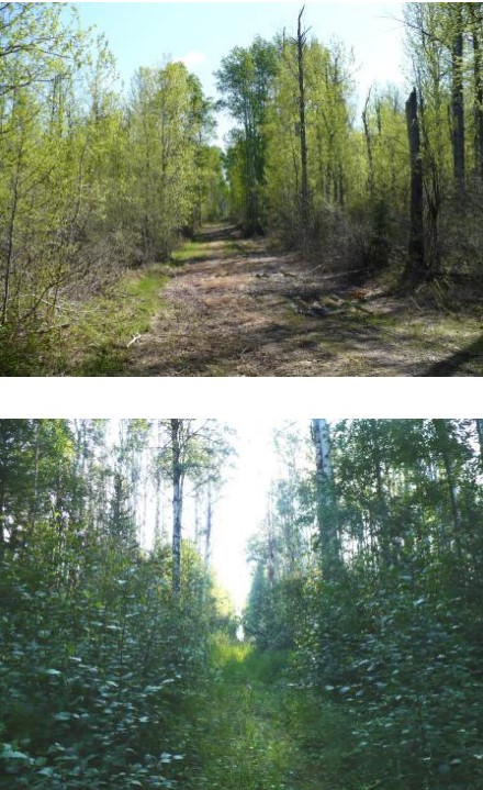
We conducted a series of surveys to evaluate wildlife responses to different types of seismic lines in bogs, conifer‐dominated, mixedwood and deciduous forests in the western boreal forest. Research...
Resource
The Emend for Schools: 360° Video EMEND Tour Teachers Resource is a full lesson plan and 360 immersive and interactive video teaching tool, including a teacher lesson plan and student workbook aligned...