Land Management Search Results
Resource
Authors
Virgil Hawkes
Gillian Donald
A long-term plot network would allow the monitoring data to describe the ecological condition of the reclaimed lands and define appropriate management strategies for achieving revegetation goals
Resource
Authors
Terry Macyk
Vern Albush
O. Terry
In 1992 the Alberta Research Council initiated a reclamation study at the Smoky River Coal Limited No. 12 Mine South area located northwest of Grande Cache, Alberta. The objective of the research is...
Resource
Authors
Mar Martinez
Gary Borstad
Leslie Brown
Kaan Ersahin
Michael Henley
Monitoring of reclaimed sites is a complex, interdisciplinary undertaking, especially in large, disturbed areas with difficult access. In that context, remote sensing is a unique and valuable tool...
Resource
Authors
R.J. Hall
J.J. van der Sanden
J.T. Freeburn
S.J. Thomas
The objective of this report is to review the requirements for disturbance information, the manifestation of damage patterns that may be encountered, and to provide an overview of remote sensing...
Resource
Authors
Howard Baldwin
Bryant Bidgood
Design techniques are presented for a very high frequency telemetry system capable of transmitting short radio frequency pulse signals from the body of a fish to an aircraft flying over a river.
Resource
Diesel invert wastes are one of the more difficult types of drilling mud wastes to dispose of due to the presence of hydrocarbons and salts. In 1989 a joint research program funded by the Alberta...
Resource
Authors
Jay Woosaree
Bruce Anderson
Reclamation in the oil sands in Alberta is a high priority and can be challenging. Suncor Energy is in the process of reclaiming one of its consolidated tailings (CT) ponds (Pond 5). The CT is being...
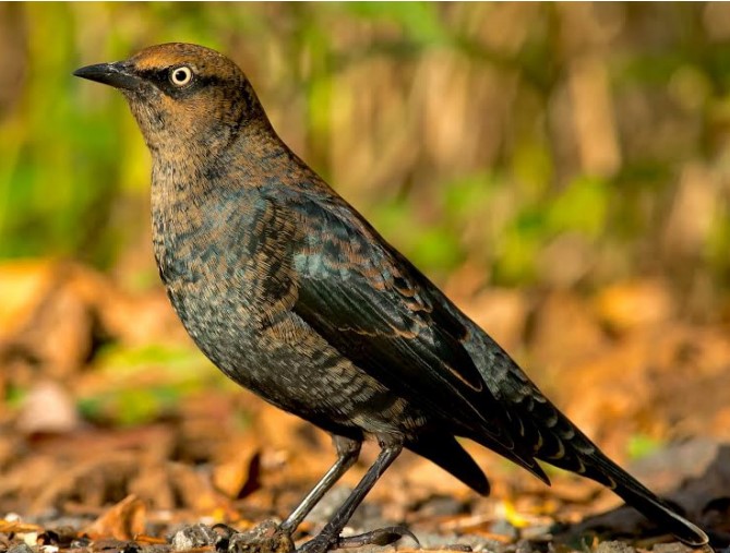
Resource
Authors
Cameron Nordell
Erin Bayne
The Rusty Blackbird ( Euphagus carolinus ) was listed as Special Concern on Schedule 1 of the federal Species at Risk Act in March 2009 because of large and longterm declines in population size. The...
Resource
This thesis investigates the effectiveness of machine learning algorithms for automatic detection of coniferous seedling data along Boreal seismic lines. In order to obtain a survival assessment and...
Resource
Authors
D.G. Maynard
K. E. Hogg
E.F. Wass
M.P. Curran
Soil disturbance from forest harvesting has been shown to compromise site productivity. We established satellite trials in five of the Long-Term Soil Productivity (LTSP) sites in southeast British...
Resource
Authors
Anne Naeth
Donna White
David Chanasyk
Terry Macyk
Chris Powter
Don Thacker
To provide coordinated direction for reclamation research in Alberta, the need to review the current understanding and the role of soil physical properties in soil disturbance related activities was...
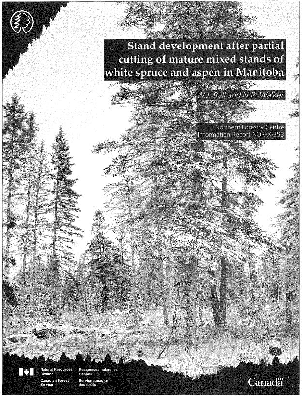
Resource
One-hundred-year-old mixed white spruce–aspen stands were partially cut in 1953, 1954, and 1955 and scarified leaving treatments that retained 14–100% of total stand basal area. Composition of the...
Resource
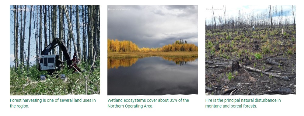
Authors
Alberta Biodiversity Monitoring Institute
This online report describes the status of human footprint, species, and habitat in Norbord Inc.'s two main operating areas located in northwestern Alberta. This information establishes baseline...
Resource
Includes sections outlining the requirements of: Environmental impact to tar sands development, Water Resources Act, Clean Air Act , Clean Water Act and land reclamation
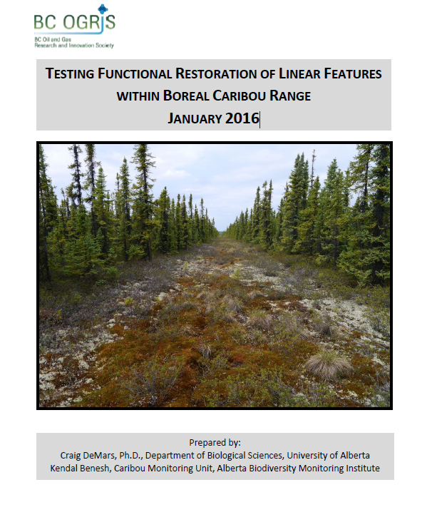
Resource
Authors
Craig DeMars
Kendal Benesh
The boreal ecotype of woodland caribou ( Rangifer tarandus caribou) is provincially Red-listed in British Columbia and federally listed as Threatened. Population declines of boreal caribou have been...
Resource
UAV-based remote sensing as a method for monitoring well pad recovery is determined to be feasible from a technical and field perspective.
Resource
Authors
Stan Aronoff
G.A. Ross
W.A. Ross
Figures and Tables associated with Volume 1
Resource
Authors
B.L. Barge
R.G. Humphries
S.L. Olson
The feasibility of a weather radar to map precipitation in the Alberta Oil Sands Environmental Research Program (AOSERP) study area near Fort McMurray, Alberta was investigated
Resource
Authors
Alberta Biodiversity Monitoring Institute
As of 2010, human footprint in the Active In-situ Region was 7.7%, whereas it was 20.8% in the Mineable Region. Total human footprint in all Woodland Caribou ranges increased between 2007 and 2010
Resource
Authors
Alberta Biodiversity Monitoring Institute
As of 2012, the total human footprint across the OSR was 13.8%. Energy footprint covered 2.2% of the OSR. The total human footprint in the OSR increased from 11.3% to 13.8% between 1999 and 2012.