Land Management Search Results
Resource
Authors
Anne Naeth
Konstantin Dlusskiy
Leonard Leskiw
Chris Powter
Andy Etmanski
Humans impact everything, including our soil. We remove, mix and compact soil horizons. We add amendments, including waste materials, to replace soil or improve its health. Soils that that have been...
Resource
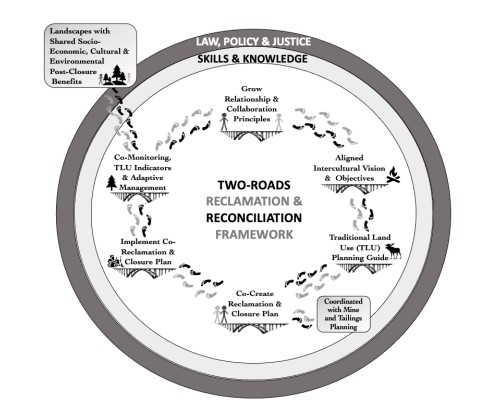
The sustainability of a landscape and its host community post-mining depends on careful and effective mine closure and reclamation planning. Such planning has the potential to support the renewal of...
Resource
Authors
Eric Kessel
Owen Sutton
Jonathan Price
Given the potential for moisture limited conditions due to the sub-humid regional climate, ensuring sufficient water availability in these landscapes is a principal concern. This research demonstrates...
Resource
Authors
William Wadsworth
Ave Dersch
Robin Woywitka
Kisha Supernant
The Athabasca Oil Sands (AOS) region of Alberta has one of the densest accumulations of known archaeological sites, and possibly the most archaeological sites at risk, in the country. Expanding...
Resource
Authors
Bonnie Drozdowski
Craig Aumann
Chris Powter
Report of a seminar to develop a collective understanding of the benefits and opportunities of Predictive Soil Mapping as they relate to Alberta
Resource
Mounding is a highly versatile technique for addressing site conditions that may limit forest recovery on a wide range of reclamation sites. The technique is particularly useful on wet and cool sites...
Resource
Seeding is less reliable than planting, and natural regeneration even less so, but these regeneration methods may be suitable, low-cost alternatives on some reclaimed sites. both seeding and natural...
Resource
The footprint left by infrastructure and equipment can create different challenges for establishing vegetation. The best site preparation method depends on the limiting factors present.
Resource
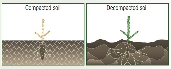
Reclaiming industrial sites in Alberta's boreal forest is not always a straightforward process. The footprints left by infrastructure and equipment are often characterized by compacted mineral soils...
Resource
Soil compaction frequently results from industrial disturbance on mineral soils, whether due to infrastructure or equipment traffic. Soil compaction tends to be most severe on sites with high clay...
Resource
Soil salvage is a pre-disturbance technique to conserve a site's topsoil, which is critical for maintaining nutrient cycling, organic matter, soil biota and plant propagules. In some cases, subsoil...
Resource
Authors
Chris Powter
Marshall McKenzie
Christina Small
The Government of Alberta has long been a strong proponent of the use of native species for land reclamation and restoration projects. In 1973 the Department of Agriculture began an evaluation of...
Resource
Authors
Chris Powter
Brent Scorfield
Brent Lakeman
Shane Patterson
The development of integrated geomatics and remote sensing technologies for environmental management holds promise to meet economic diversification and effective environmental management.
Resource
Authors
Terry Antoniuk, John Nishi, Rochelle Harding, Lynn McNeil, Karen Manuel
Resource Date:
March
2016
The Caribou Predator Fencing Pilot project (the Pilot) is a tool developed by Canada’s Oil Sands Innovation Alliance (COSIA) Land Environmental Priority Area (Land EPA) for caribou recovery. The...
Resource
Authors
Roger DeAbreu
Shane Patterson
Todd Shipman
Chris Powter
NRCan pilot science projects have proven that Earth Observation can provide relevant and valuable information to inform and enhance monitoring and support regulatory frameworks
Resource
The presentation describes the development and content of the draft Biodiversity Management Framework for the Lower Athabasca Region
Resource
Report focuses on evolution and current state of pertinent federal legislative Acts in the environmental, natural resource, and energy policy sectors that may impact oil sands environmental management
Resource
Authors
Brian Eaton
Tyler Muhly
Jason Fisher
Shauna-Lee Chai
Reclaimed mine sites will consist of engineered landforms (including water bodies and waterways); the long-term hydrological and ecological function of those sites may be vulnerable to beaver activity
Resource
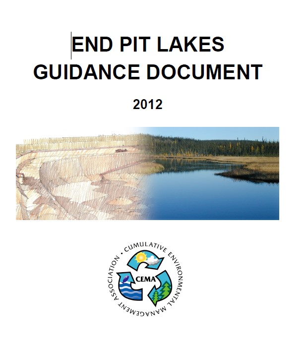
Document presents the scientific and engineering expertise to guide all reclamation activities associated with end pit lake design and construction
Resource
Authors
Ken Foster
Christine Godwin
Peter Pyle
The MAPS protocol (Monitoring Avian Productivity and Survivorship) was applied in a 2011 pilot program in the boreal forest in the oil sands region