Wetlands Knowledge Search Results
Resource
Authors
Virgil Hawkes
Gillian Donald
A long-term plot network would allow the monitoring data to describe the ecological condition of the reclaimed lands and define appropriate management strategies for achieving revegetation goals
Resource
Authors
Marie-Claude Roy
J. Kariyeva
Jim Herbers
Jim Schieck
Final recommendations to the development of a wetland monitoring program for the Oil Sands region of Alberta.
Resource
Authors
Mar Martinez
Gary Borstad
Leslie Brown
Kaan Ersahin
Michael Henley
Monitoring of reclaimed sites is a complex, interdisciplinary undertaking, especially in large, disturbed areas with difficult access. In that context, remote sensing is a unique and valuable tool...
Resource
This thesis investigates the effectiveness of machine learning algorithms for automatic detection of coniferous seedling data along Boreal seismic lines. In order to obtain a survival assessment and...
Resource
Authors
Doug Maynard
K. E. Hogg
E.F. Wass
M.P. Curran
Soil disturbance from forest harvesting has been shown to compromise site productivity. We established satellite trials in five of the Long-Term Soil Productivity (LTSP) sites in southeast British...
Resource
Authors
Alberta Biodiversity Monitoring Institute
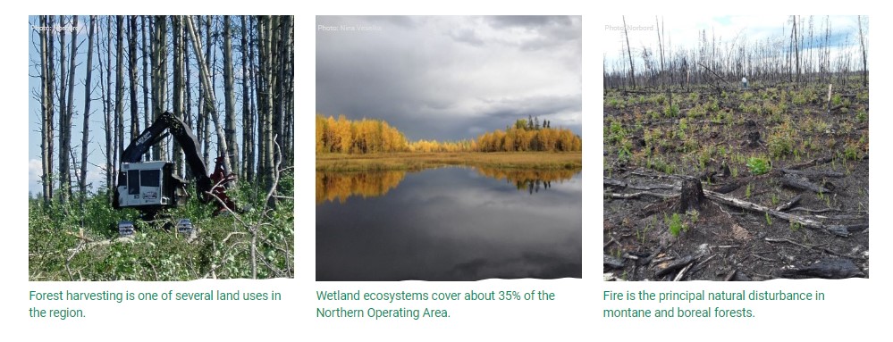
This online report describes the status of human footprint, species, and habitat in Norbord Inc.'s two main operating areas located in northwestern Alberta. This information establishes baseline...
Resource
UAV-based remote sensing as a method for monitoring well pad recovery is determined to be feasible from a technical and field perspective.
Resource
Protocols for sampling biotic and abiotic parameters in large lakes, large rivers, wetlands, and streams in Alberta is provided. Estimates of time costs are given.
Resource
Authors
Stan Aronoff
G.A. Ross
W.A. Ross
Figures and Tables associated with Volume 1
Resource
Authors
Alberta Biodiversity Monitoring Institute
As of 2010, human footprint in the Active In-situ Region was 7.7%, whereas it was 20.8% in the Mineable Region. Total human footprint in all Woodland Caribou ranges increased between 2007 and 2010
Resource
Authors
Alberta Biodiversity Monitoring Institute
As of 2012, the total human footprint across the OSR was 13.8%. Energy footprint covered 2.2% of the OSR. The total human footprint in the OSR increased from 11.3% to 13.8% between 1999 and 2012.
Resource
Authors
Alberta Biodiversity Monitoring Institute
This report presents data on several indicators of environmental health for the Kakwa River Project area where ARC Resources operates in northwestern Alberta. The Kakwa River Project area covers...
Resource
There is uncertainty related to the long-term consequences of reconstructing landscapes on Alberta’s specified lands. Alberta has over 100,000 wellsites that have been certified under evolving...
Resource
Authors
Alberta Biodiversity Monitoring Institute
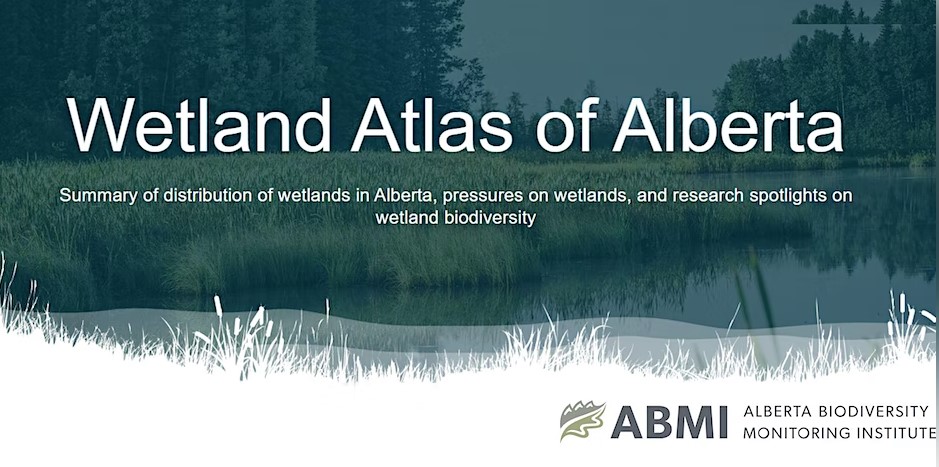
The Wetland Atlas describes the distribution of wetlands in Alberta and summarizes human footprint around open water wetlands. Also included are research spotlights on wetland biodiversity including...
Resource
Authors
Christopher Evans
Vincent Gauci
To reduce global greenhouse gas emissions, conservation and restoration of wetlands play a key role. This report outlines the contribution of wetlands to global methane output; differences between...