
Search Results
Displaying:
1 - 8 of 8
COSEWIC Assessment and Status Report on the Caribou (Rangifer tarandus), Barren-ground Population in Canada - 2016
Resource
The 2016 assessment report on barren-ground caribou prepared by the Committee on the Status of Endangered Species in Canada (COSEWIC). It is a long, thorough and quite technical overview. It resulted...

COSEWIC Assessment and Status Report on the Caribou (Rangifer tarandus) Dolphin and Union population in Canada 2017
Resource
The Committee on the Status of Endangered Wildlife in Canada (COSEWIC) assesses the national status of wild species, subspecies, varieties, or other designatable units that are considered to be at...
COSEWIC Assessment and Status Report on the Peary Caribou Rangifer tarandus pearyi in Canada
Resource
A 2015 assessment and status report on Peary caribou from the Committee on the Status of Endangered Wildlife in Canada (COSEWIC). This resource and others can be found on the Northern Caribou Canada...

Denitrification Potential of Surface Soils of Constructed Wetlands in Newtown Creek, an Urban Superfund Site
Resource
Denitrification, the anaerobic microbial conversion of nitrate (NO 3 −), a common water pollutant, to nitrogen (N) gases, is often high in the soil of natural wetlands. In areas where natural wetlands...

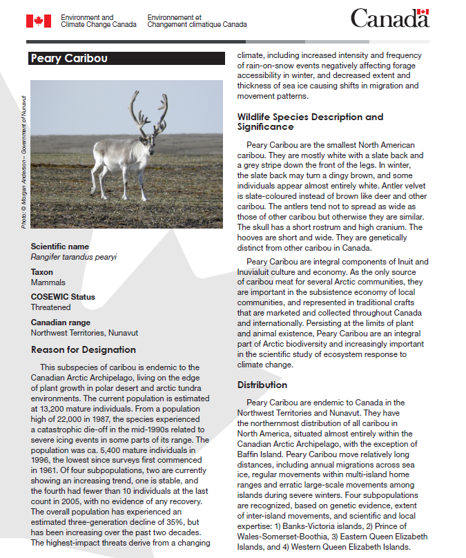
Fact Sheet: Peary Caribou
Resource
A 2015 three-page fact sheet on Peary caribou produced by the Canadian government. This resource and others can be found on the Northern Caribou Canada website. To find more related resources click...
Linking Co-monitoring to Co-management: Bringing Together Local, Traditional, and Scientific Knowledge in a Wildlife Status Assessment Framework
Resource
Effective wildlife management requires accurate and timely information on conservation status and trends, and knowledge of the factors driving population change. Reliable monitoring of wildlife...
The Third Generation of Pan-Canadian Wetland Map at 10 m Resolution Using Multisource Earth Observation Data on Cloud Computing Platform
Resource
Development of the Canadian Wetland Inventory Map (CWIM) has thus far proceeded over two generations, reporting the extent and location of bog, fen, swamp, marsh, and water wetlands across the country...