
Search Results
Displaying:
1 - 12 of 12
Boreal Caribou Traditional Knowledge-based Habitat Supply Model, Restoration and Monitoring Strategy for Constance Lake Traditional Territory in Ontario
Project
Contact
The purpose of this project is to enable Constance Lake First Nation to address the threat of habitat loss, degradation, and fragmentation for the Woodland Caribou, boreal population (Threatened)...

Continental Synchrony and Local Responses: Climatic Effects on Spatiotemporal Patterns of Calving in a Social Ungulate
Resource
Warming temperatures and advancing spring are affecting annual snow and ice cycles, as well as plant phenology, across the Arctic and boreal regions. These changes may be linked to observed population...

Factors Contributing to the Cultural and Spatial Variability of Landscape Burning by Native Peoples of Interior Alaska
Project
Organization:
In this project, a multidisciplinary research team, together with native community partners, analyzed patterns of human-fire interaction over time and then stratified the predominant anthropogenic...
Factors Contributing to the Cultural and Spatial Variability of Landscape Burning by Native Peoples of Interior Alaska
Resource
This article analyzes the geographical extent to which native peoples of Interior Alaska used fire to modify the landscape at the time of European contact. Although wildfire has been central to the...
Integrating Coastal Vulnerability and Community-Based Subsistence Resource Mapping in Northwest Alaska
Project
Organization:
This project integrates physical, anthropological, and survey data to assess coastal vulnerability and to identify areas of concern for local and regional planning and environmental protection. This...
Integrating Coastal Vulnerability and Community-Based Subsistence Resource Mapping in Northwest Alaska
Resource
This resource is available on an external database and may require a paid subscription to access it. It is included on the CCLM to support our goal of capturing and sharing the breadth of all...
Microtopography Matters: Belowground CH4 Cycling Regulated by Differing Microbial Processes in Peatland Hummocks and Lawns
Resource
This resource is available on an external database and may require a paid subscription to access it. It is included on the CCLM to support our goal of capturing and sharing the breadth of all...

Reclamation by Transalta Utilities through Planned Research and Experience
Resource
TransAlta Utilities has always believed that finding solutions to reclamation problems must identify the most economical and technically feasible methods. A range of research related programs have...

Reclamation Experience: An Industrial Perspective
Resource
The concepts important to the regulation of reclaimed land have been evolving and will continue to evolve. We have gone from emphasis on "equal to or greater than productivity" to emphasis on...
The Third Generation of Pan-Canadian Wetland Map at 10 m Resolution Using Multisource Earth Observation Data on Cloud Computing Platform
Resource
Development of the Canadian Wetland Inventory Map (CWIM) has thus far proceeded over two generations, reporting the extent and location of bog, fen, swamp, marsh, and water wetlands across the country...

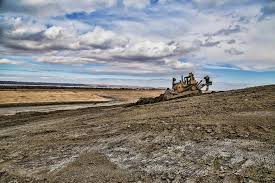
Whitewood Mine Closure
Resource
1665 ha has been reclaimed, including one end pit lake, numerous wetland features, woodland/wildlife areas revegetated through assisted natural recovery and perennially cropped agricultural lands
