
Search Results
Displaying:
1 - 6 of 6
Plant Functional Traits as Indicator of the Ecological Condition of Wetlands in the Grassland and Parkland of Alberta, Canada
Resource
The analysis of functional trait-habitat relationships has been used to measure the degree to which environmental factors influence the assembly of ecological communities. In the Parkland and...

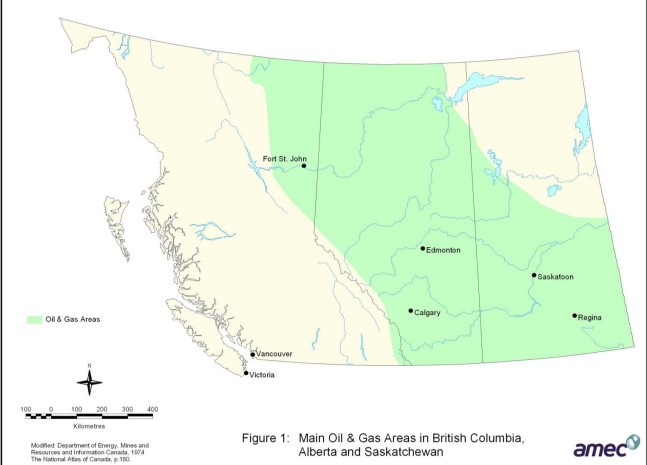
Review of Revegetation Practices for Oil and Gas Disturbances in Western Canada
Resource
Various methods have been developed and used to revegetate sites disturbed by oil and gas activities in Western Canada. Considerable information describing these methods and their effectiveness exists...
The Alberta Oil Sands
Resource
Overview of the oil sands, current commercial developments, experimental work, an overview of Fort McMurray and the role of government agencies in development and management of oil sands.

The Third Generation of Pan-Canadian Wetland Map at 10 m Resolution Using Multisource Earth Observation Data on Cloud Computing Platform
Resource
Development of the Canadian Wetland Inventory Map (CWIM) has thus far proceeded over two generations, reporting the extent and location of bog, fen, swamp, marsh, and water wetlands across the country...
Using GIS and Remote Sensing to Monitor Industrial Impacts to Archaeological Sites in the Athabasca Oil Sands of Alberta
Resource
The Athabasca Oil Sands (AOS) region of Alberta has one of the densest accumulations of known archaeological sites, and possibly the most archaeological sites at risk, in the country. Expanding...
