
Search Results
Displaying:
1 - 15 of 15
Extending the National Burned Area Composite Time Series of Wildfires in Canada
Resource
This study created a 35-year time series of wildfire burned areas in Canada from 1986 to 2020, using data from satellite imagery and aerial surveys. Wildfires are a major natural disturbance in Canada...

Guiding Principles for Wetland Stewardship and Forest Management Practitioner Guide
Resource
This practitioner guide provides a user-friendly overview of the interactions between boreal wetlands and forests and what these interactions mean for forest managers working in Canada’s boreal.

Guiding Principles for Wetland Stewardship and Forest Management Technical Report
Resource
This technical report describes in detail the interactions between boreal wetlands and forests and how forest managers can use this information to help avoid or minimize adverse effects on wetlands.

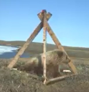
Network of Wildlife Cameras and Audio Recorders Expanded to Better Monitor Biodiversity
News
Organization
Biodiversity monitoring partners across the NWT are getting a closer look at wildlife as the Government of the Northwest Territories’ Biodiversity Monitoring Program expands. Remote cameras and audio...
Regional Habitat Needs of a Nationally Listed Species, Canada Warbler (Cardellina canadensis), in Alberta, Canada
Resource
Understanding factors that affect the distribution and abundance of species is critical to developing effective management plans for conservation. Our goal was to quantify the distribution and...

The Forest Management and Wetland Stewardship Initiative
Project
Contact
Organization:
The FMWSI is a partnership between Ducks Unlimited Canada (DUC), Alberta-Pacific Forest Industries Inc., Canfor, the Forest Products Association of Canada (FPAC), Millar Western Forest Products Ltd...
The Multisource Vegetation Inventory (MVI): A Satellite-Based Forest Inventory for the Northwest Territories Taiga Plains
Resource
Wall-to-wall 30 m raster maps of broad forest type, stand height, crown closure, stand volume, total volume, aboveground biomass, and stand age were created for a ~400,000 km2 area, validated with independent data, and generalized into a polygon GIS layer resembling a traditional FI map. The MVI project showed that a reasonably accurate FI map for large, remote, predominantly non-inventoried boreal regions can be obtained at a low cost by combining limited field data with remote sensing data from multiple sources.
Transportation Corridor Study. Volume 4 Appendix: Environment - General Characteristics & Conditions - Part 1
Resource
Contains the following sections: Environment Characteristics and Conditions; Soils; Wildlife; and, Preliminary Review and Land Evaluation

Transportation Corridor Study. Volume 4 Appendix: Environment - General Characteristics & Conditions - Part 2
Resource
Contains the following chapters: Environment Characteristics and Conditions; Soils; Wildlife; and Human Settlement Pattern of the Expanded Study Area

Webinar - Hot Hot Peat! Managing Boreal Peatland Wildfires in an Era of Climate Change
Resource
This presentation provides an overview of current boreal peatland wildfire research and of management approaches in the face of climate change.

Wings Over Water - Premiere
Event
Edmonton, AB
Organization
Wings Over Water - Soaring onto IMAX at TELUS World of Science on June 24! As the glaciers retreated at the end of the last ice age, they left an astounding gift of connected rivers, lakes and...
