Boreal Caribou Search Results
Resource
Authors
Stewart Weir Stewart Watson & Heinrichs
A 16 page questionnaire was prepared and sent to some six hundred landowners in the area from Fort Saskatchewan north to Atmore (120 responded); public meetings were held in 7 locations
Resource
Authors
Stewart Weir Stewart Watson & Heinrichs
Technical meetings were held to obtain pertinent information from these people to complete specific parts of the study: Calgary Technical Group, Calgary Industry Seminar, Edmonton Study Group
Resource
Authors
Athabasca Tar Sands Corridor Study Group
Contains the following chapters: SUPPLY & DEMAND - Seaton-Jordan & Associates Ltd. URBAN GROWTH IMPLICATIONS OF CORRIDOR TERMINAL LOCATION - K.C. Mackenzie Associates Ltd. IMPACTS OF PETROCHEMICALS ON...
Resource
Authors
Alexander MacPhail
Daniel Yip
Elly Knight
Richard Hedley
Michelle Knaggs
Julia Shonfield
Emily Upham-Mills
Erin Bayne
Increasing popularity in passive acoustic monitoring and the ease with which researchers can accumulate large quantities of acoustic data has resulted in challenges for audio recording storage...
Resource
Authors
Nicole Balliston
Jonathan Price
Resource Date:
April
2022
This resource is available on an external database and may require a paid subscription to access it. It is included on the CCLM to support our goal of capturing and sharing the breadth of all...
Resource
This is a compilation of on-line accessible papers from the 1982, 1985 and 1986 conferences of the Alberta Chapter, Canadian Land Reclamation Association. This list will be updated periodically.
Resource
Authors
Majid Iravani
Brandon Allen
Ermias Azeria
Monica Kohler
Shannon White
This proof of concept assessment helps understand better market opportunities associated with biodiversity management in Alberta’s agricultural lands. Land management can increase biodiversity.
Resource
Authors
Alberta Biodiversity Monitoring Institute
We’re pleased to announce the release of the ABMI Alberta-wide Wetland Inventory—our most up-to-date and high-resolution wetland data yet.
Resource
Authors
Alberta Biodiversity Monitoring Institute
From1999 to 2015, human activity in Alberta visibly converted over 23,000 km2 of native ecosystems into residential, recreational, or industrial landscapes
Resource
Resource Date:
August
2021
With the support of Alberta Environment and Parks, the Alberta Biodiversity Monitoring Institute has become the trusted source for data about habitat, species, and the human footprint.
Resource
Authors
Bev Gingras
Stuart Slattery
Kevin Smith
Marcel Darveau
Resource Date:
August
2016
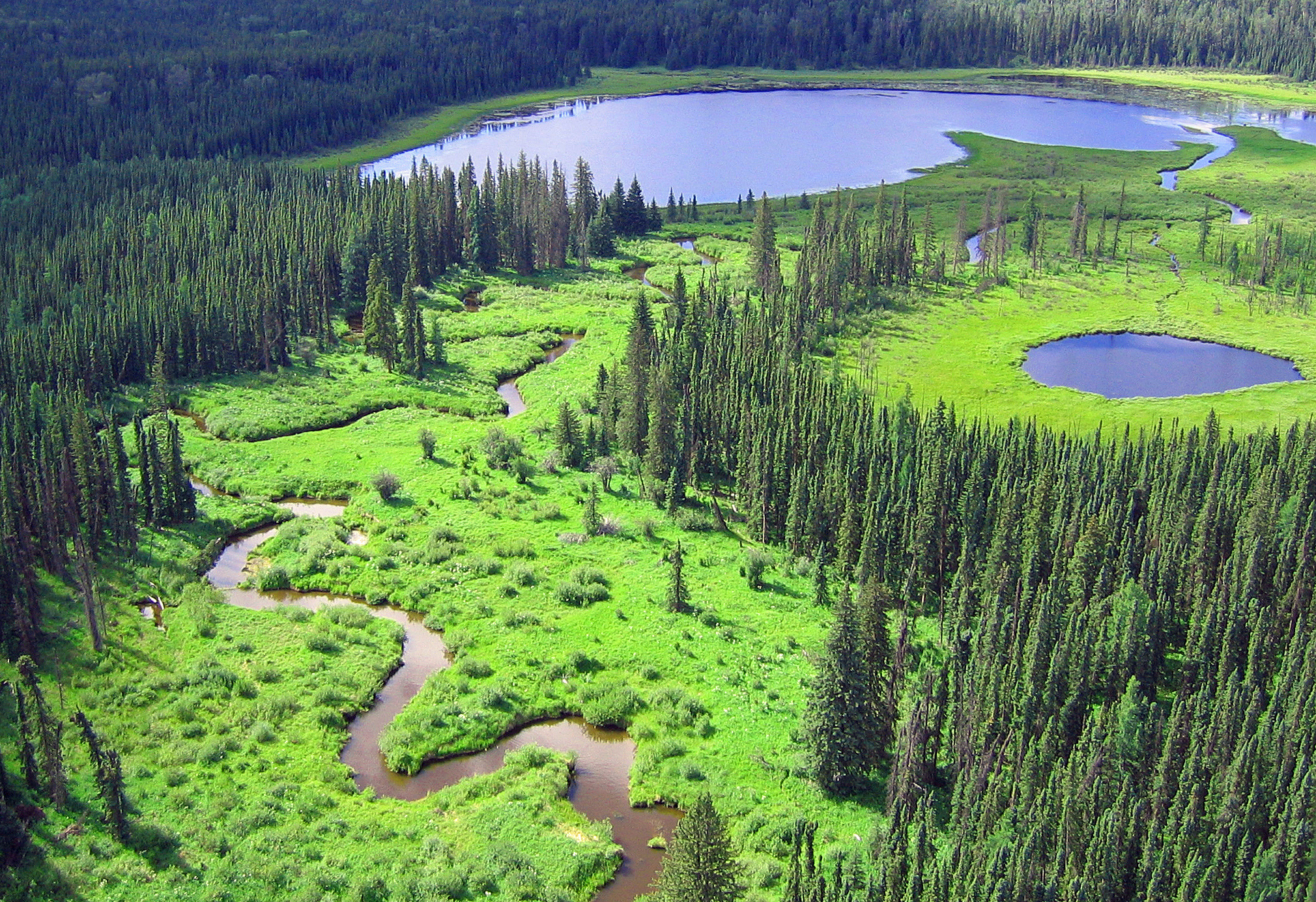
The Canadian and Alaskan boreal zone is one of the most water rich areas in the world, and contains an estimated combined surface water and peatland area the size of Indonesia (∼1.94 million km2)...
Resource
Authors
Delayney Brooks
Joseph Nocera
This resource is available on an external database and may require a paid subscription to access it. It is included on the CCLM to support our goal of capturing and sharing the breadth of all...
Resource
Authors
Alberta Biodiversity Monitoring Institute
Vulnerability to climate change of more than 170 of Alberta’s native species is assessed on the basis of exposure and sensitivity to change
Resource
Authors
Christopher Shank
Amy Nixon
This report provides a broad overview of how Alberta species are likely to be affected by climate change by the 2050s. Amphibians were consistently found to be the most vulnerable to climate change
Resource
Authors
Alex Schumacher
Reinhard Hermesh
Antoine Bedwany
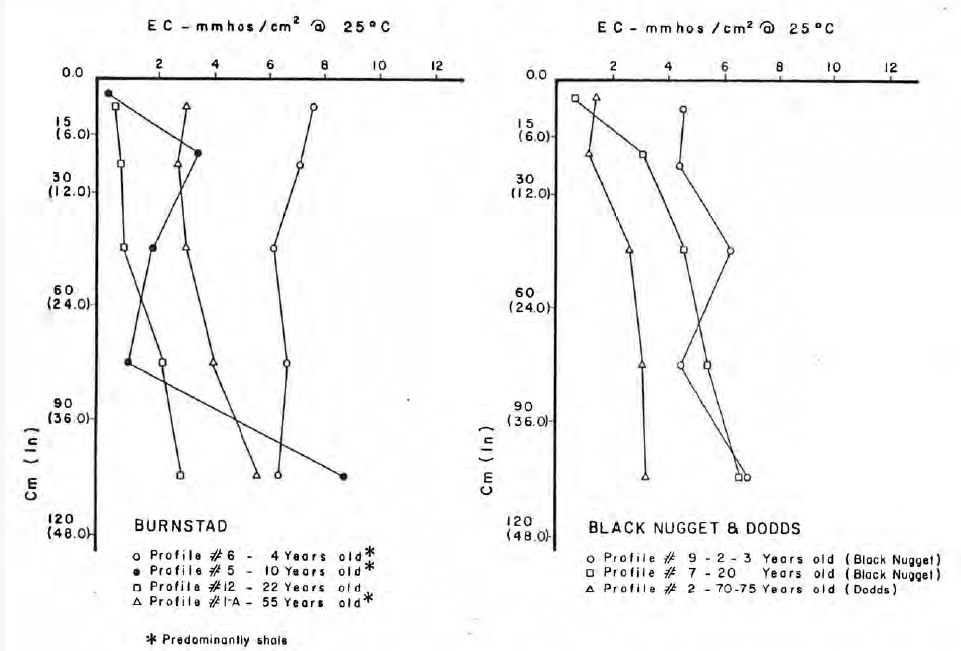
The study involved an examination of the vegetation and spoils on five mine locations in the central Parkland of Alberta. These five locations represented different spoil types, and methods of mining...
Resource
Authors
Alberta Environment and Parks
This code of practice regulates wetland restoration and wetland construction activities as defined in the Code by replacing Water Act approval requirements. Wetland restoration is applied to wetlands...
Resource
Authors
Harald Thimm
G.J. Clark
G. Baker
The construction of a wastewater evaporation lagoon at the Quirk Creek Gas Plant a number of years ago resulted in the creation of a six acre area of overburden consisting of heavy clay, gravel and...
Resource
Authors
Chris Powter
Brent Scorfield
Brent Lakeman
Shane Patterson
The development of integrated geomatics and remote sensing technologies for environmental management holds promise to meet economic diversification and effective environmental management.
Resource
Authors
Bev Gingras
Cynthia Paszkowski
Garry Scrimgeour
Sharon Kendall
Objective was to compare the effectiveness of four commonly used sampling techniques (pitfall traps, funnel traps, visual searches and call surveys) to detect stream amphibian communities.
Resource
Authors
Terry Macyk
Bonnie Drozdowski
This report identifies and summarizes reclamation practices that have been used in the mineable Oil Sands region and coal mining industry over the last 40+ years.