Land Management Search Results
Resource
Authors
NAIT Centre for Boreal Research
This flowchart outlines each step of the treatment process for forest land (upland) soil as incorporated in the corresponding Decision Support Systems (DSS). View more tools by NAIT Centre for Boreal...
Resource
Authors
NAIT Centre for Boreal Research
This flowchart outlines each step of the treatment process for forest land (upland) vegetation as incorporated in the corresponding Decision Support Systems (DSS). View more tools by NAIT Centre for...
Resource
Authors
Daniel Fortin
Pietro-Luciano Buono
André Fortin
Nicolas Courbin
Christian Gingras
Paul Moorcroft
Réhaume Courtois
Claude Dussault
Associate Editor: Wolf Mooij
Editor: Judith Bronstein
This resource is available on an external database and may require a paid subscription to access it. It is included on the CCLM to support our goal of capturing and sharing the breadth of all...
Resource
Authors
B. Ayres
Mike O'Kane
Lee Barber
D. Hiller
D. Helps
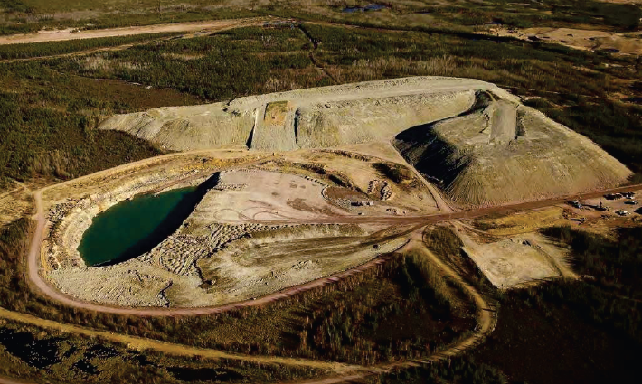
The Claude waste rock pile at Cluff Lake uranium mine in northern Saskatchewan's Athabasca basin contains ~7.2 million tonnes of waste rock, upon which an engineered enhanced store-and-release cover...
Resource
Authors
Bonnie Drozdowski
Craig Aumann
Chris Powter
Report of a seminar to develop a collective understanding of the benefits and opportunities of Predictive Soil Mapping as they relate to Alberta
Resource
During the Fall of 2006, the Ontario Ministry of Northern Development and Mines tendered a construction project to provide a soil cover over the North Impounded Tailings (NIT) area at the abandoned...
Resource
Authors
A.U. Mallik
Y.L. Gong
F.W. Bell
Secondary succession, which follows forest harvesting, begins with the growth of herbs, shrubs, and trees and eventually leads to a mature forest. However, young, commercially important trees are...
Resource
Restoration of post mining disturbed sites within the boreal sub-alpine ecological communities of the Yukon has varied levels of success. Employing ecological succession principles to further the...
Resource
Authors
Amanda Schoonmaker
Catherine Brown
The practice of mulching forested sites for industrial activities during winter operations is a useful construction practice as it minimizes soil disturbance by protecting the forest floor. However...
Resource
Authors
Larry Turchenek
J.D. Lindsay
Recurring patterns of soils, landforms, and vegetation were delineated. The information was transferred first to 1:50,000 preliminary maps and then to eight 1:126,720 maps which accompany this report
Resource
A four year study has been carried out to determine the ability of coniferous trees to aid in the reclamation of uranium tailings at Elliot Lake. Five species were planted: white cedar, white spruce...
Resource
Authors
Guillermo Castilla
Ronald Hall
Rob Skakun
Michelle Filiatrault
André Beaudoin
Michael Gartrell
Lisa Smith
Kathleen Groenewegen
Chris Hopkinson
Jurjen van der Sluijs
Resource Date:
February
2022
Wall-to-wall 30 m raster maps of broad forest type, stand height, crown closure, stand volume, total volume, aboveground biomass, and stand age were created for a ~400,000 km2 area, validated with independent data, and generalized into a polygon GIS layer resembling a traditional FI map. The MVI project showed that a reasonably accurate FI map for large, remote, predominantly non-inventoried boreal regions can be obtained at a low cost by combining limited field data with remote sensing data from multiple sources.
Resource
Authors
Y. Huberman
J. Beckers
R. Brett
G. Castilla
R. Errington
E.C. Fraser-Reid
D. Goodsman
E.H. Hogg
J. Metsaranta
E. Neilson
J. Olesinski
M.-A. Parisien
D. Price
T. Ramsfield
C. Shaw
D. Thompson
M.F. Voicu
E. Whitman
J. Edwards
The climate in Canada’s north has changed over the past 70 years. Indeed, mean annual temperature in the Northwest Territories has increased by 2°C to 4°C since record keeping began in 1950. Annual...
Resource
Review of provides basis for evaluating the current progress regarding vegetation descriptions in this area and for designing certain future vegetation studies.
Resource
Authors
Nicholas Beier
Dave Sego
Norbert Morgenstern
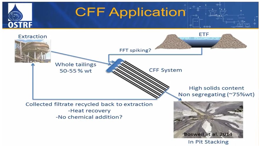
Dr. Nicholas Beier is a Research Associate with the Oil Sands Tailings Research Facility, University of Alberta, Edmonton, Alberta. He describes his doctoral thesis research using tailings management...
Resource
Uranium mining in the Athabasca Basin region in Northern Saskatchewan was developed in the early 1950s. The mines developed during this period were abandoned, leaving deep holes and mining debris...
Resource
Authors
Dianne Allen
Mark Calette
In 1960, the Lorado Mill was abandoned in northern Saskatchewan, leaving an estimated 227,000 cubic meters of radioactive uranium tailings that covered the mill site and flowed into nearby Nero Lake...