Land Management Search Results
Resource
It is generally recognized that plants are genetically adapted to the prevailing climate. Planting stock is often moved across environmental gradients with little knowledge of the ecological risks...
Resource
This thesis investigates the effectiveness of machine learning algorithms for automatic detection of coniferous seedling data along Boreal seismic lines. In order to obtain a survival assessment and...
Resource
Authors
David Olefeldt
Mikael Hovemyr
McKenzie Kuhn
David Bastviken
Theodore Bohn
John Connolly
Patrick Crill
Eugénie Euskirchen
Sarah Finkelstein
Hélène Genet
Guido Grosse
Lorna Harris
Liam Heffernan
Manuel Helbig
Gustaf Hugelius
Ryan Hutchins
Sari Juutinen
Mark Lara
Avni Malhotra
Kristen Manies
David McGuire
Susan Natali
Jonathan O'Donnell
Frans-Jan Parmentier
Aleksi Räsänen
Christina Schädel
Oliver Sonnentag
Maria Strack
Suzanne Tank
Claire Treat
Ruth Varner
Tarmo Virtanen
Rebecca Warren
Jennifer Watts
Here we present the Boreal–Arctic Wetland and Lake Dataset (BAWLD), a land cover dataset based on an expert assessment, extrapolated using random forest modelling from available spatial datasets of...
Resource
Authors
José Gérin-Lajoie
Alain Cuerrier
Laura Siegwart Collier
In full colour with photos of the 145 contributing Inuit elders, “The Caribou Taste Different Now” grounds the discussions, debates, and discourses about climate change to material and everyday life in the contemporary Canadian Arctic.
Resource
Authors
Rachel Hovel
Jeremy Brammer
Emma Hodgson
Amy Amos
Trevor Lantz
Chanda Turner
Tracey Proverbs
Sarah Lord
Rapid environmental change in the Arctic elicits numerous concerns for ecosystems, natural resources, and ways of life. Robust monitoring is essential to adaptation and management in light of these...
Resource
Authors
Guillermo Castilla
Ronald Hall
Rob Skakun
Michelle Filiatrault
André Beaudoin
Michael Gartrell
Lisa Smith
Kathleen Groenewegen
Chris Hopkinson
Jurjen van der Sluijs
Resource Date:
February
2022
Wall-to-wall 30 m raster maps of broad forest type, stand height, crown closure, stand volume, total volume, aboveground biomass, and stand age were created for a ~400,000 km2 area, validated with independent data, and generalized into a polygon GIS layer resembling a traditional FI map. The MVI project showed that a reasonably accurate FI map for large, remote, predominantly non-inventoried boreal regions can be obtained at a low cost by combining limited field data with remote sensing data from multiple sources.
Resource
Authors
Allice Legat
Mary McCreadie
This report considers Tłı̨chǫ knowledge of the relationships that tǫdzı (boreal caribou) have with their habitat, including human and other-than human beings.
Resource
Authors
Ingrid Visseren-Hamakers
Marcel Kok
Over fifty years of global conservation has failed to bend the curve of biodiversity loss, so we need to transform the ways we govern biodiversity. The UN Convention on Biological Diversity aims to...
Resource
Authors
Julie Lovitt
Mir Mustafizur Rahman
Saraswati Saraswati
Gregory McDermid
Maria Strack
Bin Xu
Resource Date:
February
2018
Peatlands are globally significant stores of soil carbon, where local methane (CH 4 ) emissions are strongly linked to water table position and microtopography. Historically, these factors have been...
Resource
Authors
Brenda Parlee
John Sandlos
David Natcher
Resource Date:
February
2018
The paper describes a “tragedy of open access” occurring in Canada’s north as governments open up new areas of sensitive barren-ground caribou habitat to mineral resource development. A growing body of science and traditional knowledge research points to the adverse impacts of resource development; however, management efforts have been almost exclusively focused on controlling the subsistence harvest of northern Indigenous peoples.
Resource
Understanding how populations are structured and how they use natural and anthropogenic spaces is essential for effective wildlife management. A total of 510 barren-ground ( Rangifer tarandus...
Resource
Authors
K.A. Baldwin
Lorna Allen
S. Basquill
K. Chapman
D. Downing
N. Flynn
W. Mackenzie
M. Major
W.J. Meades
D. Meidinger
C. Morneau
J.-P. Saucier
J. Thorpe
Vegetation Zones of Canada: a Biogeoclimatic Perspective maps Canadian geography in relation to regional climate, as indicated by vegetation patterns. Compared to previous similar national-scale...
Resource
The various applications of Ducks Unlimited Canada’s wetland inventories play a critical role in wetland conservation. They serve as key planning tools, helping people who live and work in the boreal...
Resource
In order to protect boreal wetlands, we must first know where they are. This 6-minute video will show you how Ducks Unlimited Canada uses satellite data and remote sensing techniques to map wetlands...
Resource
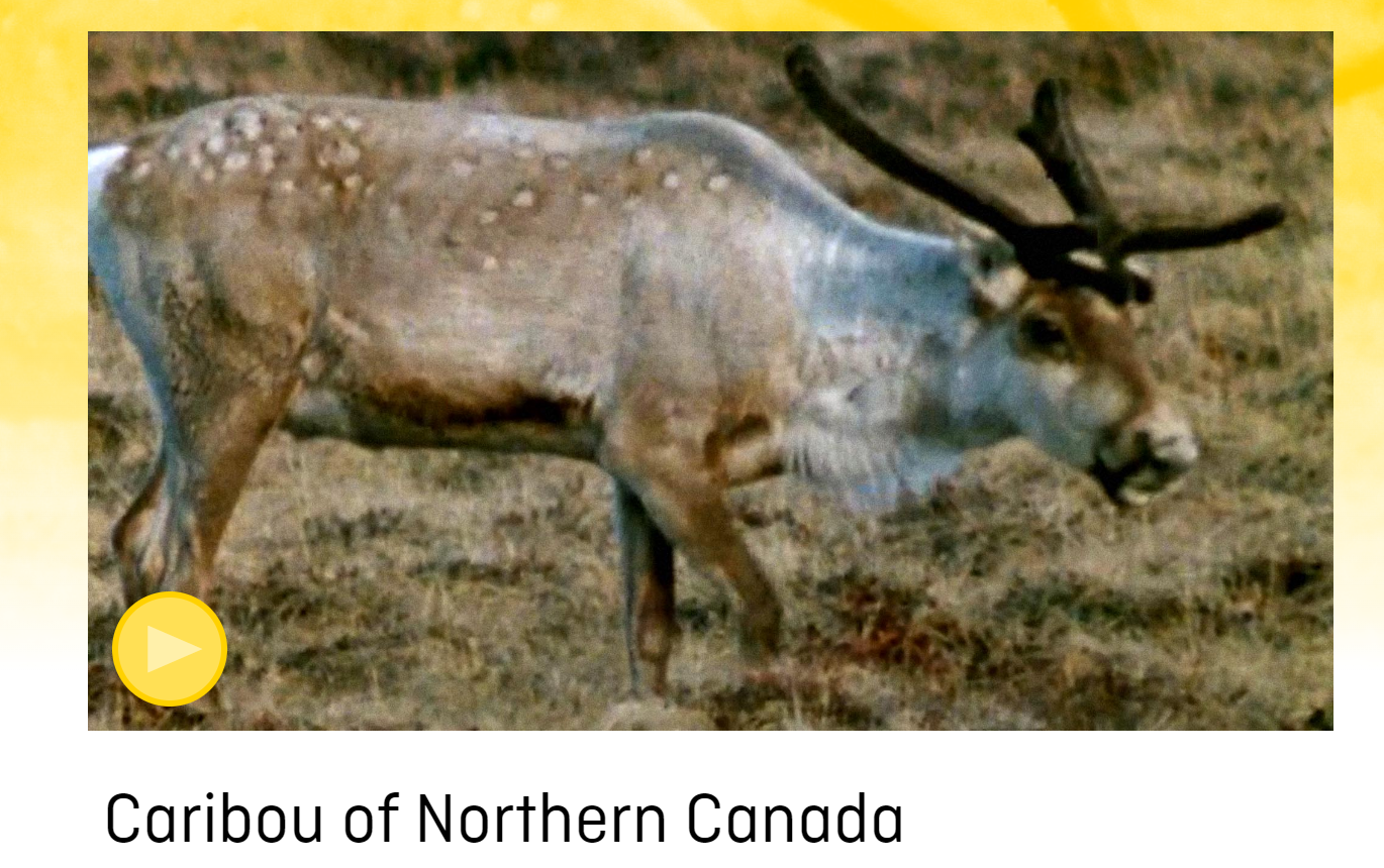
This 1971 13 minute film from the Canadian Wildlife Service has some dated information, but good basic information on the lifecycle of the barren-ground caribou. This resource and others can be found...
Resource
A beautifully shot 24':46" film that follows Indigenous Ekwǫ̀ Nàxoèhdee K’è caribou monitors in the Northwest Territories as they follow the Bathurst caribou herd to try to understand the herd's...
Resource
This presentation provides insight and understanding to how LiDAR data is used to produce digital elevation models and vegetation maps.
Resource
The presentation describes how multi-temporal remote sensing offers a better understanding of landscape changes over time in comparison to the more traditional two-date, before and after comparison.
Resource
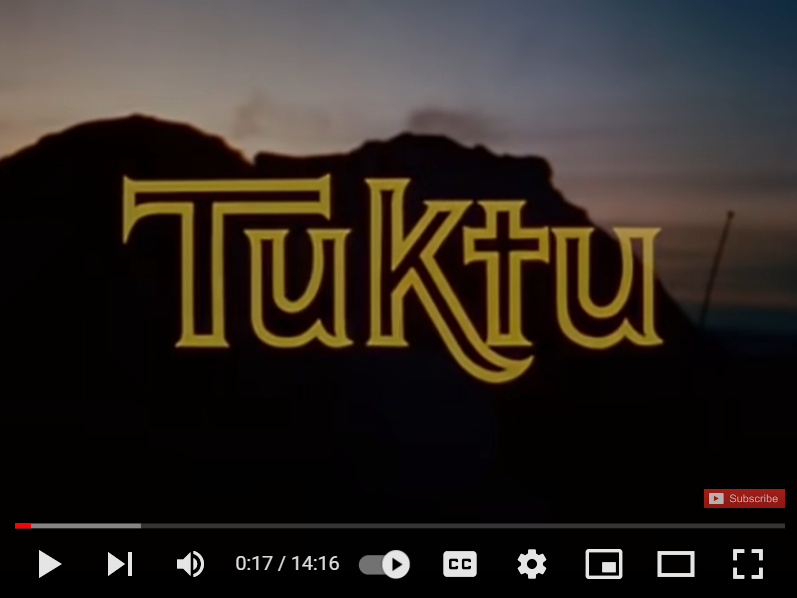
A 1968 National Film Board of Canada production, this 14 minute film shows traditional caribou hunting techniques of the Netsilik Inuit. This resource and others can be found on the Northern Caribou...
Resource
Authors
Kristine Wray
Brenda Parlee
Resource Date:
March
2013
This resource is available on an external database and may require a paid subscription to access it. It is included on the CCLM to support our goal of capturing and sharing the breadth of all...


")