Land Management Search Results
Resource
Authors
Wei-Yew Chang
Chris Gaston
Julie Cool
Barb Thomas
Genomics-assisted tree breeding (GATB) is an emerging biotechnology method that has the potential to produce improved planting stock in selected traits, such as greater volume or higher wood quality...
Resource
Authors
Jean-François Côté
Joan Luther
Patrick Lenz
Richard Fournier
Olivier van Lier
Information about wood fibre attributes (WFA) is important for optimizing forest resource management and increasing the competitiveness of the sector. Many factors influence WFA at both the plot (e.g...
Resource
Authors
Tyler Searls
X. Zhu
D.W. McKenney
R. Mazumder
J. Steenberg
G. Yan
F.-R. Meng
Climate has a considerable influence on tree growth. Forest managers benefit from the empirical study of the historic relationship between climatic variables and tree growth to support forest...
Resource
Authors
Sarah Ficko
Diane Haughland
Anne Naeth
This resource is available on an external database and may require a paid subscription to access it. It is included on the CCLM to support our goal of capturing and sharing the breadth of all...
Resource
Authors
Alex Mosseler
J.E. Major
D. McPhee
Ten-year-old bur oak ( Quercus macrocarpa Michx.) saplings established on the exposed, infertile, treeless barrens of a former coal mine site in New Brunswick, Canada, were harvested to assess the...
Resource
Salix interior Rowlee (INT) is a wide-ranging North American willow from the small taxonomic group Salix section Longifoliae, notable for its ability to form multi-stemmed vegetative stem colonies...
Resource
Authors
Claudia Méndez-Espinoza
Geneviève Parent
Patrick Lenz
André Rainville
Laurence Tremblay
Greg Adams
Andrew McCartney
Éric Bauce
John MacKay
The spruce budworm (SBW) is a forest insect pest that causes damage to boreal trees in North America. Resistance against SBW in white spruce had previously been linked to the content of specific...
Resource
Authors
Zhan Li
Joanne White
Michael Wulder
Txomin Hermosilla
Andrew Davidson
Alexis Comber
Large-area land cover maps are produced to satisfy different information needs. Land cover maps having partial or complete spatial and/or temporal overlap, different legends, and varying accuracies...
Resource
Authors
Camile Sothe
Alemu Gonsamo
Joyce Arabian
James Snider
Resource Date:
August
2021
Canada has extensive forests and peatlands that play key roles in global carbon cycle. Canadian soils and peatlands are assumed to store approximately 20% of the world’s soil carbon stock. However...
Resource
Authors
Jacques Régnière
Lukas Seehausen
Véronique Martel
Despite their importance as mortality factors of many insects, the detailed biology and ecology of parasitoids often remain unknown. To gain insights into the spatiotemporal biology of insect...
Resource
Resource Date:
September
2017
Rapid landscape alteration associated with human activity is currently challenging the evolved dynamical stability of many predator–prey systems by forcing species to behaviourally respond to novel...
Resource
Authors
Sam Vander Kloet
Trevor Avery
P.J. Vander Kloet
G.R. Milton
The research reported here aims to characterise and compare different planting methods in terms of which would be more successful for achieving the regeneration of dwarf fleshy-fruited shrubs on...
Resource
Authors
Rachel Hovel
Jeremy Brammer
Emma Hodgson
Amy Amos
Trevor Lantz
Chanda Turner
Tracey Proverbs
Sarah Lord
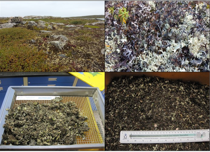
Rapid environmental change in the Arctic elicits numerous concerns for ecosystems, natural resources, and ways of life. Robust monitoring is essential to adaptation and management in light of these...
Resource
Authors
Guillermo Castilla
Ronald Hall
Rob Skakun
Michelle Filiatrault
André Beaudoin
Michael Gartrell
Lisa Smith
Kathleen Groenewegen
Chris Hopkinson
Jurjen van der Sluijs
Resource Date:
February
2022
Wall-to-wall 30 m raster maps of broad forest type, stand height, crown closure, stand volume, total volume, aboveground biomass, and stand age were created for a ~400,000 km2 area, validated with independent data, and generalized into a polygon GIS layer resembling a traditional FI map. The MVI project showed that a reasonably accurate FI map for large, remote, predominantly non-inventoried boreal regions can be obtained at a low cost by combining limited field data with remote sensing data from multiple sources.