Wetlands Knowledge Search Results
Resource
Authors
Cari Ficken
Stephanie Connor
Rebecca Rooney
Danielle Cobbaert
Resource Date:
August
2021
Boreal peatlands provide numerous ecosystem services ranging from carbon sequestration to the provisioning of habitat for species integral to Indigenous communities. In the Oil Sands Region of Alberta...
Resource
Resource Date:
January
2016
This presentation provides an overview of the Ducks Unlimited Canada Enhanced Wetland Classification System, including current and potential uses for wetland conservation and management.
Resource
Authors
Roger DeAbreu
Shane Patterson
Todd Shipman
Chris Powter
NRCan pilot science projects have proven that Earth Observation can provide relevant and valuable information to inform and enhance monitoring and support regulatory frameworks
Resource
Resource Date:
April
2016
Large shifts in vegetation distributions are occurring worldwide and at unprecedented rates. The most extreme of these regime shifts are expected to occur at ecosystem boundaries of both semi-arid and...
Resource
Authors
M.D. Thompson
M.C. Wride
M.E. Kirby
Classification system devised for mapping vegetation and surficial geology from 1:60,000 scale false colour infrared photographs; 1:50 000 base maps plus a vegetation and a surficial geology overlay
Resource
Ground surveys of vegetation and surficial geology generally confirmed that the classification systems used in the mapping accurately described and defined the ecological habitat features
Resource
Authors
Erin Bayne
Hedwig Lankau
Jesse Tigner
We conducted a series of surveys to evaluate wildlife responses to different types of seismic lines in bogs, conifer‐dominated, mixedwood and deciduous forests in the western boreal forest. Research...
Resource
Authors
Cole Burton
Christopher Beirne
Catherine Sun
Erin Tattersall
Joanna Burgar
Jason Fisher
This project has clearly demonstrated the utility of camera trap surveys for monitoring restoration effectiveness in boreal environments. The cameras facilitated the collection of longitudinal data on...
Resource
The Emend for Schools: 360° Video EMEND Tour Teachers Resource is a full lesson plan and 360 immersive and interactive video teaching tool, including a teacher lesson plan and student workbook aligned...
Resource
Authors
Humaira Enayetullah
Laura Chasmer
Chris Hopkinson
Daniel Thompson
Danielle Cobbaert
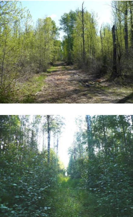
Seismic lines are the dominant anthropogenic disturbance in the boreal forest of the Canadian province of Alberta, fragmenting over 1900 km 2 of peatland areas and accounting for more than 80% of all...
Resource
Authors
Chris Stockdale
Quinn Barber
Amit Saxena
Marc-Andre Parisien
Resource Date:
March
2019
We undertook a wildfire risk assessment across the Cold Lake caribou range where we used the Burn-P3 model to determine: a) burn probability; b) wildfire risk to restored seismic line areas; and c) the effectiveness of mitigation measures. The burn probability of the landscape was highly heterogeneous, and recent large burns and some waterbodies provided “shields” that reduced burn probability on their leeward sides.
Resource
Authors
Brad Seely
John Nelson
Pierre Vernier
Ralph Wells
Arnold Moy
The primary response to the present mountain pine beetle (MPB) epidemic has focused on salvaging beetle-killed wood while it remains economically viable, and developing methods for reducing the spread...
Resource
Authors
Mathilde Lapointe St-Pierre
Julie Labbé
Marcel Darveau
Louis Imbeau
Marc Mazerolle
This resource is available on an external database and may require a paid subscription to access it. It is included on the CCLM to support our goal of capturing and sharing the breadth of all...
Resource
Authors
Tyler Flockhart
Greg Mitchell
Richard Krikun
Erin Bayne
Successful conservation of migratory birds demands we understand how habitat factors on the breeding grounds influences breeding success. Multiple factors are known to directly influence breeding...
Resource
Authors
Terrance Power
Robert Cameron
Thomas Neily
Brad Toms
Resource Date:
April
2018
This resource is available on an external database and may require a paid subscription to access it. It is included on the CCLM to support our goal of capturing and sharing the breadth of all...
Resource
Authors
Jian Zhang
Scott Nielsen
Jessica Stolar
Youhua Chen
Wilfried Thuiller
We found that 368 species (24%) may lose on average > 80% of their current suitable climates (habitats), while 539 species (35%) were projected to more than double their current suitable range
Resource
The Galena Hill Ecosystem Map (GHEM) was initially developed to provide information about existing plant communities and their growth conditions to guide upcoming reclamation efforts at the historical...
Resource
Breeding bird studies using the mapping method were combined with intensive habitat quantification to determine the relative values to breeding avifauna of 21 habitat types
Resource
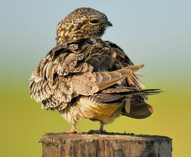
Conservation management is impeded by the lack of baseline data for many non-passerine, cryptic, or nocturnal species that are inadequately sampled by traditional monitoring programs. The recent rise...
Resource
A 30-page report from 2012 on the Yukon portion of the herd’s range. It includes discussion of the potential impacts of forest fires. This resource and others can be found on the Northern Caribou...