Wetlands Knowledge Search Results
Resource
Protocols for sampling biotic and abiotic parameters in large lakes, large rivers, wetlands, and streams in Alberta is provided. Estimates of time costs are given.
Resource
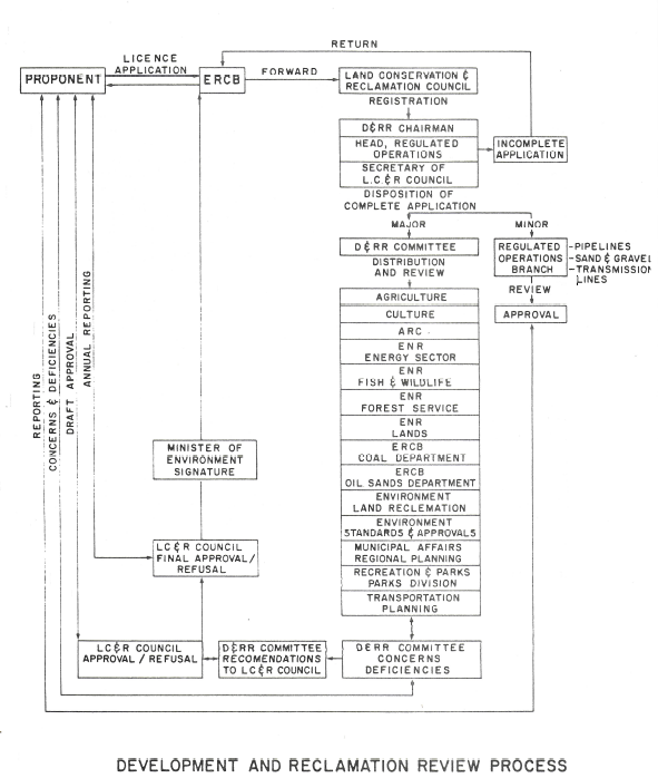
The Development and Reclamation Review process, as it currently operates, is presented and discussed with the aid of a flow chart. Suggestions are made to improve and expedite the process with...
Resource
Authors
Erin Bayne
Cameron Nordell
Jesse Watson
Melynda Johnson
Adam Moltzahn
Janet Ng
The Ferruginous Hawk (FEHA) has been listed as an Endangered Species under the Alberta Wildlife Act by the provincial government since 2006 (Alberta FEHA Recovery Team 2009); and were re-listed as a...
Resource
Study concentrated on the well-documented 1981 right-of-way, and compared it to the oldest trench, installed in 1957, and to the undisturbed adjacent mixed prairie
Resource
Authors
Majid Iravani
Monica Kohler
Shannon White
The results showed a pronounced variation in the historic supply of soil organic carbon and aboveground biomass in the watershed. Land management resulted in a diverse range of gains or losses.
Resource
Through the development of two Department of Environment programs; namely, the Regional Landfill Program and the H.S.T.F. Land Reclamation Program and the enactment of the Sand and Gravel regulations...
Resource
Reclamation of the land surface is what makes non-renewable resource developments sustainable. We must continue to strive to improve our science so that we can prove to regulators and the public that
Resource
NOVA, AN ALBERTA CORPORATION embarked on a research and development project approximately one and one-half years ago to develop a machine capable of stripping frozen topsoil . The result was a...
Resource
The Alberta Research Council, Inc. (ARC) has conducted a surface coal mine reclamation research program in association with the operations of Smoky River Coal Ltd. near Grande Cache, Alberta since...
Resource
Recent decline of trembling aspen ( Populus tremuloides Michx.) near St. Walburg, Saskatchewan, prompted a study to document the onset and progress of aspen decline and to examine how past climate...
Resource
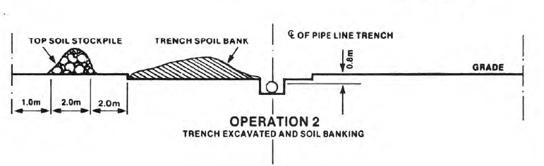
Objectives of the Twelve Mile Coulee Soil Research Project are to evaluate the impact of pipeline construction on Solonetzic soil quality and salt movement in the Brown soil zone
Resource
Authors
Terry Macyk
Zdenek Widtman
Vernon Betts
The Alberta Research Council has conducted a surface mine reclamation research program in association with the operations of Smoky River Coal Ltd. near Grande Cache, Alberta since 1972. The main...
Resource
Authors
Amy Nixon
Christopher Shank
Dan Farr
The Biodiversity Management and Climate Change Adaptation project has produced a comprehensive, evidence-based, and original examination of the effects of climate change on Alberta’s biodiversity
Resource
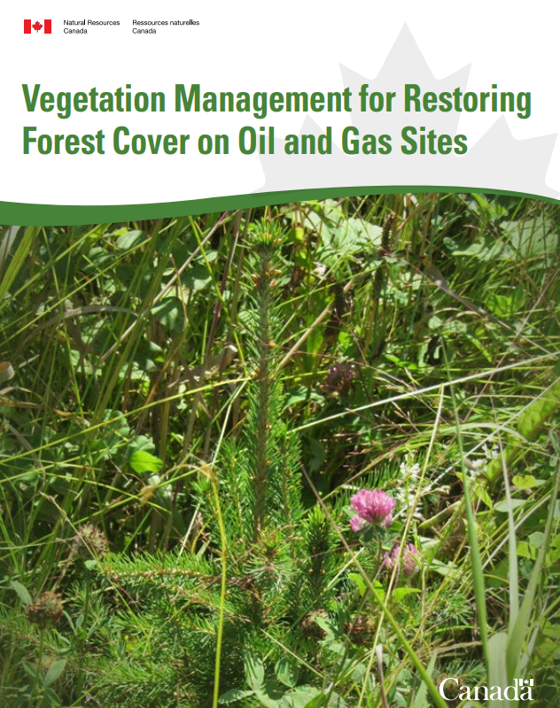
This guidebook explains vegetation management tools and techniques. Natural Resources Canada Canadian Forest Service (NRCan-CFS) developed this guidebook to help with the successional restoration of...
Resource
Resource Date:
November
2020
The Vermillion River watershed region, found in central Alberta between Edmonton and Lloydminster, is home to residents and farmers who rely on the watershed for drinking water, agriculture, and...
Resource
This presentation describes a method of assessing cumulative effects, taking into account the many drivers or pressures on the landscape and their effects on watershed processes.
Resource
Resource Date:
March
2013
This presentation discusses the state of wetland and peatland conservation in Alberta.
Resource
Resource Date:
March
2013
This presentation describes how the Alberta oil and gas industry decided to go with a oil/gas spill cooperative rather than having individual company spill response units.
Resource
Resource Date:
March
2013
This presentation summarizes a 6 year project to evaluate the environmental and economic performance of agricultural BMPs to improve water quality on small watercourses in Alberta.
Resource
This presentation provides an example oaf how Wet Areas Mapping and LiDAR can be used as a tool to monitor biodiversity.